11 October 2026
Mainly fine, the odd shower from late afternoon. Southwesterlies for a time afternoon and early evening.
Loading outdoor place details…
Dunedin area
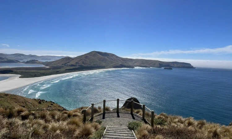
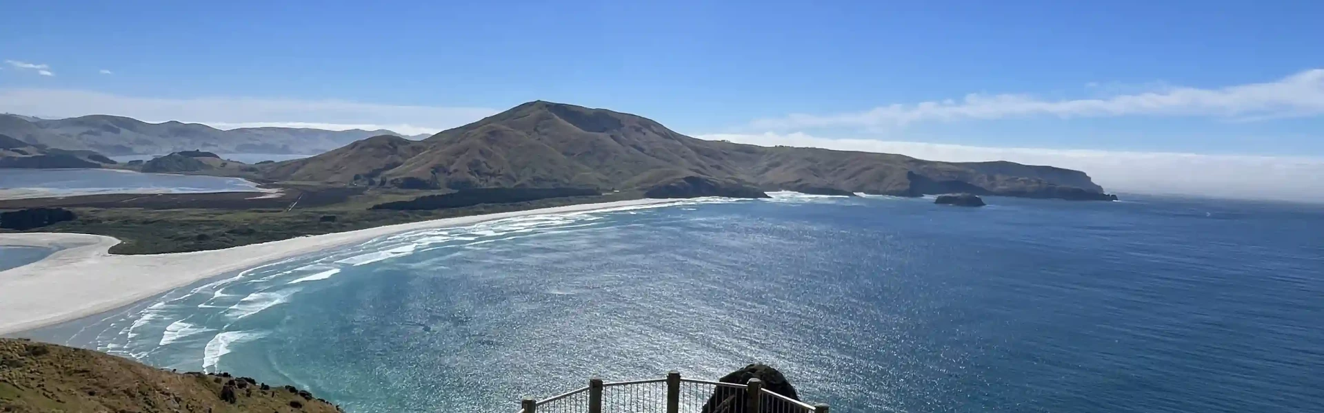
A gentle walk through Sandymount Recreation Reserve provides spectacular views of the Otago Peninsula coastline.
Distance
1.7 km
Walking time
30 min return
Difficulty
Easy
Dogs
Not allowed
Wheelchair access
Not marked friendly
Current status
Weather outlook
Issued 11 Oct 2026, 4:35 pm
11 October 2026
Mainly fine, the odd shower from late afternoon. Southwesterlies for a time afternoon and early evening.
12 October 2026
Morning cloud and possible fog, then fine. Low cloud returning about the coast at night affecting the Otago Peninsula. Northerlies, dying out for a time in the afternoon and evening.
13 October 2026
Partly cloudy, with a period of rain in the afternoon and evening. Northwesterlies, turning southerly in the evening.
14 October 2026
Occasional rain, persistent with heavy falls in the morning. Northeasterlies, dying out in the morning.
15 October 2026
Showers, some heavy, easing in the afternoon. Snow lowering to 600 metres in the morning. Southwesterlies.
Regional guidance only; elevation and terrain can produce different conditions.
Explore the area
Explore the track route and surrounding area before you set out.
Begin your walk to the viewpoint in a tunnel of historic macrocarpa trees from the car park at the end of Sandymount Road. Wander through coastal pastureland before reaching the viewpoint and its stunning views to the northeast over Allans Beach, Hoopers Inlet, Poatiri/Mt Charles and inland to Wharekākahu/Harbour Cone. The walk is through an active working farm. Expect to see sheep and farm vehicles. Lambing occurs in August and September. The stock is being managed by the farmer and should not be approached. Note: The Sandymount track network has changed due to visitor safety issues with the tracks. The walking track to the viewpoint and the track to Sandfly Bay remain open but the Loop and Summit track are not accessible at this time. Follow the onsite signs and orange markers to stay on the track.
This is an exposed coastal site. Take care around cliff areas as they may be slippery and unstable after heavy rain. Avoid forest areas during high winds as branches may fall out of trees. Be careful of the ongaonga (stinging nettle) that grows in places along the track. The nearest toilets are in Macandrew Bay. The track passes through an active working farm. Be aware that there may be moving vehicles and take due care.
Turn off Highcliff Road onto Sandymount Road. Sandymount Road turns into gravel and is narrow and windy. Keep to the left and drive to the conditions. Don't leave valuables in your car, as there have been break-ins. The track begins at the end of the road. Use this location on Google Maps to help find your way there.
We encourage you to continue gaining the skills and knowledge required for a safe trip. The NZ Mountain Safety Council has lots of free resources and information you can use. These can be accessed via www.mountainsafety.org.nz . We recommend trying these online learning tools: Trip Planning Tramping / field Skills Basic Navigation River Safety Additionally, check out the range of helpful videos available from the NZ Mountain Safety Council YouTube channel
No dogs.
Track information, access and weather can change. Confirm current alerts and land-manager information close to departure, tell someone your plans, and carry equipment appropriate for the route and conditions.