11 October 2026
Showers, clearing to fine spells early afternoon, but returning this evening. Westerlies, dying out this evening.
Loading outdoor place details…
Raglan area
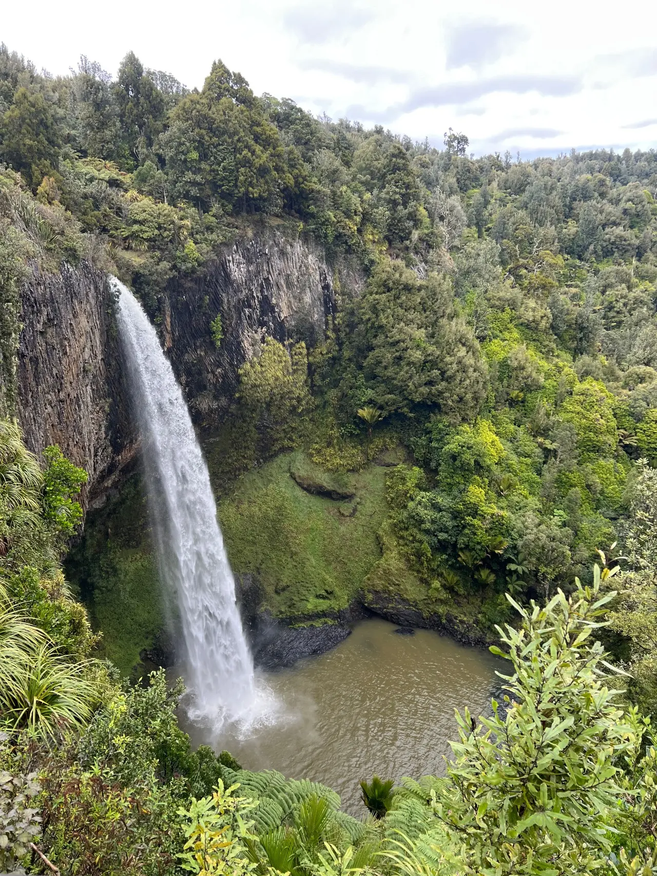
Walk to the top and down to the base of these spectacular 55 m falls.
Distance
0.73 km
Walking time
20 min one way
Difficulty
Easiest
Dogs
Not allowed
Wheelchair access
Not marked friendly
Current status
No active alerts found. Conditions can still change, so check again before leaving.
Weather outlook
Issued 11 Oct 2026, 4:35 pm
11 October 2026
Showers, clearing to fine spells early afternoon, but returning this evening. Westerlies, dying out this evening.
12 October 2026
Scattered rain, possibly heavy, clearing by evening as fine spells develop. Clouding over again in the evening with drizzle. Westerlies.
13 October 2026
A few showers. Northwesterlies developing in the morning.
14 October 2026
A few showers. Northwesterlies developing in the morning.
15 October 2026
A period of rain with heavy falls, otherwise a few showers. Northerlies, turning westerly in the morning.
Regional guidance only; elevation and terrain can produce different conditions.
Explore the area
Explore the track route and surrounding area before you set out.
Only 15 minutes drive from Raglan, the spectacular 55-metre-high the Wairēinga Falls, also known as the Bridal Veil Falls, is a popular Waikato walking track. It's an easy 10 minute walk through native bush, following the Pakoka River for most of the way, to two viewing platforms at the top, both providing stunning vistas and ample photo opportunities of the plunging white falls flanked by grey rock and green bush. Looking down to the base of the waterfall, you will see soft sandstone rocks, worn away by the water to form a large amphitheatre. A steep set of steps leads down to the bottom of the falls. From here there is another magnificent view, directly across the pool and up at the falls.
No swimming - water quality does not meet health standards for swimming. No abseiling or rock climbing to protect endangered plants. The track is no longer suitable for wheelchairs as it needs repairing after significant weather events.
Access is via Te Mata Road off the Hamilton/Raglan Highway (SH23). Turn left into Kawhia Road, 1 km past Te Mata and travel another 4 km to the car park. Use this location in Google Maps to find your way there.
We encourage you to continue gaining the skills and knowledge required for a safe trip. The NZ Mountain Safety Council has lots of free resources and information you can use. These can be accessed via www.mountainsafety.org.nz . We recommend trying these online learning tools: Trip Planning Tramping / field Skills Basic Navigation River Safety Additionally, check out the range of helpful videos available from the NZ Mountain Safety Council YouTube channel
No dogs.
Track information, access and weather can change. Confirm current alerts and land-manager information close to departure, tell someone your plans, and carry equipment appropriate for the route and conditions.