11 October 2026
Showers, possibly heavy, becoming few and far between in the morning, then clearing to fine early evening. Northerlies turning westerly in the afternoon, dying out early evening.
Loading outdoor place details…
Marlborough
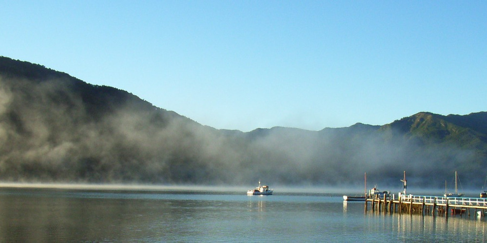
Te Araroa trail section: After completing the Queen Charlotte Track, follow the Link Pathway beside tranquil inlets, through forest and farmland, passing through Havelock, the Green Shell Mussel Capital of the World!
Distance
41.5 km
Walking time
2 days
Difficulty
Easy
Dogs
Not allowed
Wheelchair access
Not marked friendly
Current status
Weather outlook
Issued 11 Oct 2026, 5:43 am
11 October 2026
Showers, possibly heavy, becoming few and far between in the morning, then clearing to fine early evening. Northerlies turning westerly in the afternoon, dying out early evening.
12 October 2026
Fine. Light winds, then northerlies developing in the afternoon.
13 October 2026
Mainly fine, but isolated showers in the morning and afternoon. Northwesterlies.
14 October 2026
Showers developing in the morning. Northerlies developing in the morning.
15 October 2026
Showers, some heavy. Southeasterlies developing.
Regional guidance only; elevation and terrain can produce different conditions.
Explore the area
Explore the track route and surrounding area before you set out.
This section of Te Araroa is maintained by a local group whose project, the Link Pathway , is a 42km walking and cycling trail linking Picton to Havelock with a side trail to Anakiwa. Anakiwa is the small village at the southern end of the Queen Charlotte Track . Te Araroa signage will come in due course, but for now, walkers can follow the numerous Link Pathway signs. Take in the impressive views of the Marlborough Sounds and native bush as you follow this community-built path. Anakiwa to Havelock 20.6km The Link Pathway heads out from Anakiwa to the T junction with Queen Charlotte Drive , turn right and continue to Linkwater School some 1.25km distant. From the school, continue on Queen Charlotte Drive past the Linkwater Service Station. At the end of the Linkwater straight, follow the trail around the Mahakipawa Arm to the next stretch of bush track leading off from the right-hand side of the road. The Link Pathway will take you all the way around the point and into Havelock — a triumph of community vision and energy. Continue following the Link Pathway crossing the Havelock Causeway Bridge, then a series of beautifully constructed boardwalks will take you across the estuary and up through the historic Havelock Cemetery. Continue on the footpath to SH6, turn right and walk the remaining 100m into Havelock Village. Havelock to Daltons Bridge - 14km From the shopping area on Havelock Main Street (SH6), walk west on the footpath and then the road shoulder. 2.5km from the northern edge of Havelock, turn right/west into Te Hoiere Rd. Cross the bridge and continue 1km on Te Hoiere Road, crossing another bridge and reaching Kaiuma Bay Road. Turn left into Kaiuma Bay Road and walk some 9.5km to Daltons Bridge and the start of Daltons Track. This is a shady and dusty road with occasional fast traffic and heavy trucks. Local residents often comment on how hard it is to see walkers. Please be mindful of this and wear hi-vis while walking on road. Daltons Track (Special Conditions of Access) to Pelorus Bridge - 7km Daltons Track opened in March 2011 following a collaborative process involving the Te Araroa Trust, private landowners, DoC, Marlborough District Council, and Herenga ā Nuku (Outdoor Access Commission). The track is to tramping track standard. It has a natural grassed surface, stiles over fence lines, and several unbridged creek crossings, which are straightforward in normal flows. When you reach Daltons Bridge, the large sign and stile onto Daltons Track will be immediately in front of you at the intersection of Kaiuma Bay Road and Daltons Road laneway - cross the stile, walk over towards the river and follow Daltons Track following the orange triangles. This is a working dairy farm. Dairy cows may be present in one or more of the paddocks you walk through and are often curious but not aggressive. Note: Under no circumstances should you continue ahead (south) on Daltons Road laneway — this becomes a farm track. It is used extensively by stock and farm vehicles and is not to be entered. Daltons Track follows the true left bank of the Pelorus River for 6.5km. The route follows the fence line adjacent to (beside) the Pelorus River, and at no time does it follow the farm road / laneway, so, to repeat, please do not use that under any circumstances. Continue following the orange triangles through the paddocks, the trail then enters the DoC Pelorus Bridge Scenic Reserve. This well marked loop track can be followed in either direction (15mins one way or 20mins the other way) to a swing bridge over the the sparkling Rai River, just before the confluence with the gorgeous Pelorus / Te Hoiere River. It then emerges through the forest at Pelorus Bridge, 100m from the DoC Campground, where there is parking and public toilets. The stunning green waters of the river pools may tempt you for a dip on a hot day. Otherwise, Maungatapu Road (also known as Mt Richmond Road) lies in front of you, and Te Araroa continues south on that to the Pelorus River track trailhead. Note: It is 14km along Maungatapu / Mt Richmond Road to the next trailhead (and 8.5km further to Captain Creek Hut) — there are no budget accommodation options along Maungatapu Road — the Pelorus Bridge Campground should be used. Pelorus Bridge is home to the critically endangered pekapeka, long tailed bat. This year $10 from your walker registration fee is helping protect them. Want to know what they sound like? When staying at the campground, ask the Ngāti Kuia Campground Kaitiaki to borrow a bat detector and listen to their calls at night.
Daltons Track opened in March 2011 following a collaborative process involving Te Araroa Trust, private landowners, DOC, Marlborough District Council, and Herenga ā Nuku.
Te Araroa Trust gratefully acknowledges the generosity of the two landowners allowing us access on to their land. To ensure ongoing goodwill, please respect the following conditions of access: Track use is restricted to trampers during daylight hours only Stiles are to be used where provided Farm operations and stock have the right of way No dogs, camping, fires, bikes or firearms.
Northern Start: Northern end of Anakiwa Road, Anakiwa Southern End: Junction of SH6 and Maungatapu Road, Pelorus Bridge Havelock - Getting there/away InterCity - P: 03 365 1113 - Daily buses to Blenheim, Picton and Nelson. Private Driver Hire - P: 0272 565 643 (Paul) - can transport to/from all locations Picton-Anakiwa-Pelorus Bridge-Nelson-St Arnaud, priced on enquiry. We can take you from Anakiwa to the start of the trail head for the Pelorus track at the end of Maungatapu road, including stopping to re-supply in Havelock en-route. Travel time just under 2 hours including time to re-supply. This saves almost 3 days of road walking. Pelorus Bridge InterCity - P: 03 365 1113 to Blenheim, Picton and Nelson. Private Driver Hire - P: 0272 565 643 (Paul) - can transport to/from all locations Picton-Anakiwa-Pelorus Bridge-Nelson-St Arnaud, priced on enquiry. Anakiwa Lodge - 9 Lady Cobham Grove, Anakiwa P: 03 574 2115 E: info@anakiwa.co.nz Shuttle to Havelock, Pelorus Bridge, Picton and Blenheim available
Before starting Te Araroa either as a through-walker of the whole country or a section walker, please register on Te Araroa website . Please also visit the website or download the app for detailed maps, trail alerts and other relevant information. This track is part of the Herenga ā Nuku Aotearoa track database. Herenga ā Nuku has maps and advice about public access to the outdoors . We encourage you to continue gaining the skills and knowledge required for a safe trip. The NZ Mountain Safety Council has lots of free resources and information you can use. These can be accessed via www.mountainsafety.org.nz . We recommend trying these online learning tools: Trip Planning Tramping/field Skills Basic Navigation River Safety Additionally, check out the range of helpful videos available from the NZ Mountain Safety Council YouTube channel .
Te Araroa Trust gratefully acknowledges the generosity of these landowners and, to ensure ongoing goodwill, asks to respect the following conditions of access: Track use is restricted to trampers during daylight hours only Stiles are to be used where provided; Farm operations and stock have the right of way No dogs, camping, fires, cycles or firearms. Please note: Out of respect for the landowners and to help ensure Te Araroa can continue to use this critical link please comply with all conditions outlined.
Track information, access and weather can change. Confirm current alerts and land-manager information close to departure, tell someone your plans, and carry equipment appropriate for the route and conditions.