11 October 2026
Mainly fine, with areas of early morning fog. Showers developing in the afternoon, possibly heavy with thunderstorms and hail, clearing in the evening. Northwesterlies developing for a time in the morning and afternoon.
Loading outdoor place details…
Kaweka Forest Park
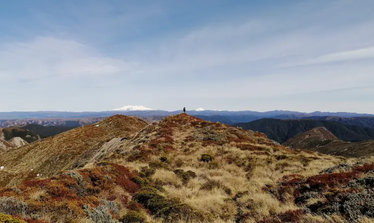
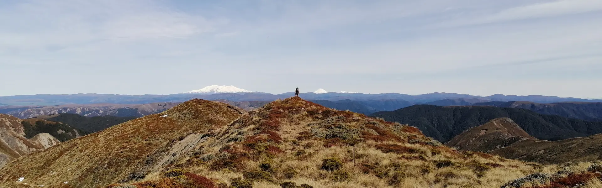
This is a multi-day hike traversing the open tops of the Kaweka range suitable for experienced hikers only.
Distance
35.09 km
Walking time
3-4 days
Difficulty
Advanced
Dogs
Not allowed
Wheelchair access
Not marked friendly
Current status
Weather outlook
Issued 10 Oct 2026, 11:01 pm
11 October 2026
Mainly fine, with areas of early morning fog. Showers developing in the afternoon, possibly heavy with thunderstorms and hail, clearing in the evening. Northwesterlies developing for a time in the morning and afternoon.
12 October 2026
Fine. Easterlies developing for a time in the afternoon.
13 October 2026
Fine. Northwesterlies developing in the morning.
14 October 2026
Fine apart from isolated showers. Northwesterlies.
15 October 2026
Showers developing. Northerlies, turning westerly.
Regional guidance only; elevation and terrain can produce different conditions.
Explore the area
Explore the track route and surrounding area before you set out.
Lakes Car park to Kiwi Saddle Hut Time: 4-5 hours Distance: 6.5 km Track: Advanced tramping track From the Lakes car park there are several tracks leading to different areas of the Kaweka Forest Park. Check the notice board to make sure you follow the correct route heading west towards Mt Kuripapango. The track begins to climb straight away and it's a gruelling 500m ascent to the top following a rocky, dirt clay track with plenty of loose scree and exposed tree roots. Once the summit of Mt Kuripapango is reached, the way continues along the ridgeline heading west, the route is exposed and sidles around some rocky bluffs. High winds are common in this region, assess weather conditions before setting out. The track then descends to Kiwi Saddle Hut which is nestled in a grassy clearing on the saddle. Kiwi Saddle Hut to Kiwi Mouth Hut Time: 2-3 hours Distance: 5 km Track: Advanced tramping track The track to Kiwi Mouth Hut begins heading west and after around 1km drops steeply down to Kiwi Creek. After or during rain this descent will be slippery and will require care to navigate. The track follows Kiwi Creek for 3km towards the Ngaruroro river with many crossings required. If the creek is in flood, there is an alternate track to Kiwi Mouth which continues on higher ground when the creek track begins to descend towards the valley floor, around 1km from Kiwi Saddle Hut. This track is longer and very steep, careful navigation is required in wet weather and extra time must be factored in if taking this route. Kiwi Mouth Hut to Back Ridge Biv Time: 4-5 hours Distance: 5 km Track: Advanced tramping track From Kiwi Mouth Hut cross back to the true right side of Kiwi Creek to rejoin the track. There is a steep climb out of the valley followed by further challenging uphill battle, the track ascends almost 1000m of elevation in 6km. There is a turn off for Back Ridge Biv which is located 5 minutes off the ridgeline. Back Ridge Biv to Back Ridge Hut Time: 1.5 hours Distance: 3 km Track: Advanced tramping track Back Ridge hut sits about 300m off track in a sheltered gully between two spurs of the main Kaweka range. The track from Back Ridge Biv continues along Back Ridge under the canopy of beech trees until the junction to Back Ridge Hut is reached. Back Ridge Hut to Studholme Saddle Hut Time: 1.5 hours Distance : 3 km Track: Advanced tramping track The poled route up to the main Kaweka range is heavily exposed, with steep drop offs to either side and should only be attempted by experienced hikers. Sudden weather changes in sub-alpine environments require proper alpine gear and navigation skills. Re-assess your route here and prepare to turn back if conditions are poor or deteriorating. From Back Ridge Hut there are two ridges that can be traversed to reach the tops, the northern route climbs steeply out of the gully behind the hut, whereas the southern route retraces your steps back up to the Back Ridge Hut junction. There are plenty of false peaks along both routes before the final climb up to the Kaweka tops is reached. Traverse the open tops South past the 'J' towards the Studholme Saddle Hut turn off, reached shortly before the saddle. Descend about 200m to reach the hut which situated in a tributary of Kiwi Creek and is surrounded by beech forest. Studholme Saddle Hut to Lakes car park Time: 3 hours Distance: 8 km Track: Advanced tramping track You can continue on from the hut instead of retracing your steps back up to the main ridge, follow the track to link up with the poled route on the other side of the saddle. There are expansive views over the region as you continue to Kaiarahi and The Tits. The turn off to descend down Cooks Horn Basin is difficult to find and not marked by any obvious means. It becomes a more apparent track as you enter the bush line and orange poled markers do mark the way. The route is steep and made slippery by the scree surface and fallen pine needles, poles and sturdy footwear are recommended for this section. The route flattens out once a tributary of the Tutaekuri is reached, the track crosses and sidles this for a time before descending to the riverbed. The Tutaekuri river is unbridged and may be impassable after heavy rain, be prepared to wait it out if unsafe to cross. Lakes car park is 1km up a 4WD track on the other side of the river.
Animals: O nly permitted hunting dogs allowed. Waste: Take all rubbish and recycling with you when you leave. Outdoor fires: The park is a restricted fire area, which means permits to light fires are required all year round.
Kiwi Saddle Hut is a standard eight-bunk hut with a toilet, untreated water and a wood burner Kiwi Mouth Hut is a standard four-bunk hut with a toilet, untreated water and a wood burner Back Ridge Bivouac is a two-bunk bivvy with a toilet and untreated water Back Ridge Hut is a standard four-bunk hut with a toilet, untreated water and a wood burner Studholme Saddle Hut is a standard four-bunk hut with a toilet, untreated water and a wood burner
Kuripapango is located 76 km from Napier on the Napier/Taihape Road. To reach the Lakes carpark, turn off the Napier-Taihape Road onto Kuripapango Road and follow the signs to Lakes carpark. We recommend 4WD vehicles to reduce wear on the road and safe travel. Use this location in Google maps to find your way there.
We encourage you to continue gaining the skills and knowledge required for a safe trip. The NZ Mountain Safety Council has lots of free resources and information you can use. These can be accessed via www.mountainsafety.org.nz . Level up in your outdoor knowledge with these interactive online learning tools: Trip Planning Tramping / field Skills Basic Navigation River Safety Additionally, check out the range of helpful videos available from the NZ Mountain Safety Council YouTube channel .
Track information, access and weather can change. Confirm current alerts and land-manager information close to departure, tell someone your plans, and carry equipment appropriate for the route and conditions.