10 October 2026
Partly cloudy, with the odd shower until evening. Northerlies developing in the morning.
Loading outdoor place details…
Coromandel Forest Park
This track offers views of the surrounding countryside and evidence of the logging era.
Distance
10.5 km
Walking time
4–5 hr
Difficulty
Easy
Dogs
Not allowed
Wheelchair access
Not marked friendly
Current status
Weather outlook
Issued 10 Oct 2026, 5:00 am
10 October 2026
Partly cloudy, with the odd shower until evening. Northerlies developing in the morning.
11 October 2026
Showers, easing for a time in the morning and afternoon. Northerlies, turning westerly in the morning.
12 October 2026
Showers becoming isolated in the afternoon but remaining cloudy. Northerlies, dying out in the morning.
13 October 2026
Partly cloudy, with isolated evening showers. Northwesterlies developing in the morning.
14 October 2026
Showers. Northwesterlies developing.
Regional guidance only; elevation and terrain can produce different conditions.
Explore the area
Explore the track route and surrounding area before you set out.
Time required : 4–5 hr From the road end car park cross the swing bridge over the Kauaeranga River. Take the first track on your right which leads you for 5 minutes to Billygoat Landing. Here you’ll have great views of the Billygoat Falls (180 m high). Next, follow the track to the Webb Creek/Moss Creek junction and take Webb Creek Track to Hydro Camp (1 hr 30 min – 2 hr). From the Hydro Camp junction, take the Billygoat Track where a steady 30-minute climb leads to a saddle with excellent views down the Kauaeranga Valley to the Hauraki Plains. A little further on, a knoll overlooks the Billygoat Basin. Dropdown into Billygoat Basin and cross a bridged stream before passing through Billygoat Basin Campsite. Billygoat Basin Campsite (opens in browser) has 8 non-powered tent sites on platforms. Bookings are required. A few minutes further on, a short 50m track overlooks the site of a collapsed long trestle bridge, once part of the bush tramline. The trestle was 160 m long and 11 m above the ground at the highest point. Back on the main Billygoat walking track, pass the junction for the Tarawaere and Hihi tramping tracks and follow the tramline through deep cuttings past two short trestles. Near the hauler site at the top of the incline there are good views of Billygoat Falls (180 m). From here it is another 40 mins downhill to the Kauaeranga Valley Road which requires crossing the Kauaeranga River to the Tarawaere car park. Walk 300 m north along the road to get back to the road end car park.
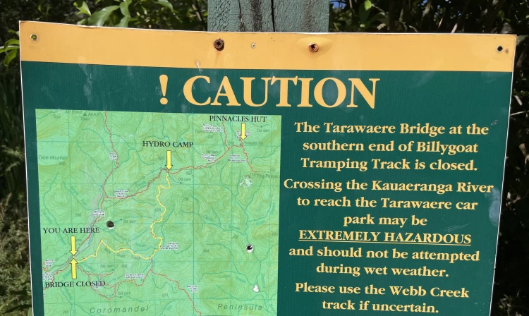
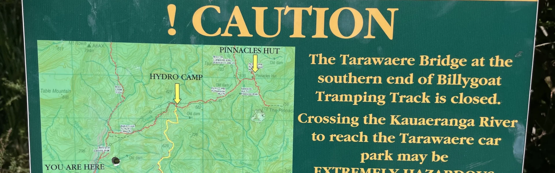
The bridge at the bottom of the Billygoat Track has been removed due to flood damage. You will need to wade across the river at this point. We recommend not crossing this river during or after heavy rainfall. Parts of the Billgoat Circuit track are clay, so when it rains it gets slippery. The Webb Creek Track is an easier walking option and is unaffected by the bridge removal, so return that way when wet.
Billygoat Basin Campsite (opens in browser) has 8 non-powered tent sites on platforms. Bookings are required.
From SH25 at the southern entrance to Thames, turn right into Banks Street beside the service station. Banks Street veers right into Parawai Road, which then becomes Kauaeranga Valley Road. Follow this for 13 km to the Kauaeranga Visitor Centre. The road continues unsealed a further 9 km to the road end. Most of the walks start from various points along this part of the road. Use this location in Google Maps to find your way there.
We encourage you to continue gaining the skills and knowledge required for a safe trip. The NZ Mountain Safety Council has lots of free resources and information you can use. These can be accessed via www.mountainsafety.org.nz . We recommend trying these online learning tools: Trip Planning Tramping / field Skills Basic Navigation River Safety Additionally, check out the range of helpful videos available from the NZ Mountain Safety Council YouTube channel .
No dogs.
Track information, access and weather can change. Confirm current alerts and land-manager information close to departure, tell someone your plans, and carry equipment appropriate for the route and conditions.