10 October 2026
Cloud, low about the foothills, breaking up in the morning. Scattered showers developing this afternoon, possibly heavy and thundery with hail, mainly about the foothills.
Loading outdoor place details…
Hāwea Conservation Park
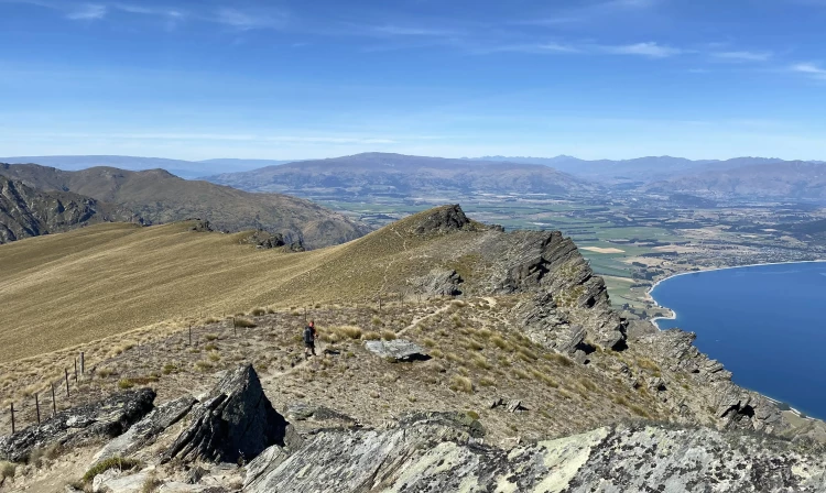
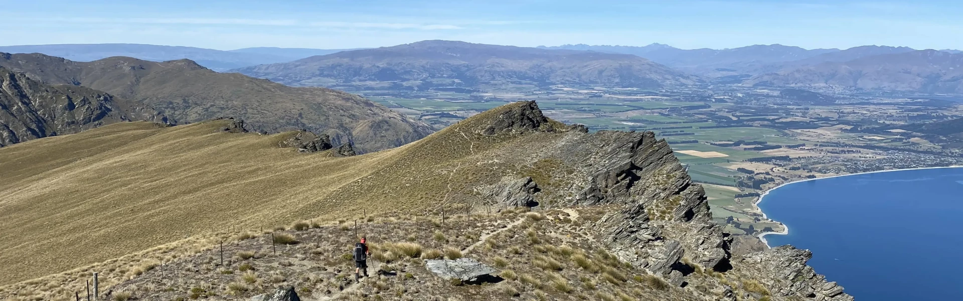
Te Araroa section: Breast Hill Track takes walkers to the summit of Breast Hill (1578m). Views of Mt Aspiring dominate the western skyline, with Lake Hawea far below. The track was formed using public access easements across the large Hawea Station following a tenure review. It is a crucial and spectacular connection for Te Araroa.
Distance
54.9 km
Walking time
3 - 4 days
Difficulty
Advanced
Dogs
Not allowed
Wheelchair access
Not marked friendly
Current status
No active alerts found. Conditions can still change, so check again before leaving.
Weather outlook
Issued 10 Oct 2026, 7:33 am
10 October 2026
Cloud, low about the foothills, breaking up in the morning. Scattered showers developing this afternoon, possibly heavy and thundery with hail, mainly about the foothills.
11 October 2026
About the Divide: Showers, possibly heavy in the morning, clearing in the evening. Elsewhere: mainly fine but the odd afternoon shower.
12 October 2026
Fine.
13 October 2026
Showers developing.
14 October 2026
Rain turning to showers. Snow lowering to 1900 metres.
Regional guidance only; elevation and terrain can produce different conditions.
Explore the area
Explore the track route and surrounding area before you set out.
The track begins on a public access easement across Longslip Station, a run established by pastoral lease in 1858 and which once comprised 42526ha. In the 1880s, the property was overrun by rabbits and abandoned. In 1897 Lake Hāwea and Ben Avon Stations were subdivided off, and what remained of Long Slip Station then passed through a succession of lessees before going through tenure review, a process that concluded in 2008. Access over the final 18km of this track became available when Lake Hāwea Station completed its tenure review in 2010. This property has been owned by the Rowley family since 1912. Like Longslip Station, Lake Hāwea Station still operates as a working farm. Birchwood Carpark to Top Timaru Hut - 22.8km / 7-8 hours A marked route leads off from the carpark and follows a fence line towards the Avon Burn. Ford the burn, then climb to the farm track above the true right bank. Turn right here and head upstream on the farm track as it climbs into the Avon Burn catchment towards Mt Martha Saddle (1680m). The Tin Hut (6 bunk beds), located at km 2542.3, 9.5 km after the trail crosses Birchwood Rd (SOBO), or 13 km after Top Timaru Hut (NOBO), is not covered by the Backcountry Hut Pass. It is a private hut owned by Longslip Station. Available at $10/night using an honesty box system, or you can use internet banking when you next have service. Account details in the hut. Beyond the saddle, Te Araroa descends on an unmarked bulldozer track to Top Timaru Hut (6 bunks). The track is occasionally washed out, but travel is still straightforward. The route remains on the true left of the Timaru River all the way down to the hut. Top Timaru Hut to Timaru River Junction — 12km / 5-6 hours The bulldozed track on the river’s true left continues downstream to the tree line, about a 20-minute walk away. Once in the forest, progress is slower on a marked track that climbs, descends, and sidles through this steep-sided river valley. This is to the Breast Hill Track/Timaru River Track junction. Along the way, the track is on the true left for about 2.5km, then emerges from the forest at a grassy area. From here, the track leads down to the first of about a dozen river crossings. These are straightforward in normal flow. The route along the Timaru River beyond km 2562 (southbound) requires hard scrambling along steep banks. In low water conditions, it may be easier to walk in the riverbed, but careful continuous assessment is required as even when the water is low, the riverbed route may encounter flooded gorge sections with steep sides. There is one place where it is necessary to use the higher track even when the river is very low. Be prepared to backtrack and use the higher-level marked route to get around some narrow sections. Timaru River Junction to Stodys Hut — 2.2km / 1.5-2 hours The track from the junction climbs steeply to the tree line and then sidles across an open section. The track then returns briefly to the forest before reaching Stodys Hut (6 bunks), an old musterers’ hut on the tree line. The hut has a dirt floor but was restored to a reasonable condition in 2010. Water is available from the nearby creek, the last reliable water source until Pakituhi Hut. Stodys Hut to Pakituhi Hut via Breast Hill — 11.2km / 3.5-4.5 hours The route between the huts is high and exposed but, from Breast Hill, has views over Lake Hāwea and beyond to the Alps, including Mt Aspiring. It is a Te Araroa highlight. From Stodys Hut, Te Araroa follows an old farm track up to the ridgeline, then turns right and follows the farm track along the broad ridge as it undulates towards the Breast Hill summit (1578m). The track is lightly marked, but all junctions are signposted, so navigation is usually easy. Beyond the summit, the track is close to a fence line and mostly unformed. It descends to the 8-bunk Pakituhi Hut (1300m), 200m along a side trail to the left. The hut can also be accessed along a foul weather route, which departs Te Araroa on the left a little over 1km before it reaches the summit. This alternative route is less exposed but lacks the drama the Breast Hill route affords. Pakituhi Hut to Gladstone Reserve — 5.1km / 3-4 hours There are no streams en route so carry plenty of water from the hut. This challenging section descends 950m to the Timaru River Rd, initially along the ridgeline to a small saddle and then down a steep face on a zig-zagging track. Turn left at the road. The Gladstone Reserve is lakeside and about 1km distant. Note: Allow more time if walking this section in the opposite direction.
Potential hazards Farming operations at both ends River crossings - Never cross flooded rivers Track exposed to sun, wind or cold Weather extremes Few water sources in places
The Tin Hut (6 bunk beds), located 9.5 km after the trail crosses Birchwood Rd (SOBO), or 13 km after Top Timaru Hut (NOBO) is not covered by the Backcountry Hut Pass. It is a private hut owned by Longslip Station. Available at 10$/night using an honesty box system, or you can use internet banking when you next have service. Account details in the hut. Top Timaru Hut - 6 bunks Stodys Hut - 6 bunks - the hut has a dirt floor but was restored to reasonable condition Pakituhi Hut - 8 bunks
Northern Start: Birchwood Road carpark, Ahuriri Valley Southern End: Gladstone Reserve, Lake Hāwea Alternative transport Alpine Coachlines - P: 03 443 9120 - Wānaka based. Wānaka Bike Tours - offers a Bike and Shuttle service to suit Te Araroa hikers! For an additional $25pp, Wānaka Bike Tours will carry hikers' packs so they can skip the walking and bike from Lake Hāwea to Lake Wānaka or vice versa. Regular departure times apply, so please contact Wānaka Bike Tours to find out more. +64 3 443 6363 / info@wanakabiketours.co.nz / www.wanakabiketours.co.nz
More information Te Araroa Canterbury trail notes, including information about accommodation, transport and resupplying Map 131 Map 132 Map 133 Map 134 Before starting Te Araroa either as a through-walker of the whole country or a section walker, please register on Te Araroa website . Please also visit the website or download the app for detailed maps, trail alerts and other relevant information. Upskill for free We encourage you to continue gaining the skills and knowledge required for a safe trip. The NZ Mountain Safety Council has lots of free resources and information you can use. These can be accessed via www.mountainsafety.org.nz . We recommend trying these online learning tools: Trip Planning Tramping/field Skills Basic Navigation River Safety Additionally, check out the range of helpful videos available from the NZ Mountain Safety Council YouTube channel .
No dogs.
Track information, access and weather can change. Confirm current alerts and land-manager information close to departure, tell someone your plans, and carry equipment appropriate for the route and conditions.