11 October 2026
Showers about the Divide, clearing early evening, otherwise fine.
Loading outdoor place details…
Diamond Lake and Hospital Flat conservation areas
Enjoy a family-friendly walk around Diamond Lake. The walk leads to other tracks in the area.
Distance
2.92 km
Walking time
1 hour incl. lookout
Difficulty
Easy
Dogs
Not allowed
Wheelchair access
Not marked friendly
Current status
No active alerts found. Conditions can still change, so check again before leaving.
Weather outlook
Issued 10 Oct 2026, 9:23 pm
11 October 2026
Showers about the Divide, clearing early evening, otherwise fine.
12 October 2026
Fine.
13 October 2026
Rain developing.
14 October 2026
Heavy rain easing to showers. Snow lowering to 1900 metres.
15 October 2026
Showers developing. Snow lowering to 1100 metres.
Regional guidance only; elevation and terrain can produce different conditions.
Explore the area
Explore the track route and surrounding area before you set out.
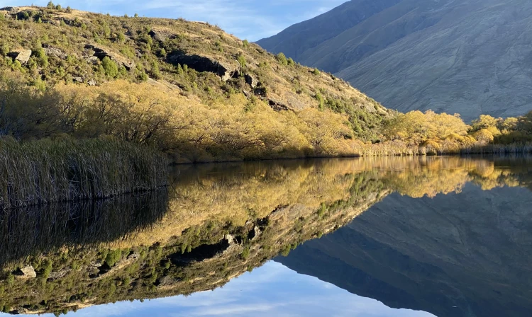
A short drive from Wanaka, and just down the road from Glendu Bay, the trail is wide and well-maintained. After a short uphill stroll, the track splits to head around each side of the lake. Which way you choose is up to you, although the left-hand side is easier as this is the way that walkers heading up to Rocky Mountain and Lake Wanaka viewpoint take. Heading around the lake, you'll have opportunities for glimpses across the lake at varying intervals before reconnecting with the track you came in on. For a longer walk, head up the steps at the far end of the lake to the Diamond Lake lookout, or continue further uphill to either the Lake Wānaka Lookout Track or Rocky Mountain .
Drive West out of Wanaka towards Glendu Bay and Treble Cone Ski field. After 20-30 mins you should pass through Glendu Bay. The road will then leave the lakeshore to enter the Hospital Flat Conservation Area. The Diamond Lake Conservation area and carpark for Rocky Mountain should be just after, down a small hill on the right-hand side. The carpark can get busy during peak holiday periods so either arrive early or there is alternative parking space at the Motatapu picnic area about a kilometre further down the road. Use this location in Google Maps to find your way there.
We encourage you to continue gaining the skills and knowledge required for a safe trip. The NZ Mountain Safety Council has lots of free resources and information you can use. These can be accessed via www.mountainsafety.org.nz . Level up in your outdoor knowledge with these interactive online learning tools: Trip Planning Tramping / field Skills Basic Navigation River Safety Additionally, check out the range of helpful videos available from the NZ Mountain Safety Council YouTube channel .
No dogs.
Track information, access and weather can change. Confirm current alerts and land-manager information close to departure, tell someone your plans, and carry equipment appropriate for the route and conditions.