11 October 2026
Cloudy with showers, mainly about the Sounds and inland ranges, clearing and becoming mainly fine late afternoon. Northwesterlies but northeasterlies about Kaikoura Coast, strong at times, easing everywhere in the evening.
Loading outdoor place details…
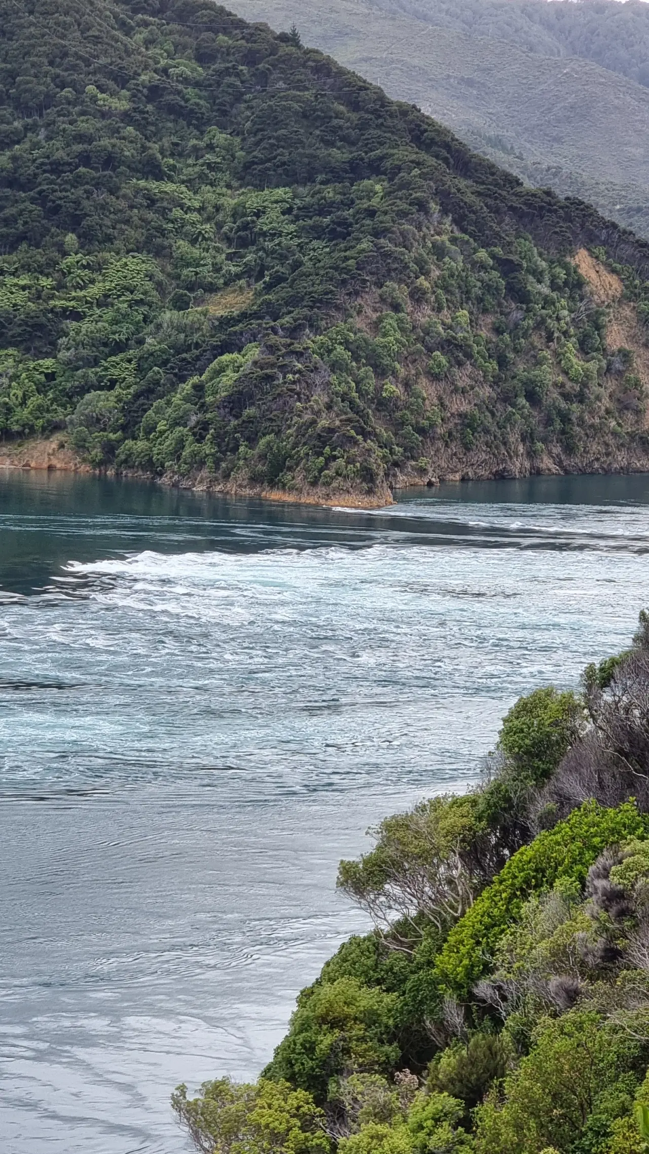
French Pass and D'Urville Island Scenic Reserves
This track takes you to a viewpoint over historic Te Aumiti/French Pass, where the tide rushes back and forth like a river.
Distance
0.59 km
Walking time
10 min
Difficulty
Easiest
Dogs
Not allowed
Wheelchair access
Not marked friendly
Current status
No active alerts found. Conditions can still change, so check again before leaving.
Weather outlook
Issued 10 Oct 2026, 11:01 pm
11 October 2026
Cloudy with showers, mainly about the Sounds and inland ranges, clearing and becoming mainly fine late afternoon. Northwesterlies but northeasterlies about Kaikoura Coast, strong at times, easing everywhere in the evening.
12 October 2026
Fine. Light winds, then northerlies developing in the afternoon.
13 October 2026
Mainly fine, but isolated showers in the morning and afternoon. Northwesterlies.
14 October 2026
Showers developing in the morning. Northerlies developing in the morning.
15 October 2026
Showers, some heavy. Southeasterlies developing.
Regional guidance only; elevation and terrain can produce different conditions.
Explore the area
Explore the track route and surrounding area before you set out.
Track description While this is only a short walk, it gives spectacular views of the swirling waters of French Pass. The ocean acts like a river here and these are the fastest tidal currents in the country. Due to the remote location of the track, there are often no or not many people around. Part way through the track, there is the option to turn left and go down to the beach. Turning right takes you to the lookout where there are information panels explaining the history of the channel. Toilets are located further on at the French Pass Town Hall. Cell reception is unlikely. Getting there At the time of writing, a lot of the roads in the Marlborough area are closed. While the road may be open, there could be lanes closed and some unforseen delays. It’s usually about 2 and a half hours from both Blenheim and Nelson. The roads are windy, narrow, very steep and not for the faint hearted. It’s a gravel road for the last part. From State Highway 6, you’ll see the turnoff at Rai Valley. Take Ronga Road, which turns into Croissilles Road, which eventually turns into Croissilles-French Pass Road. Look out for the track sign on the left. There is a very small gravel area to park at the start of the track. It’s enough for about 2 vehicles. Use this location in Google Maps to find your way there. Helpful resources Find tips, guides and how-to videos to help you prepare for your walk at mountainsafety.org.nz
No dogs.
Track information, access and weather can change. Confirm current alerts and land-manager information close to departure, tell someone your plans, and carry equipment appropriate for the route and conditions.