10 October 2026
Cloud increasing, and light showers developing this evening.
Loading outdoor place details…
Fiordland National Park
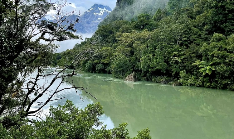
The Hollyford Track is a 4–8 day Fiordland tramp from the mountains to the sea at Martins Bay, and can be walked all year round.
Distance
56 km
Walking time
4–5 days
Difficulty
Advanced
Dogs
Not allowed
Wheelchair access
Not marked friendly
Current status
Weather outlook
Issued 10 Oct 2026, 9:23 pm
10 October 2026
Cloud increasing, and light showers developing this evening.
11 October 2026
Scattered showers, becoming confined south of Doubtful Sound in the afternoon.
12 October 2026
Partly cloudy, with one or two morning showers south of Secretary Island.
13 October 2026
Heavy rain developing, with snow to 2400 metres.
14 October 2026
Rain, with snow to 1900 metres, turning to showers.
Regional guidance only; elevation and terrain can produce different conditions.
Explore the area
Explore the track route and surrounding area before you set out.
Lower Hollyford Road to Hidden Falls Hut - 9 km (2–3 hr) Cross the swing bridge over Humboldt Creek and follow the old road to the start of the track, which initially sidles along bluffs, with swampland to the left. Sections of raised boardwalk cross areas prone to flooding. Swamp Creek has a bridge over the waterway. However, there is a dry flood channel that can be impassable during or after heavy rain. Where Swamp Creek joins the Hollyford River/Whakatipu Kā Tuka, the track follows the riverbank, with occasional views of the Darran Mountains. At Hidden Falls Creek the track passes Sunshine Hut (private hut) then continues upstream to a swingbridge. Hidden Falls Hut is about 15 minutes from here. Hidden Falls Hut to Lake Alabaster Hut - 10.5 km (3–4 hr) The track passes through a section of lowland ribbonwood/podocarp forest draped with colourful mosses and ferns. It then enters tall beech forest before climbing to Little Homer Saddle, with views of Mount Madeline and Fiordland’s highest mountain, Mount Tūtoko (2723 m). From here, the track descends to Little Homer Falls (60 m) and continues to the confluence of the Hollyford and Pyke rivers. Beyond this is Pyke River Lodge (managed by Hollyford Track Guided Walks) and 15 min further on is Lake Alabaster Hut. Lake Alabaster Hut to to Demon Trail Hut – 10.5 km (3-4 hr) This section of the track is maintained to a much lower standard than the Lower Hollyford Road end to Lake Alabaster section. Use the orange markers on the trees to guide you. It can be muddy, rocky and wet underfoot. Tree falls may obscure the track. Unbridged streams or rives may become impassable during and after heavy rain. Backtrack from the Alabaster Hut for 15 minutes and cross the Pyke River swing bridge. After two hours of relatively level track, the track meets the Hollyford River/Whakatipu Kā Tuka again. There are some long sections of mud. Follow the eastern side of Lake McKerrow/Whakatipu Waitai for about 1.5 hr to reach Demon Trail Hut. Demon Trail Hut to Hokuri Hut - 9.6 km (5–6 hr) Demon Trail is a historic cattle track. This section is rocky and undulating, but there are long sections of formed, flat track in between loose rocks can make it difficult underfoot, and the track can become slippery in wet weather. Some of the creek crossings can be dangerous, so extreme care is required – using the three wire bridges is recommended. Some creeks may become impassable after heavy rain Hokuri Hut to Martins Bay Hut - 13 km (4–5 hr) Walk for 30 min from Hokuri Hut to reach Hokuri Creek. In low river conditions, you can cross near the creek mouth, but otherwise should use the three-wire crossing 20 min upstream. After crossing the creek, follow the lake shore past the bay where the settlement of Jamestown once stood. After a further 1.5–2 hr walk, the track leaves the lake and continues for another hour to the Hollyford Airstrip and Martins Bay Lodge, managed by Hollyford Track Guided Walks. Martins Bay Hut, situated at the mouth of the Hollyford River/Whakatipu Kā Tuka, is a further 1.5–2 hr from Martins Bay Lodge turn off. Take care when crossing Jerusalem Creek as it is prone to flooding after rain. The track continues on to Long Reef. Beyond Long Reef, the track becomes the Pyke - Big Bay Route . This route is not as well defined and suitable only for well-equipped and experienced trampers.
The Hollyford Track is a great tramping adventure for those who like to be a little off the beaten track, but still, have a good track and huts to stay in. It is suitable for people with moderate to high level backcountry and remote areas skills and experience as some sections of the track are rough and muddy and not well defined. There may be unbridged stream and river crossings. As the only major track in Fiordland found at low altitude, the Hollyford is a popular option as it can be walked in any season and is rarely cut off by snow. Regardless of this, hikers should always check weather conditions before setting off and ensure they are prepared for all weather events. There are areas of the Hollyford Track that are prone to flooding during heavy rainfall events. You will find the starting point of the track (or the finishing point if you are walking it in the other direction) at the end of the Lower Hollyford Road (off the Milford road). It will take approximately two hours to drive from Te Anau to the start of the track. The Hollyford Track finishes (or starts) at Martins Bay, and you can choose to fly by helicopter or fixed wing plane or walk back along the track. There are regular transport services available to get you to the track during the summer season. During winter, track transport will need to be arranged on an on-demand basis. Like all tracks in Fiordland, the Hollyford Track is prone to damage from heavy rainfall and hikers should always check weather conditions before setting off. Emergency equipment, including a personal locator beacon, should be carried. Independent walkers need to arrange their food and gear, as well as transport to and from the track. Walkers also need to arrange hut passes through DOC. It is recommended you contact the Fiordland National Park Visitor Centre before you walk the track, always check weather conditions and ensure you are prepared for extreme conditions. The following Topo50 series map sheets cover the Hollyford Track: Topo50 Map CB09 – Hollyford Track Topo50 Map CA09 – Alabaster Pass Topo50 Map CA08 – Milford Sound/Piopiotahi.
All huts are on a first come basis year round, there are no reservations. You can camp beside the huts. You need hut tickets or a backcountry pass to stay at these huts. They're available from any DOC visitor centre. Each hut has heating, mattresses and a pit toilet. There are no cooking facilities, carry your own portable stove. Hidden Falls Hut Lake Alabaster Hut Demon Trail Hut Hokuri Hut Martins Bay Hut
The Hollyford Track begins at the end of Lower Hollyford Road, which turns off SH94 Milford Road shortly after The Divide. The turn off point is called Marian Corner, and is about 87 km along the Milford Road from Te Anau. Allow 2 hours to drive from Te Anau to the end of the Hollyford Road. The track is not a loop track so you'll need to arrange transportation to or from the track. For more information contact Fiordland National Park Visitor Centre. Use this location in Google Maps to find your way there.
We encourage you to continue gaining the skills and knowledge required for a safe trip. The NZ Mountain Safety Council has lots of free resources and information you can use. These can be accessed via www.mountainsafety.org.nz . We recommend trying these online learning tools: Trip Planning Tramping / field Skills Basic Navigation River Safety Additionally, check out the range of helpful videos available from the NZ Mountain Safety Council YouTube channel .
No dogs.
Track information, access and weather can change. Confirm current alerts and land-manager information close to departure, tell someone your plans, and carry equipment appropriate for the route and conditions.