11 October 2026
Scattered showers, becoming confined south of Doubtful Sound in the afternoon.
Loading outdoor place details…
Mount Aspiring National Park
Weave through meadows, reflective tarns and alpine gardens, and be rewarded with spectacular vistas over vast mountain ranges and valleys. From May to October, conditions can be challenging – only attempt if you have the skills.
Distance
33 km
Walking time
2-4 days
Difficulty
Intermediate
Dogs
Not allowed
Wheelchair access
Not marked friendly
Current status
Weather outlook
Issued 10 Oct 2026, 9:23 pm
11 October 2026
Scattered showers, becoming confined south of Doubtful Sound in the afternoon.
12 October 2026
Partly cloudy, with one or two morning showers south of Secretary Island.
13 October 2026
Heavy rain developing, with snow to 2400 metres.
14 October 2026
Rain, with snow to 1900 metres, turning to showers.
15 October 2026
Showers, with snow to 800 metres, easing.
Regional guidance only; elevation and terrain can produce different conditions.
Explore the area
Explore the track route and surrounding area before you set out.
The Great Walks season (November–April) is the best time to walk the track - there are more facilities and fewer hazards. Bookings are required for huts and campsites. In the Great Walks season the track is well marked and signposted, but some sections are steep and rough, cold temperatures, snow, strong winds and heavy rain can occur, DOC manages avalanche risk and walkers may be flown (at their cost) over dangerous sections, track is not recommended for children under the age of 10, due to the exposed mountainous environment and often adverse weather conditions.
It can be cold and wet, with ice, snow and short daylight hours. Avalanche-prone bridges across some major watercourses are removed. DOC does not manage hazards such as flooding and avalanches. Facilities are greatly reduced. Walking the track at this time should only be attempted if you are fit, experienced and well equipped. Outside of the Great Walks season, hut bookings are still required but are at a reduced cost. Gas is not provided – you will need to bring your own cooking stove. Flush toilets are replaced with pit toilets. Running water is turned off inside the huts. Water can be obtained from the outside water tank; if this is frozen, then from the nearest water course or by melting snow. No rangers based at the huts. Bridges between Lake Mackenzie and Harris Saddle may be removed over winter to avoid damage from avalanches, so you must be competent at crossing swift, icy side streams. The Routeburn Track has a lot of challenging and complex avalanche terrain. Avalanches are frequent. There are over 32 avalanche paths, some of which may bring avalanche debris to the valley floor and have the potential to cross the Routeburn Track. If you are going into places avalanches could occur, be sure you: have checked the New Zealand Avalanche Advisory for Fiordland have checked what avalanche advisory and alert information is available from the DOC visitor centre nearest the area where you want to go take an avalanche transceiver, avalanche probe and a snow shovel. Know how to use these tools. Maps of avalanche paths: Lake Howden to Lake MacKenzie (JPG, 9,111K) | Lake MacKenzie to Falls Hut (JPG, 9,186K)
The track begins at Routeburn Shelter, gently winding alongside the crystal-clear Route Burn (river). After passing Sugarloaf Stream, you’ll climb to Bridal Veil Waterfall and continue above the gorge. A swing bridge leads to open grassed flats, and the Routeburn Flats Hut and Campsite. The next section up to Routeburn Falls climbs steadily through stunning beech forest, providing views of the Humboldt Mountains.
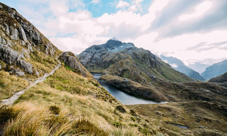
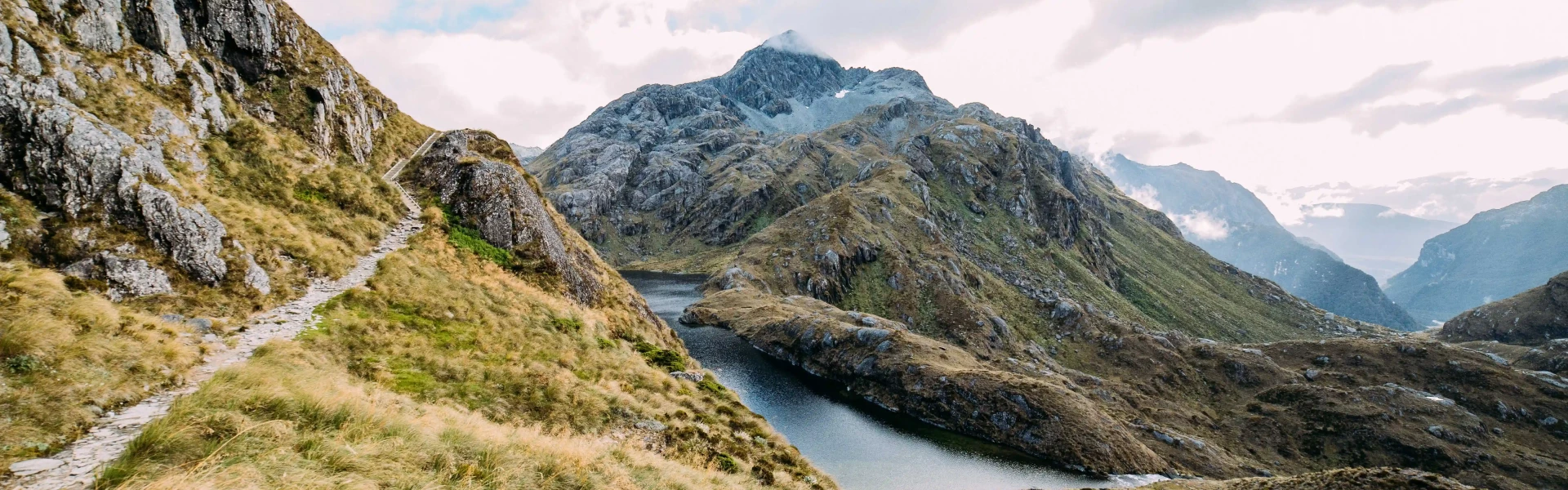
Climb steadily up the valley, through wetlands and tussock-covered flats, before sidling along the bluffs above Lake Harris to reach the highest point on the track at Harris Saddle/TarahakaWhakatipu (1,255 m). Shortly after the Harris Saddle, the track brings you to Harris Saddle Shelter (day use only). Here you can take a break from the elements and use the toilet facilities provided. There is a side-track from here to Conical Hill (1 hr 30 min – 2 hr return). It is a short, steep climb from the Harris Saddle up Conical Hill gives superb views of the Hollyford Valley through to Lake McKerrow and beyond to Martins Bay and the Tasman Sea. Snow and ice can sometimes make this trip hazardous early and late into the Great Walks season. Due to rock fall danger, observe the no stopping zones along this track. The track then descends and traverses along the exposed Hollyford Face, with expansive views over the Darran Mountains. This section of the track is well-known for its impressive array of alpine plants. A steady descent leads to Lake Mackenzie Hut, set beside the enchanting Lake Mackenzie.
Leaving Lake Mackenzie Hut the track crosses a small flat before climbing to the bush line. A gradual descent then leads past the ‘Orchard’, an open grassyarea dotted with ribbonwood trees, to the impressive Earland Falls (174 m). The track continues its descent through beech forest to Lake Howden (Lake Howden Hut was destroyed by storm damage in February 2020). From Lake Howden, the well graded track climbs steadily for about 15 minutes to the Key Summit Track turn-off. From the Key Summit turn-off, the gradual downhill walk is through silver beech forest to The Divide on the Milford Highway. At 532 m, The Divide is the lowest crossing of the Southern Alps in New Zealand.
Huts have bunks, mattresses, heating, toilets, basic cooking facilities, solar-powered lighting and cold running water. A DOC ranger is in residence. Huts do not have food, cooking utensils, showers or bedding. Campsites have basic facilities including toilets, sinks and a water supply. Routeburn campsites have picnic tables and cooking shelters. Campers can't use hut facilities. Bookings are required for all huts and campsites.
Routeburn Track can be started from: Routeburn Shelter, 25 km from Glenorchy along a partially unsealed road. Use this location in Google Maps to find your way there. The Divide Shelter, 85 km from Te Anau. Use this location in Google Maps to find your way there. The road distance between each end of the track is 325 km - transport is needed at each end.
We encourage you to continue gaining the skills and knowledge required for a safe trip. The NZ Mountain Safety Council has lots of free resources and information you can use. These can be accessed via www.mountainsafety.org.nz . We recommend trying these online learning tools: Trip Planning Tramping / field Skills Basic Navigation River Safety Additionally, check out the range of helpful videos available from the NZ Mountain Safety Council YouTube channel .
Weather conditions can change quickly in any season. Fiordland National Park experiences very high rainfall (up to 9000 mm per year) and weather conditions can change quickly in any season. Cold temperatures, snow, strong winds and heavy rain can occur at any time of the year. Be prepared for all conditions. Watch for fronts moving up from the south as heavy rain, strong winds and rapidly deteriorating conditions are possible. Southerly changes are known to drop temperatures quickly and often bring snow.
No dogs.
Track information, access and weather can change. Confirm current alerts and land-manager information close to departure, tell someone your plans, and carry equipment appropriate for the route and conditions.