11 October 2026
Scattered showers, becoming confined south of Doubtful Sound in the afternoon.
Loading outdoor place details…
Fiordland National Park
Walk along the shores of beech-forested lakes and up to tussock-covered ridgelines with spectacular views. From May to late October, conditions can be challenging – only attempt if you have the skills and experience.
Distance
60 km
Walking time
3-4 days
Difficulty
Intermediate, Advanced, Expert
Dogs
Not allowed
Wheelchair access
Not marked friendly
Current status
Weather outlook
Issued 10 Oct 2026, 9:23 pm
11 October 2026
Scattered showers, becoming confined south of Doubtful Sound in the afternoon.
12 October 2026
Partly cloudy, with one or two morning showers south of Secretary Island.
13 October 2026
Heavy rain developing, with snow to 2400 metres.
14 October 2026
Rain, with snow to 1900 metres, turning to showers.
15 October 2026
Showers, with snow to 800 metres, easing.
Regional guidance only; elevation and terrain can produce different conditions.
Explore the area
Explore the track route and surrounding area before you set out.
Best time to walk the track - there are more facilities and fewer hazards. Bookings are required for huts and campsites. The risk of avalanche can extend into December. During the Great Walks season, DOC manages avalanche risk and may close the alpine section between Luxmore Hut and Iris Burn Hut if there is avalanche hazard. The track is not recommended for children under the age of 10, due to the exposed mountainous environment and often adverse weather conditions.
It can be cold and wet, with ice, snow and short daylight hours. DOC does not manage hazards such as avalanches and flooding. There are additional hazards to consider. Walking the track at this time should only be attempted by fit, experienced and well-equipped people with alpine, river crossing and navigation skills. . The track over the alpine section is not marked and is often blanketed in thick snow. The side track to the Luxmore Caves can also be very slippery and icy. Outside of the Great Walks season, hut fees are reduced and bookings are required at Luxmore Hut only. Track conditions during this time can change daily, as can the weather. Alpine areas are usually covered in snow. Strong winds and cold temperatures, combined with rain or snow, can create blizzard conditions above the bush line. Dress for these conditions. Avalanches will be frequent. There are 9 avalanche paths, and most have the potential to cross the track. In some instances, by following the track, you'll be crossing avalanche paths - you may need to navigate around them. If you are going into places avalanches could occur, be sure you: have checked the New Zealand Avalanche Advisory for Fiordland have talked to the Fiordland National Park Visitor Centre take an avalanche transceiver, avalanche probe and a snow shovel. Know how to use these tools. Map of avalanche paths on Kepler Track (JPG, 934K)
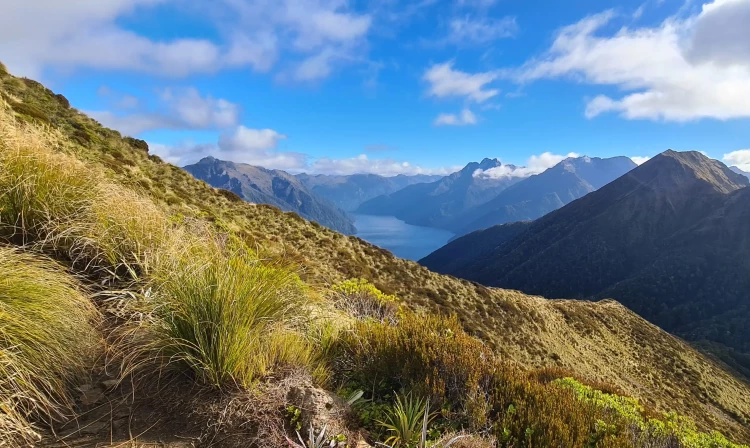
The track begins with a stroll through the beech forest along the shore of Lake Te Anau, the largest body of fresh water in Australasia, to Brod Bay. You’ll then start a challenging climb under impressive limestone bluffs, which takes you above the bushline to panoramic views of the Te Anau Basin and surrounding mountains. Luxmore Hut is a 45-minute walk from the bushline. From Luxmore Hut, there is a 20-minutes side trip to Luxmore Cave. Follow the clearly marked signs and bring a head torch.
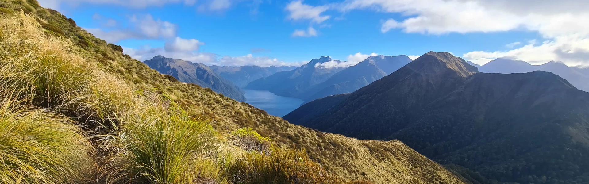
Start your day on top of the world. From the hut, you’ll climb to a ridge just below Mount Luxmore, where you can take a short detour to the summit with stunning views across the south fiord of Lake Te Anau to the Murchison Mountains. A welcoming sight after a day on the tops, Iris Burn Hut is situated in a large tussock clearing. This alpine section of the Kepler Track is not recommended for children under the age of 10, due to the exposed mountain environment and weather that can change very quickly. An overnight stay at Moturau Hut is a better option for the whole family. The Kepler Track has complex avalanche terrain and the risk of avalanche can extend into December. During the Great Walks season (late October to April) DOC manages this risk, and may close the alpine section of the track between Luxmore Hut and Iris Burn Hut if avalanche conditions exist. Warning: Outside of the Great Walks season (between May and late October), the track over the alpine section is not marked and is often blanketed in thick snow. The track to the Luxmore Caves can also be very slippery and icy. Avalanches are frequent. There are 9 avalanche paths, and most have the potential to cross the track. In some instances, by following the track, you'll be crossing avalanche paths - you may need to navigate around them.
Experience ever-changing scenery as the track takes you over a low saddle, then down past a large slip caused by heavy rain to Rocky Point. You’ll then wind through a gorge and lowland beech and podocarp forest, before reaching the shore of beautiful Lake Manapouri. The beach-side Moturau Hut has stunning views of the lake.
The last section is easy walking across a unique and fragile wetland. The track then follows the Waiau River terrace to the swing bridge at Rainbow Reach. You can leave the track here and catch a shuttle bus to Te Anau, or continue alongside the Waiau River for another 9.5km to the Kepler Track car park.
DOC operates 3 huts and 2 campsites along the Kepler Track, which must be booked in advance during the Great Walks season (27 October 2020 – 30 April 2021). Camping or staying overnight in the shelters at Forest Burn and Hanging Valley is not permitted.
Kepler Track can be started from: Kepler Track car park: 5 km from Te Anau. Use this location in Google Maps to find your way there. Fiordland National Park Visitor Centre: 50 min walk along the lakefront to the entrance of the track. Rainbow Reach car park: 12 km from Te Anau. Use this location in Google Maps to find your way there. Shuttle buses provide a daily service to the entry and exit points on the track during the Great Walks season. A scheduled boat service also offers transport to Brod Bay. Visit Fiordland (external site) has information about transport operators.
We encourage you to continue gaining the skills and knowledge required for a safe trip. The NZ Mountain Safety Council has lots of free resources and information you can use. These can be accessed via www.mountainsafety.org.nz . We recommend trying these online learning tools: Trip Planning Tramping / field Skills Basic Navigation River Safety Additionally, check out the range of helpful videos available from the NZ Mountain Safety Council YouTube channel .
Fiordland National Park is in an area with high rainfall and changeable weather. Cold temperatures, snow, strong winds and heavy rain can happen at any time of the year. Be prepared for all conditions. Heavy rain generally comes from the west and falls as snow in the colder months. Strong winds from the northwest are also prevalent. Be wary of southerly wind changes which can bring rapidly deteriorating conditions. Cloudy / low visibility conditions could be dangerous on the ridgeline.
No dogs.
Track information, access and weather can change. Confirm current alerts and land-manager information close to departure, tell someone your plans, and carry equipment appropriate for the route and conditions.