10 October 2026
Mostly cloudy. Easterlies, dying out in the evening.
Loading outdoor place details…
Kaweka Forest Park
A tramp featuring two huts and hot springs, starting and ending at Makahu Road
Distance
13.72 km
Walking time
6-7 hrs
Difficulty
Advanced
Dogs
Allowed — check local rules
Wheelchair access
Not marked friendly
Current status
Weather outlook
Issued 10 Oct 2026, 11:01 pm
10 October 2026
Mostly cloudy. Easterlies, dying out in the evening.
11 October 2026
Mainly fine, with areas of early morning fog. Showers developing in the afternoon, possibly heavy with thunderstorms and hail, clearing in the evening. Northwesterlies developing for a time in the morning and afternoon.
12 October 2026
Fine. Easterlies developing for a time in the afternoon.
13 October 2026
Fine. Northwesterlies developing in the morning.
14 October 2026
Fine apart from isolated showers. Northwesterlies.
Regional guidance only; elevation and terrain can produce different conditions.
Explore the area
Explore the track route and surrounding area before you set out.
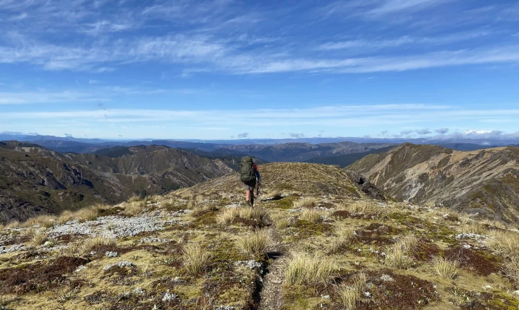
A short distance after Makahu Road enters the park it climbs to a saddle. It is from this point the track to Makino Hut leaves the road. There is a small carpark, for about 4 vehicles, and an information panel here. The track leads up a manuka ridge for 20 minutes (plus climb) – from where there are good views of the Mohaka valley and surrounding plateau farmland. Look and listen for fernbirds in the ground level scrubland and listen for kiwi at night. The track continues along a manuka covered flat, then climbs again to a further flat section. Manuka vegetation gives way to red beech as altitude is gained. The track continues past the Middle Hill turnoff to the left, then to the right to Te Puia Lodge. If you are not planning to visit Makino Hut, then take the turnoff to Te Puia Lodge. Otherwise, continue on Makino Track. About 15 - 20 minutes from this junction, in a small clearing, is Makino Hut.
If you went to Makino Hut, return back down Makino Track until you reach the track junction to Te Puia Lodge. Take this track, which descends steeply for around 1.85 km into the Mohaka River valley. Once the track reaches the valley, it joins Te Puia Track. Follow the track downstream for a short distance, until you reach Te Puia Lodge.
From the junction of the track from Makino Hut with Te Puia Track, you can continue upstream to visit Mangatainoka Hot Springs. The track crosses a bridge over the Makino River just above its confluence with the Mohaka River. The track then continues alongside the Mohaka, through native bush with some rolling terrain. Steep drop-offs in some sections lend nice views of the surrounding foothills. There is a final steep descent to reach the hot springs. At the hot springs, there are 3 pools surrounded by a decking area. These pools have valves to control water flow and to empty the tubs. The hot springs are on a small manuka terrace beside the Mohaka River. The Mangatainoka Hot Springs Campsite is adjacent to the pools. If you wish to travel up the river from the hot springs, it's private land and prior permission from the landowner is required.
From Te Puia Lodge, follow the track down the true right of the Mokaha River to the end of Makahu Road. Mangatutu Hot Springs Campsite is at the end of the track. A short, steep track descends from the campsite to Mangatutu Hot Springs. Thermal water issues from a deep hole in an undercut bank near the top terrace. The water trickles down a riverside bluff, where it is channelled into two pools.
Return to your starting point by following Makahu Road (either walking or arranging transport). Take care if you plan to walk on the road. The whole loop can also be done in reverse: Mangatutu to Te Puia, to Makino then out to the road.
This track is in a restricted fire area, which means permits to light fires are required all year round.
Makino Hut Te Puia Lodge
Makahu Road is 75 km north-west of Napier. From Napier follow Puketitiri Road for 40 km before turning right into Pakaututu Road. Makahu Road is 9 km on the left. At the very end of the road, 500 metres from the Mangatutu Hot Springs and camping area, is "The Gums" parking area and shelter. The tracks to Te Puia Lodge and Mangatainoka Hot Springs begin here. The trip involves about 1 hr of travel on unsealed gravel roads. There is a river ford on Makahu Road 7.5 km from the road end – heavy rain and snow melt can affect the water level. Makahu Road is steep and narrow in places. It may be slippery when wet. Take extra caution driving this road. The road is not suitable for caravans or campervans. Use this location in Google Maps to find your way there.
We encourage you to continue gaining the skills and knowledge required for a safe trip. The NZ Mountain Safety Council has lots of free resources and information you can use. These can be accessed via www.mountainsafety.org.nz . Level up in your outdoor knowledge with these interactive online learning tools: Trip Planning Tramping / field Skills Basic Navigation River Safety Additionally, check out the range of helpful videos available from the NZ Mountain Safety Council YouTube channel .
Dogs with a DOC permit for recreational hunting or management purposes only.
Track information, access and weather can change. Confirm current alerts and land-manager information close to departure, tell someone your plans, and carry equipment appropriate for the route and conditions.