11 October 2026
Showers, possibly heavy, clearing to fine spells by early evening. The odd shower west of Tauranga at night. Northwesterlies, dying out early evening.
Loading outdoor place details…
Whirinaki Te Pua-a-Tāne Conservation Park
This shared-use track includes an overnight stop at an historic hut and amazing views from the top of the Moerangi saddle (955 m). Listen for the piercing calls of kiwi at night.
Distance
35 km
Walking time
3 days
Difficulty
Intermediate
Dogs
Not allowed
Wheelchair access
Not marked friendly
Current status
No active alerts found. Conditions can still change, so check again before leaving.
Weather outlook
Issued 11 Oct 2026, 4:35 pm
11 October 2026
Showers, possibly heavy, clearing to fine spells by early evening. The odd shower west of Tauranga at night. Northwesterlies, dying out early evening.
12 October 2026
East of Te Puke: Morning cloud clearing to fine, then isolated showers and cloud developing from mid-afternoon. Elsewhere: Occasional rain, clearing to fine spells mid-afternoon, then cloud increasing again in the evening Afternoon northerlies.
13 October 2026
A few showers. Northwesterlies developing in the morning.
14 October 2026
A few showers. Northwesterlies developing in the morning.
15 October 2026
Rain, clearing in the evening. Northerlies, turning westerly in the morning.
Regional guidance only; elevation and terrain can produce different conditions.
Explore the area
Explore the track route and surrounding area before you set out.
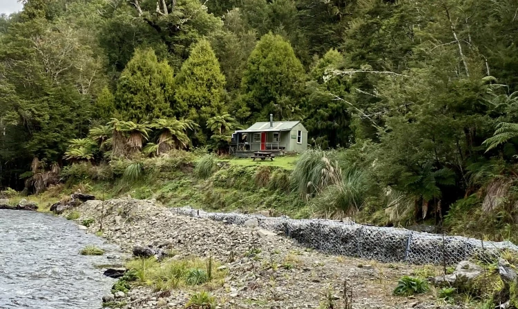
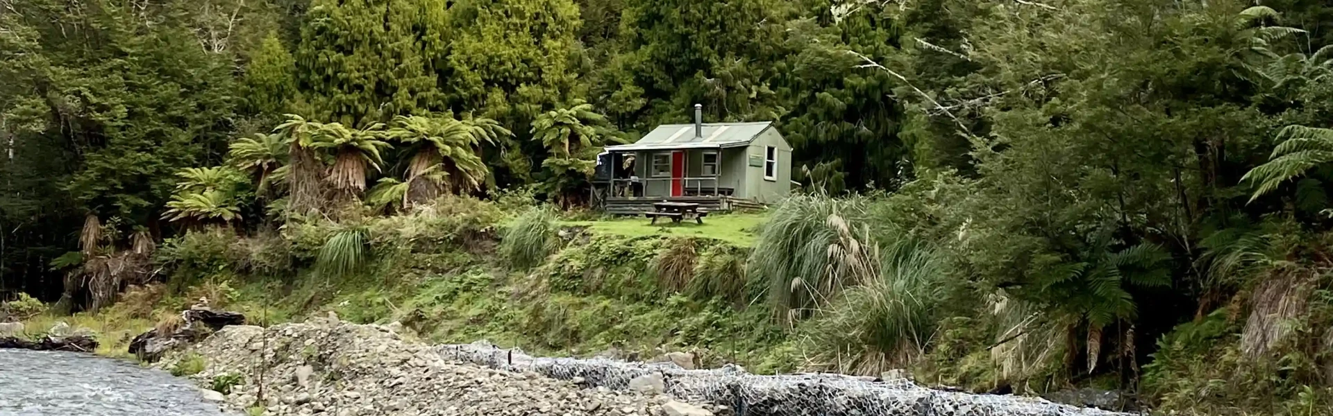
Okahu Rd to Rogers Hut (Te Wairoa) Time: 3 hr 30 min Distance: 13 km Begin at the Okahu Road end; it’s a 2-hour (7 km) walk to Skips Hut (Whangatawhia) . From there, the track climbs over a saddle before descending to Rogers Hut . Rogers Hut is one of the original deer culler huts in the Whirinaki, built from massive beech slabs and featuring a stained-glass window. Keep an eye out for whio/blue ducks in the stream next to the hut. Rogers Hut to Moerangi Hut Time: 3 hr Distance: 9 km From Rogers Hut, it’s an easy walk to the next overnight stop: Moerangi Hut . The hut is located about 500 m up a slight detour from the main track. There are plenty of kiwi in the area, so listen for their shrill calls as night falls. Moerangi Hut to River Rd Time: 4 hr 30 min Distance: 13 km From Moerangi Hut, the track climbs steeply over Moerangi Saddle, which tops out at 955 m. From here, enjoy spectacular views of the Rangitaiki Plains far below. Descending from the saddle, the track enters lush lowland podocarp forest. Walk among the towering trees before reaching the River Rd car park, marking the end of the track.
This is a dual (shared use) track for both walkers and mountain bikers. People heading uphill should give way to those heading down. This bike track starts at the Okahu Valley Road end. Do not start from River Road car park as this may cause head-on injuries with other bikes coming through from Okahu. Mountain bikers should dismount at every major bridge crossing and walk your bike across.
For passionate mountain bikers, this track is a "must-do" ride. Covering 35 km of challenging single track with 1000 m of climbing, it demands respect—but the thrilling descents make it all worthwhile. The three huts along the way provide great spots to rest and regroup. They also offer the option of turning this demanding ride into an overnight adventure. Okahu Road to Skips Hut Distance: 7 km Starting from Okahu Valley Rd car park, the trail immediately climbs towards the first saddle gaining 100 m in height in just 1 km. The rewards are instant. The trail then has an undulating descent following the Whangatawhia Stream for a further 6 km. There are numerous bridges to cross before reaching Skips Hut. Skips Hut to Rogers Hut Distance: 6 km From Skips Hut the trail continues along the Whangatawhia Stream a short distance before beginning a sustained climb of 150 m. Once the saddle is reached after 2 km, a fast and flowing 2.5 km descent follows. Rogers Hut is the perfect stopping point at the confluence of the Moerangi and Wairoa streams. Rogers Hut to Moerangi Hut Distance: 9 km Leaving Rogers Hut the track heads west (take a right at the junction) up the Moerangi Stream. This section is an undulating climb with some steeper pinches. The right hand side of the track has some exposed sections with large drop offs - take care. Don’t miss the short detour to Moerangi Hut if you are keen on a visit. Moerangi Hut to River Road Distance: 13 km Immediately from the hut the real climbing begins. The trail continues to weave its way up the Moerangi Stream for a short period before ascending the saddle. The climb is steep and sustained gaining almost 300 m - most will find it a challenge. A rest point is available at the saddle and some cell phone reception is possible. From the saddle it's a fast and long descent loosely following the ridge line before dropping down to the Whirinaki River. Take care as the sides of the track have large drop offs. This is a stunning section of downhill riding that is sure to please. From Te Whaiti Nui A Toi Canyon it is a short climb to the River Rd car park. Navigation tip : keep an eye on the green trail markers that line the side of the Moerangi Track to ensure you stay on track.
Whirinaki Te Pua-a-Tāne Conservation Park is 90 km south east of Rotorua. From Murupara travel south east along Te Whaiti Rd. Once you reach Te Whaiti this road becomes Ruatahuna Rd. Continue along this road for a further 7.5 km until you reach a right hand turn to Okahu Valley Rd. The car park is 9 km south on Okahu Valley Rd. The bike track starts from Okahu Valley Rd and ends at River Road car park. To get to River Road car park turn left off Te Whaiti onto Minginui Road and follow the signs. Mountain bikers should only start from Okahu Valley Rd. Use this location to help find your way there.
We encourage you to continue gaining the skills and knowledge required for a safe trip. The NZ Mountain Safety Council has lots of free resources and information you can use. These can be accessed via www.mountainsafety.org.nz . We recommend trying these online learning tools: Trip Planning Tramping / field Skills Basic Navigation River Safety Additionally, check out the range of helpful videos available from the NZ Mountain Safety Council YouTube channel
No dogs.
Track information, access and weather can change. Confirm current alerts and land-manager information close to departure, tell someone your plans, and carry equipment appropriate for the route and conditions.