11 October 2026
Showers, possibly heavy, becoming isolated this afternoon as fine spells increase. Westerlies.
Loading outdoor place details…
Ruapehu
Te Araroa trail section: On a fine day, there are sweeping views of Tongariro National Park to the east and Mt Taranaki to the west from Mangapurua Trig, the highest point in this area.
Distance
88.1 km
Walking time
4 days
Difficulty
Intermediate
Dogs
Not allowed
Wheelchair access
Not marked friendly
Current status
Weather outlook
Issued 11 Oct 2026, 4:35 pm
11 October 2026
Showers, possibly heavy, becoming isolated this afternoon as fine spells increase. Westerlies.
12 October 2026
Mostly cloudy with patchy drizzle south of Taihape, clearing to fine in the morning. Clouding over again in the evening. Light winds.
13 October 2026
A few showers. Northwesterlies.
14 October 2026
Fine, but becoming mostly cloudy with isolated showers in the morning. Northwesterlies developing in the morning.
15 October 2026
A period of rain with heavy falls, otherwise a few showers. Northwesterlies, dying out in the evening.
Regional guidance only; elevation and terrain can produce different conditions.
Explore the area
Explore the track route and surrounding area before you set out.
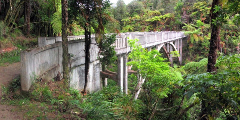
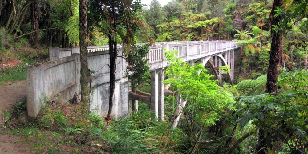
From National Park Railway Station, head north up Ward Street for 430m, then west onto Carroll Street and over the railway tracks at the crossing. Fisher Track - 16.5km / 5-6 hours Turn right onto Fisher Road. Walk 30 minutes down Fisher Road until the turnoff for the Tupapakurua Falls Track (on the left side of the road). It's an optional, easy 20-minute diversion to the Taranaki Lookout. Continue on Fisher Track westward and largely downhill, dropping from 800m to 400m. It eventually joins Kurua Road for 3.5km (a metalled road in deer-farming country), which runs alongside Tupapakurua Stream for a while until reaching Rētāruke Road. It is a mix of well-formed track, rough tramping track and gravel road. Kurua Rd to Whakahoro- 36km / 8-9 hours From the junction of Kurua and Rētāruke Roads, walk north on Upper Rētāruke Road for 12km. At the intersection with Oio Road (there is a toilet available here), turn left (west) onto Oio Road and follow it for the next 24.5km (mostly alongside the Rētāruke River) to Whakahoro, on the banks of the Whanganui River. This section can be hot and tiring in summer, with little or no water sources. Plan and carry plenty of water. There is no walking track beyond Mangapurua. The options are to either canoe down the river from Whakahoro to Pipiriki or Whanganui, or walk from Whakahoro to Mangapurua to get picked up there by pre-arranged jet boat and taken to Pipiriki or Whanganui. Discuss with canoe/kayak hire operators. Contact suggestions at the end of this notes section, and in the Whanganui River - via Whanganui River section. Whakahoro to the Mangapurua Landing (Mangapurua-Kaiwhakauka Track) - 37km / 13 hours 7 hours from Whakahoro to the Mangapurua Trig; 6 hours from the Trig to Mangapurua Landing. A combined walking/cycleway, this track follows former road lines and makes for easy walking. It leads up the Kaiwhakauka Valley to the Mangapurua Trig. There it joins the Mangapurua Track, which descends through the Mangapurua Valley to meet the Whanganui River at the Mangapurua Landing. From Whakahoro the track follows the disused road along the true left bank of the Whanganui River for 1km, before turning sharply into the Kaiwhakauka Valley. The track follows along and crosses the Kaiwhakauka Stream over an old wooden bridge. It continues along the true left bank of the stream up to the head of the Kaiwhakauka Valley. Note : Care should be taken not to disturb stock and gates should be left as found when crossing farmland. On reaching the junction of the old Kaiwhakauka, Mangapurua and Ruatiti/Ōhura Roads, keep to the right to drop down into the Mangapurua. A side track leads to the Mangapurua Trig (near km 1,260.7), the highest point in the area. On a fine day, there are sweeping views of Tongariro National Park to the east and Mt Taranaki / Egmont to the west. Mangapurua Trig is your best opportunity to get a phone signal if you need to confirm a canoe pickup time at Mangapurua Landing. From here the track winds steadily down into the valley where the track meets and stays on the true left bank of the Mangapurua Stream. Continuing along the old road line, the track crosses numerous side streams and the valley progressively closes in. Although the track is freshly maintained, the rocks can be slippery when wet – care should be taken in negotiating these sections and beware of falling rocks. At the lower end of the valley, the track crosses to the true right bank of the stream over the historic Bridge to Nowhere. This is a large concrete bridge built in 1936, but is now standing abandoned in the bush in the middle of 'nowhere'. This last section of the track is formed to walking track standard and is often used by river travellers to visit the Bridge to Nowhere. Beyond the bridge, continue for another 40 minutes as the track follows the true right bank of the Mangapurua Stream and then leads along the true left bank of the Whanganui River to reach the Mangapurua Landing. Note: Mangapurua Landing is a dead end for walkers. River transport is the only option for those travelling south from Mangapurua Landing. Hikers reaching Mangapurua on foot can take a pre-arranged jet boat ride to Pipiriki or Whanganui. Contact suggestions at the end of this notes section, and in the Whanganui River - via Whanganui River section. General information For local information and a list of suppliers, contact: Whanganui i-SITE , 31 Taupō Quay, Whanganui - P: 06 349 0508 - E: info@whanganui.govt.nz The distances and campsite options when travelling by river are: Whakahoro to Mangapapa campsite: 11 kilometres Mangapapa to Ohauora campsite: 16 kilometres Ohauora to John Coull Hut: 10.5 kilometres John Coull Hut to Mangawaiiti campsite: 9.5 kilometres Mangawaiiti to Mangapurua campsite: 9 kilometres
Potential hazards Vehicles on road or track – bikes in particular Poisons and traps Small stream crossings Track exposed to sun, wind or cold Few water sources between National Park and Whakahoro Mangapurua-Kaiwhakauka track condition: During the winter this track can be subject to wet and muddy conditions. Slips may be present in lower sections of the track. Please contact the Department of Conservation Whanganui Area Office with any inquiries: Phone: 06 349 2100 Whanganui River (John Coull Hut) weather - NIWA
Northern Start: Railway Station, Station Rd, National Park Southern End: Mangapurua Landing, Whanganui River To trailheads There are no facilities of any type at the Kurua-Rētāruke Road end of this track. Trampers need to be totally independent and make their own pre-arrangements for food, shelter or pickups. Access points Whakahoro can be reached by road from SH4, turning off at either Ōwhango or Raurimu. Alternatively, access to the Mangapurua Trig may be gained by walking in from Ruatiti Road. Track start is on the western side (approximately 15km from the southern start of the road), off Raetihi-Ōhura Rd, off SH4, north of Raetihi. Pre-booked river transport is the only option. To kayak from Whakahoro to Mangapurua Landing (or beyond), pre-book so jetboats can pick you up or deliver kayaks to you. Whanganui River Canoes - P: 0800 40 88 88 or 06 385 4176 Taumarunui Canoe Hire and Jet Boat Tours - P: 0800 226 6348 or 027 226 6348 or 07 895 7483 email: tmncanoehire@gmail.com Yeti Tours - P: 06 385 8197 or 0800 322 388 - E info@yetitours.co.nz 3 Burns Street Ohakune.
Before starting Te Araroa either as a through-walker of the whole country or a section walker, please register on Te Araroa website . Please also visit the website or download the app for detailed maps, trail alerts and other relevant information. This track is part of the Herenga ā Nuku Aotearoa track database. Herenga ā Nuku has maps and advice about public access to the outdoors . We encourage you to continue gaining the skills and knowledge required for a safe trip. The NZ Mountain Safety Council has lots of free resources and information you can use. These can be accessed via www.mountainsafety.org.nz . We recommend trying these online learning tools: Trip Planning Tramping/field Skills Basic Navigation River Safety Additionally, check out the range of helpful videos available from the NZ Mountain Safety Council YouTube channel .
Potential hazardsVehicles on road or track - bikes in particular. Poisons and traps Small stream crossings Track exposed to sun, wind or cold Few water sources between National Park and Whakahoro Mangapurua-Kaiwhakauka track condition: During the winter this track can be subject to wet and muddy conditions. Slips may be present in lower sections of the track. Please contact the Department of Conservation Whanganui Area Office with any inquiries: Phone: (06) 349 2100
Track information, access and weather can change. Confirm current alerts and land-manager information close to departure, tell someone your plans, and carry equipment appropriate for the route and conditions.