10 October 2026
Often cloudy, with the chance of a shower. Light winds.
12° / 22°
Loading outdoor place details…
Waitomo
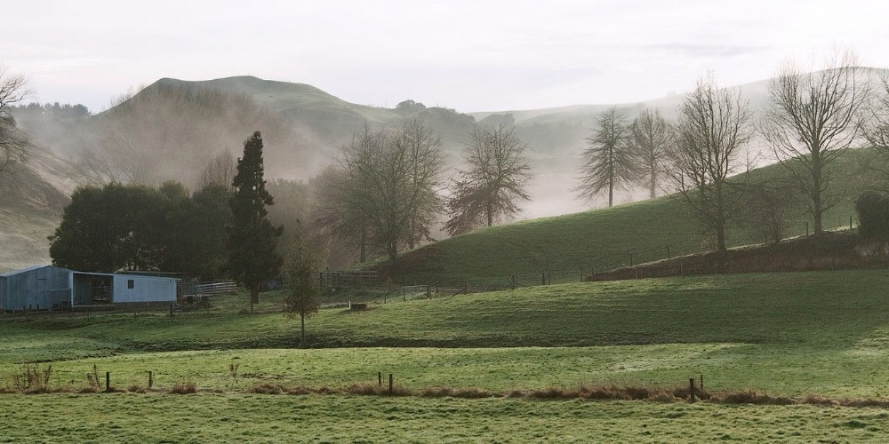
Te Araroa trail section: Most of this section crosses farmland and bush but includes a small portion of road margin. Expect hills with 150m ascents and descents. It pauses on top of high karsts to gaze across the King Country's low agriculture and tumbled limestone hills that rise to formidable volcanic summits – north to Pirongia, east to Pureora, and south to Ruapehu.
Distance
14.8 km
Walking time
6 hours
Difficulty
Intermediate
Dogs
Not allowed
Wheelchair access
Not marked friendly
Current status
No active alerts found. Conditions can still change, so check again before leaving.
Weather outlook
Issued 10 Oct 2026, 9:34 pm
10 October 2026
Often cloudy, with the chance of a shower. Light winds.
12° / 22°
11 October 2026
Showers, possibly heavy with thunderstorms, clearing to fine spells in the afternoon. Periods of rain developing in the evening. Northwesterlies.
13° / 21°
12 October 2026
Occasional rain. Northwesterlies developing for a time in the afternoon.
14° / 23°
13 October 2026
A few showers. Northwesterlies developing in the morning.
13° / 22°
14 October 2026
A few showers clearing to fine in the afternoon. Northwesterlies developing in the morning.
12° / 22°
Regional guidance only; elevation and terrain can produce different conditions.
Explore the area
Explore the track route and surrounding area before you set out.
Pehitawa Track - 17km From Waitomo Village, take the Hotel Access Road past the Tavern and School. Before the cattle stop, climb the stile on the left-hand side and follow the track completed in 2020 along a section of the Waipa Faultline, which runs north south through the district. Here Limestone is uplifted on the western side. Cross Fullerton Road, then a stile, and follow the orange markers SE across open farmland, then up through a small gate and climb a hand-formed track. You'll pass some enormous boulders - these are thought to have come from the Mangakino explosion - some 60km away! Once up and over the ridge, the track descends steeply through bush — this is very slippery when wet, so take care — and exits onto more farmland where you'll again follow markers SE along the fence line, climbing again through bush and onto a ridge. Climb through regenerating bush and the track takes a 90-degree turn towards the west, running through what Te Araroa veterans will remember (fondly?) as the infamous "Te Kuiti Tunnel of Gorse", now nicely opened up and easily passable. Exiting the bush, head over a stile and follow the marked fence to the next stile; then continue along the fence line — now on the other side of it — and drop down to a farm race (giving way to any animals found on it). This is the farm of John Were. Look for a stile on the NE (left-hand) side after crossing a farm bridge over a stream and then head for a suspension bridge over the Mangapu River. Once over the suspension bridge, the track heads through Pehitawa Forest (Queen Elizabeth II Trust-covenanted land and one of the finest remaining stands of Kahikatea trees). Follow markers up a ridgeline to a fence near the top of the hill and over a stile to Oparure Rd. Cross over the stile on the southern side of Oparure Rd onto Wicklow Farm. Follow markers through several paddocks and over stiles for roughly a kilometre to reach a farm track. Follow this farm track for 2km to reach Gadsby Road. Go about 50m down Gadsby Rd, to then turn right up the driveway for 153 Gadsby Road (you'll see a Te Araroa marker). The trail follows the flank of Pehitawa Mast Hill (264 metres), and descends through to the northern end of Brook Park. There are many trails in this council owned reserve, but try to follow Te Araroa markers down to Bosco Cafe on SH 3. Opposite the cafe, there is now a riverside path all the way to the south end of Te Kuiti with multiple entry points through town. The Brook Park route may be closed for lambing between 1st July and 30th August. Leave the track at km 901.7 and exit via Gadsby Road to SH 3. Check Alerts and Trail Status for details. Note two fine statues – a tribute to Sir Colin Meads (one of NZ's finest rugby players) adjacent to the railway station, and the shearing statue at the south end of Rora St. West of the Statue Te Tokanganui a noho can be seen, this historic marae was built in 1873 under the director of the Maori leader and prophet Te Kooti.
Vehicles on road or track Farming operations – m ove steadily and quietly through livestock Open drains Track exposed to sun, wind or cold Steep, muddy and slippery in parts
Northern Start: Waitomo Walkway carpark, Waitomo Village Southern End: Rora Street, Te Kuiti InterCity - P: 09 583 5780 - E: info@intercity.co.nz
Te Kūiti i-Site Visitor Information Centre - 160 Rōra St, Te Kūiti - P: 07 878 8077 DOC Maniapoto Area Office - 78 Taupiri Street, Te Kūiti - P: 07 878 1050 - E: maniapotoao@doc.govt.nz Before starting Te Araroa either as a through-walker of the whole country or a section walker, please register on Te Araroa website . Please also visit the website or download the app for detailed maps, trail alerts and other relevant information. This track is part of the Herenga ā Nuku Aotearoa track database. Herenga ā Nuku has maps and advice about public access to the outdoors . We encourage you to continue gaining the skills and knowledge required for a safe trip. The NZ Mountain Safety Council has lots of free resources and information you can use. These can be accessed via www.mountainsafety.org.nz . We recommend trying these online learning tools: Trip Planning Tramping/field Skills Basic Navigation River Safety Additionally, check out the range of helpful videos available from the NZ Mountain Safety Council YouTube channel .
The history behind the historic British holly and Māori pōhutukawa trees: In 1883 Māori chief Mahuki seized a railway surveying party, Wilson Hursthouse and others. Mahuki remained furious at Hursthouse’s role in sacking the peaceful village of Parihaka. The pākehā peered from their prison shed to see Māori writing their names on pigs before slitting the pig throats. Around then, the door of the cell crashed open and there stood their rescuer, Te Kooti, himself an outlaw. Whitinui Joseph, great grandfather of the All Black Jamie Joseph, and a kinsman of Mahuki, celebrated the peace by planting two trees - a British holly and a Māori pōhutukawa - on the spot where this happened. Brook Park offers a country setting with panoramic views of Te Kūiti. The park is used as a farming operation by the Te Kūiti High School Charitable Trust, but pedestrian access is allowed at all times. Care must be taken not to disturb the sheep, especially during lambing, usually 1st July to 30th August. Noted tree collections are scattered throughout the Park, i.e. Black Walnuts, Pinus Radiata tree crops, Rhododendrums including native trees such as Kauri and Rimu. In addition a recently developed Memorial Arbor offers a spectacular array of colourful trees in a peaceful setting.
Vehicles on road or track Farming operations. Move steadily and quietly through livestock. Open drains Track exposed to sun, wind or cold Steep, muddy and slippery in parts.
Track information, access and weather can change. Confirm current alerts and land-manager information close to departure, tell someone your plans, and carry equipment appropriate for the route and conditions.