11 October 2026
Showers, clearing in the afternoon, but some cloud remaining about the tops.
Loading outdoor place details…
Mount Aspiring National Park
A large slip in Dart Valley between Daleys Flat Hut and Chinamans Bluff has made the Rees-Dart Track circuit impassable, however trampers can walk some of the track from either end.
Distance
63 km
Walking time
4-5 days one way
Difficulty
Advanced
Dogs
Not allowed
Wheelchair access
Not marked friendly
Current status
Weather outlook
Issued 11 Oct 2026, 7:33 am
11 October 2026
Showers, clearing in the afternoon, but some cloud remaining about the tops.
12 October 2026
Fine, but becoming overcast at night.
13 October 2026
Rain, heavy for a time in the afternoon. Snow to 2300 metres.
14 October 2026
Heavy rain easing to showers. Snow to 2100 metres.
15 October 2026
Partly cloudy with isolated showers.
Regional guidance only; elevation and terrain can produce different conditions.
Explore the area
Explore the track route and surrounding area before you set out.
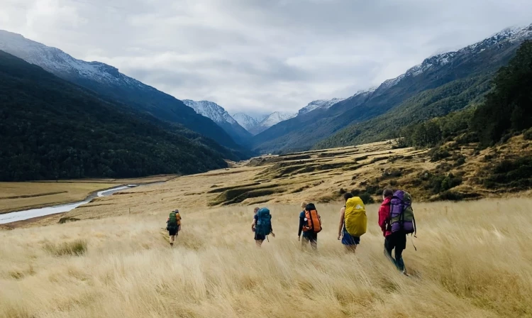
Take the vehicle track from Muddy Creek and follow the marker poles across the boggy section beyond Arthurs Creek. Continue up the grassy flats to the swing bridge on the national park boundary. This track crosses private land. Please respect the landowner’s property and leave all gates as you find them.
There is a marked track through the bush and a swing bridge crossing to the west bank of Rees River. The track continues through beech forest past Clarke Slip to the bush edge. Above the bush, the track crosses several gullies that are avalanche paths. Take care crossing these gullies in spring and early summer when late snow may still pose a risk. Half an hour up from the bush edge, cross a bridge to the river’s east bank to reach the 22-bunk Shelter Rock Hut.
The track between Shelter Rock Hut and Dart Hut is narrow with a number of steep drop-offs, particularly in the upper Snowy Creek. Follow the true left of Rees River as the track goes through scrub then rises about 100 m above the river. The track sidles into the tussock-filled upper basin and follows the river’s bed. On the final steep climb to the 1471 m Rees Saddle, there is a lightly marked track close to the bluff on the left. From the saddle, follow the orange markers as the track drops and passes tarns to a tussock bench well above Snowy Creek. From here, the track traverses steep slopes that can be dangerous when wet or snow covered. A bridge crosses upper Snowy Creek, and the track sidles across broken slopes before descending sharply. The Dart Hut is on Snowy Creek’s true left and can be reached via a swing bridge.
Find out more information on the Cascade Saddle Route (opens in browser)
From Dart Hut, it is an easy 2 to 3-hour sidle and descent through beech forest to Cattle Flat. A faint track marked by metal poles leads across the 4 kilometres of Cattle Flat, crossing terraces and gullies and is followed by a well-marked track through beech forest to Daleys Flat Hut. Note: Unbridged side streams can rise quickly with heavy rain making crossings dangerous. The Daleys flat bridge that gave access to the Margaret burn was destroyed in the February 2020 flood event.
From Daley's Flat Hut, walk through beech forest for the first hour. After passing the recently formed lake over Dredge Flat, follow the new track leading up through native forest high above the Dart River. This part of the track has been realigned after landslides had forced a long-term closure. These new sections are narrow and sometimes steep and require a higher level of backcountry skills than the other sections of the track. After descending to Surveyors Flat the track stays close to the river, then climbs over Chinamans Bluff and eases out to Chinamans Flat and the carpark.
Physical fitness and good equipment will make all the difference to your enjoyment of the trip. The track between Shelter Rock and Dart Hut is a narrow route with several steep drop offs - particularly in the Upper Snowy Creek. Throughout this circuit, there are river and stream crossings that become hazardous in heavy rain or snow melt. Make sensible decisions about river crossings and have alternative plans. South of Daleys Flat Hut at Sandy Bluff, significant track damage and landscape change has occurred in recent years. DOC has diverted the track in many areas and is still adjusting the position of certain sections of track. Keep an eye out for track markers and follow them carefully as the terrain around the bluff is steep. In winter the Rees-Dart tracks are impassable to all but experienced mountaineers, due to heavy snow, especially in the Upper Rees and Snowy Creek area. The bridge at Snowy Creek is also removed at this time of year due to avalanche danger and is not put back in place in spring until avalanche danger is no longer present. There are multiple avalanche paths that are typically active from May to November. The greatest risk is in areas with avalanche terrain rated as 'challenging' or 'complex' on the Avalanche Terrain Exposure Scale. These areas are: The Dart Track from the Whitbourn River confluence to the Dart Hut The final 1.5 km before Shelter Rock Hut on the Rees Track Between Shelter Rock Hut and Dart Hut Avalanches can occur outside of these areas but are less frequent.
There are three DOC huts in this area. Bookings are not required, so bring a bed roll in case the hut is full when you get there. Camping is also permitted, except in the fragile alpine and subalpine areas between Shelter Rock Hut and Dart Hut– this is to protect these fragile alpine and subalpine areas. Shelter Rock Hut Dart Hut Daley’s Flat Hut
The Rees track begins 68 km from Queenstown, via Glenorchy, and there is a car park at Muddy Creek. Use this location in Google Maps to find your way there. Note: It is possible to take 4WD vehicles beyond Muddy Creek, but as Muddy Creek is prone to sudden washouts which make it impassable, it is not advisable to leave vehicles for any length of time on the other side. The Dart track begins 76 km from Queenstown via Glenorchy. A 2WD road extends to Chinamans Bluff, however this is a fine weather road only and subject to washouts and flooded creeks. Use this location in Google Maps to find your way there. Jet boats service the Dart section of the track, and buses service both tracks – contact transport operators for their schedules.
We encourage you to continue gaining the skills and knowledge required for a safe trip. The NZ Mountain Safety Council has lots of free resources and information you can use. These can be accessed via www.mountainsafety.org.nz . We recommend trying these online learning tools: Trip Planning Tramping / field Skills Basic Navigation River Safety Additionally, check out the range of helpful videos available from the NZ Mountain Safety Council YouTube channel .
Heavy rain and strong winds are most likely from the west but southerly wind changes can bring rapidly deteriorating conditions with snow likely in the colder months. The circuit is also open to very heavy rain from the west which could cause rapidly rising waters and make side creeks unsafe to cross. If leaving your car at the Muddy Creek carpark in the Rees Valley, it is safer to park on the south side of the stream, in case the ford is in flood when you return.
No dogs.
Track information, access and weather can change. Confirm current alerts and land-manager information close to departure, tell someone your plans, and carry equipment appropriate for the route and conditions.