11 October 2026
Scattered showers, becoming confined south of Doubtful Sound in the afternoon.
Loading outdoor place details…
Fiordland National Park
This track of varying difficulty leads along rugged southern Fiordland coast to Port Craig (easy overnight) and beyond to the more remote Big River (4 days one way).
Distance
58.5 km
Walking time
7 hr to Port Craig, 4 days to Big River
Difficulty
Intermediate, Advanced, Expert
Dogs
Not allowed
Wheelchair access
Not marked friendly
Current status
Weather outlook
Issued 10 Oct 2026, 9:23 pm
11 October 2026
Scattered showers, becoming confined south of Doubtful Sound in the afternoon.
12 October 2026
Partly cloudy, with one or two morning showers south of Secretary Island.
13 October 2026
Heavy rain developing, with snow to 2400 metres.
14 October 2026
Rain, with snow to 1900 metres, turning to showers.
15 October 2026
Showers, with snow to 800 metres, easing.
Regional guidance only; elevation and terrain can produce different conditions.
Explore the area
Explore the track route and surrounding area before you set out.
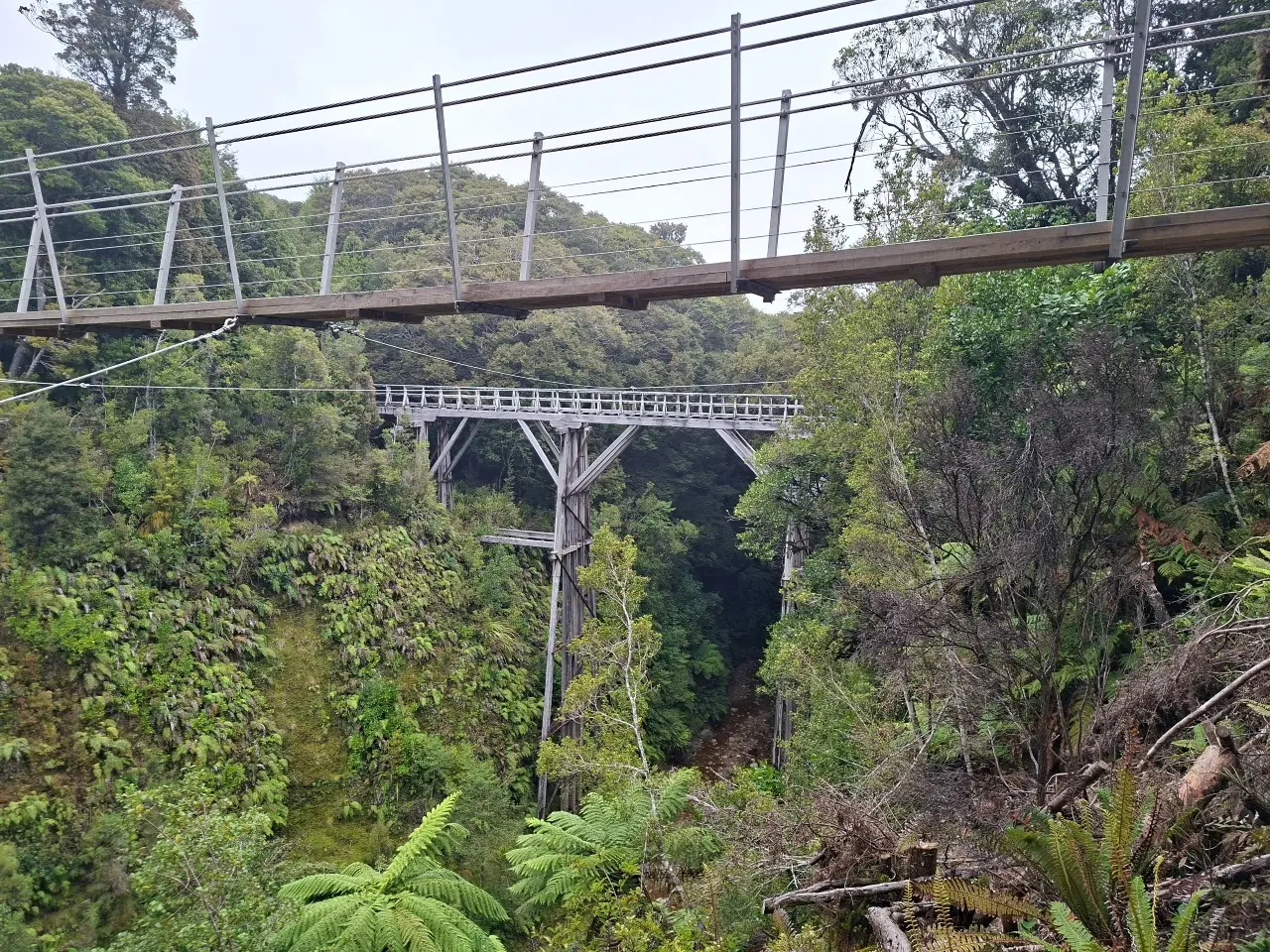
Track category: Great Walk/Easier tramping track Time: 7 hours Distance: 20 km Starting from the Rarakau car park, the track follows an old road, crossing several suspension bridges and passing beachside baches. After passing the turnoff to the Hump Ridge Track’s Okaka Lodge, the trail winds along a series of beaches and headlands before reaching the stunning Blowholes Beach. Keep an eye out for Hector’s dolphins, which are often seen along this coastline—recognizable by their distinctive, rounded dorsal fins. From Blowholes Beach, the track climbs over another headland to Breakneck Creek, where it re-enters the forest. The trail then continues to the historic Port Craig School Hut (DOC) and nearby Port Craig Lodge (private, contact Tuatapere Hump Ridge Track for information and bookings). Interpretive panels and a short walking loop provide insight into the area’s rich timber milling history.
Track category: Tramping track Time: 6 hours Distance: 16 km The track follows a historic logging tramline for 15 km through regenerating native forest, offering a gentle and well-graded route. After approximately two hours of walking from Port Craig, you’ll reach the impressive Sandhill and Percy Burn viaducts. Percy Burn is also home to the Tuatapere Port Craig Viaducts Trust hut, a good place for a break or an overnight stay. Beyond Percy Burn, the track continues, crossing the Edwin Burn and Francis Burn viaducts. At the tramline’s end, the route transitions into mature forest, descending through three river terraces before emerging at a clearing on the banks of the Wairaurahiri River, where the Wairaurahiri Hut is located.
Track category: Tramping track Time: 6 hours Distance: 13 km Cross the Wairaurahiri River via the bridge next to the hut. From here, the track winds through private Māori land and coastal forest, following bush-clad terraces along the coastline. The route eventually reaches the Waitutu River, where a suspension bridge provides access to Waitutu Hut , located 200 m upstream on the true right bank.
Track category: Route Time: 5+ hours Distance: 12 km From Waitutu Hut, the track transitions into a marked route, suitable only for experienced trampers. The terrain becomes more rugged and navigation skills are essential. Westies Hut , a unique shelter located within a sea cave at Prices Harbour, is signposted from the track approximately 2 km east of Big River.
Track conditions can be challenging, with muddy sections, unbridged streams, and river crossings. If traveling along the coast, always check tide conditions and exercise extreme caution. Beyond Port Craig, the track transitions into tramping tracks and routes, requiring good to above-average fitness. You must have advanced backcountry skills, including navigation and survival expertise, to safely navigate these remote areas.
This track begins at the Rarakau carpark near Bluecliffs Beach in Te Waewae Bay, southern Fiordland. To reach the carpark from Tuatapere, follow Papatotara Road south for approximately 28 km, following signs for Bluecliffs Beach and Rarakau. Note that the final 7 km of the road is unsealed. The carpark is located in front of the Rarakau Station homestead, about 150 m beyond the track entrance. Vehicles are left here at the owner’s risk. Use this location on Google Maps to help find your way there. There are jet boat transport operators in the area to facilitate a return trip - Wairaurahiri River Jet and Wairaurahiri Je t.
We encourage you to continue gaining the skills and knowledge required for a safe trip. The NZ Mountain Safety Council has lots of free resources and information you can use. These can be accessed via www.mountainsafety.org.nz . We recommend trying these online learning tools: Trip Planning Tramping / field Skills Basic Navigation River Safety Additionally, check out the range of helpful videos available from the NZ Mountain Safety Council YouTube channel
No dogs.
Track information, access and weather can change. Confirm current alerts and land-manager information close to departure, tell someone your plans, and carry equipment appropriate for the route and conditions.