11 October 2026
Rain at first, possibly heavy, then showers easing in the afternoon, clearing early evening. Northerlies, turning westerly in the afternoon.
Loading outdoor place details…
Abel Tasman National Park
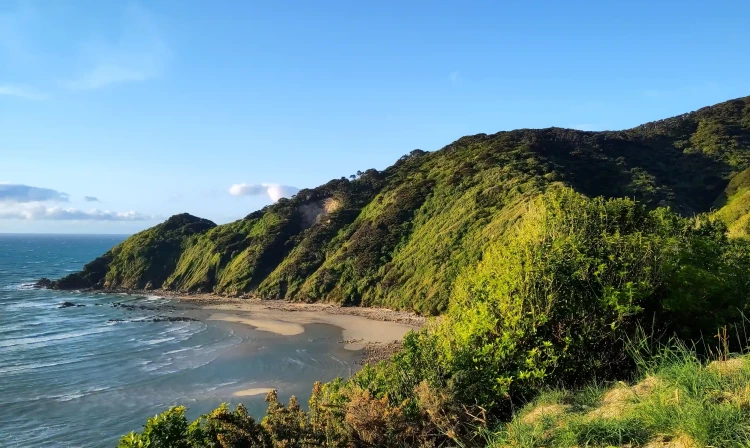
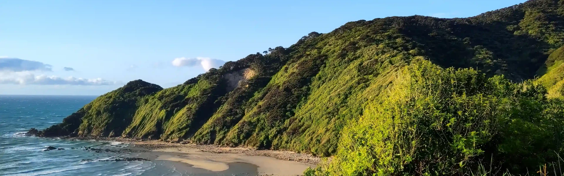
Enjoy the mild climate, golden beaches and lush coastal native bush on the Abel Tasman Coast Track.
Distance
60 km
Walking time
3–5 days one way
Difficulty
Intermediate
Dogs
Not allowed
Wheelchair access
Not marked friendly
Current status
Weather outlook
Issued 10 Oct 2026, 11:01 pm
11 October 2026
Rain at first, possibly heavy, then showers easing in the afternoon, clearing early evening. Northerlies, turning westerly in the afternoon.
12 October 2026
Fine. Northerlies developing for a time in the afternoon.
13 October 2026
A few showers, clearing in the evening. Northwesterlies developing in the morning.
14 October 2026
Rain, becoming persistent with heavy falls in the evening. Northerlies developing in the morning.
15 October 2026
Showers, some heavy. Light winds.
Regional guidance only; elevation and terrain can produce different conditions.
Explore the area
Explore the track route and surrounding area before you set out.
Time: 4 hr Distance: 12.4 km You’ll begin your journey as you cross the estuary over the Marahau causeway, and follow the track, first through open country, then lush beech forest with large kānuka trees. The track eventually turns inland, winding in and out of several little gullies before emerging to a view of the beautiful Anchorage Bay. Here you’ll descend to Anchorage Hut and Campsite. It's a beautiful walk through the coastal forest with stunning golden sand beaches and lookouts. The signage is well-marked, and you can take the side trails to the waterfront to explore the little coves along the way. Please don’t feed any Weka you come across and be careful with your gear – they are very adept at running off with things! Campsites and huts between Mārahau and Anchorage Tinline Campsite Coquille Bay Campsite Apple Tree Bay Campsite Akersten Bay Campsite Watering Cove Campsite Observation Beach Campsite Te Pukatea Bay Campsite Anchorage Campsite Anchorage Hut
High tide track Time: 4 hr Distance: 11.5 km Low tide crossing the Torrent Bay estuary Time: 3 hr Distance: 8.4 km Check the tide timetable before you hit Torrent Bay estuary which can only be crossed within 2 hours either side of low tide, or plan to take the longer all-tide track around it, including over the new 56-metre Kākāwera/Torrent River suspension Bridge. This is best way to access Cleopatra’s Pool which has a natural waterslide and great swimming hole, or the side trip to Cascade Falls (1 hr 30 min return). Campsites and huts between Anchorage and Bark Bay Torrent Bay Village Campsite Bark Bay Campsite Bark Bay Hut
Time: 4 hr 30 min Distance: 13.5 km Leaving Bark Bay Hut, the track rises up one of its steepest climbs before descending to Tonga Quarry and the beautiful Onetahuti Beach which is the longest on-beach section of the track. At the Tonga Saddle an alternative track branches off down to Awaroa Lodge and to Awaroa Beach, where the water taxi services the beach. The main track heads up Venture Creek gully then arrives at Awaroa Hut and campsite. Campsites and huts between Bark Bay and Awaroa Mosquito Bay Campsite Onetahuti Bay Campsite Awaroa Campsite Awaroa Hut
Time: 2 hr 20 min Distance : 7.1 km (tidal) The Awaroa Inlet can only be crossed at low tide, as there's no bridge or alternative route, so check the tide timetable before your trip—you can only cross within 1.5 hours before and 2 hours after low tide. The best place to cross is marked by large orange triangles opposite the hut, but conditions change, so it's a good idea to chat to the Ranger in the hut before you cross. Along the track, the scenery alternates between sandy beaches and rocky headlands of regenerating kānuka. Tōtaranui has no hut, only a visitor centre and campground. The campground is especially popular in summer, as it is the only area in the park accessible by road. If you have booked a water taxi back to Mārahau it will depart from here. Campsites and huts between Awaroa and Tōtaranui Waiharakeke Bay Campsite Tōtaranui Great Walk Campsite
Tōtaranui to Whariwharangi Bay Time: 3 hr 15 min Distance: 9.8 km Some parts from Tōtaranui to Whariwharangi are steep, but you will be rewarded with great views at the top. The track between Tōtaranui to Gibbs Hill is shared with mountain bikers between the 1 st of May to the 1 st of October. Whariwharangi Bay to Wainui Time: 2 hr Distance: 5.7 km From Whariwharangi Hut the track climbs inland to a saddle overlooking Wainui Bay, the highest point on the Coast Track, before continuing to Wainui Carpark. Water taxis are not permitted to run any further north than Tōtaranui, so visitor numbers are limited in this area. You’ll need to return to Tōtaranui via Gibbs Hill which takes approximately 3 hours, have transport arranged, or make this a longer tramp by combining this walk with the advanced-grade Inland Track for another 3 days back to Mārahau. Campsites and huts between Tōtaranui and Wainui Anapai Bay Campsite Mutton Cove Campsite Whariwharangi Bay Campsite Whariwharangi Hut
The track is well marked and signposted, but some sections may be steep and rough and the track could be muddy. Be sure to consult a tide timetable when planning your trip as there are some low tide crossings at Torrent Bay, Awaroa Inlet and Goat Bay. Torrent Bay has a track around the estuary to avoid the need to cross at high tide, however Awaroa Inlet does not and can only be safely crossed within 90 minutes before and 2 hours after low tide. Ensure you consult the low tide timetable on DOC’s website during your planning.
There are 4 huts and 18 campsites along the Abel Tasman Coast Track, which must be booked in advance all year round. Cookers and lighting are not provided in any of the huts.
The Abel Tasman Coast Track has four main entrances: Mārahau is the southern gateway and is 67 km from Nelson on a sealed road. Wainui Bay is the northern entrance and is 128 km from Nelson and 21 km from Takaka. The road is unsealed for the last 2 km. Tōtaranui is 160 km from Nelson and 32 km from Takaka. The last 12 km of the road is unsealed but suitable for campervans. Kaiteriteri is another possible access point, but only by water taxi or kayak as the coastal track only goes as far south as Mārahau. Most visitors walk in one direction on the Coast Track and get a water taxi in the other direction. Commercial water taxis operate between Mārahau and Kaiteriteri at the southern end and Tōtaranui at the Northern end. They are not permitted to go further north than Tōtaranui, so there is no service to Wainui or any of the Northern bays. Water taxis operate year round and must be booked in advance.
We encourage you to continue gaining the skills and knowledge required for a safe trip. The NZ Mountain Safety Council has lots of free resources and information you can use. These can be accessed via www.mountainsafety.org.nz . We recommend trying these online learning tools: Trip Planning Tramping / field Skills Basic Navigation River Safety Additionally, check out the range of helpful videos available from the NZ Mountain Safety Council YouTube channel
It is not common, but persistent rain and winds from the north/northeast could cause slips around the track and raise the height of streams and estuaries water levels. Washouts will persist after heavy rain.
No dogs.
Track information, access and weather can change. Confirm current alerts and land-manager information close to departure, tell someone your plans, and carry equipment appropriate for the route and conditions.