10 October 2026
Cloudy, then showers from afternoon, possibly heavy and thundery with hail.
Loading outdoor place details…
Selwyn District
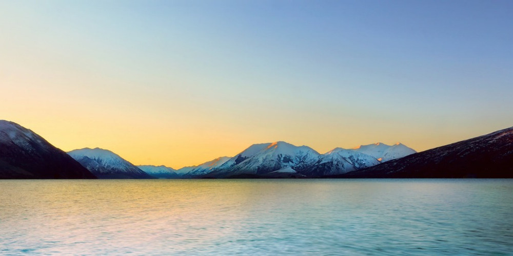
Te Araroa section: One of the highlights of this section of Te Araroa is passing the alpine Lake Coleridge (Whakamatau) situated in a glacier-formed valley. When you reach the Rakaia River, you’ll see one of the largest braided rivers in New Zealand.
Distance
72.3 km
Walking time
3-4 days
Difficulty
Advanced
Dogs
Not allowed
Wheelchair access
Not marked friendly
Current status
Weather outlook
Issued 10 Oct 2026, 7:33 am
10 October 2026
Cloudy, then showers from afternoon, possibly heavy and thundery with hail.
11 October 2026
A few showers, clearing in the evening.
12 October 2026
Fine.
13 October 2026
Showers.
14 October 2026
Heavy rain easing.
Regional guidance only; elevation and terrain can produce different conditions.
Explore the area
Explore the track route and surrounding area before you set out.
Klondyke Track - 9km / 2-3 hours The Klondyke Track is a Te Araroa-specific link. It reduces the road connection between the Deception-Mingha and Harper River Tracks. The track starts at the Mingha and Bealey River junction. It heads south on the flood control bank, initially following orange marker poles (these turn off to the Greyney Shelter carpark that is no longer a campsite, despite the old label on maps). Continue following the flood control bank, and carefully cross the railway line into the gravel quarry; a poled and marked route starts at the Bealey River / Greyney’s Creek junction following a terrace beside the river towards the Klondyke Corner Campsite, this is also a predator control line (yellow markers). At Klondyke there is a basic campsite with a pavilion, carpark and toilets. The track beyond Klondyke Corner remains on the true right bank of the Bealey River. There are occasional marker poles which lead to the Waimakariri River confluence. Cross the river as water levels allow and climb up to SH73 before the Bealey Spur settlement. If the Waimakariri is up, trampers are able to cross on the road bridge, about 1km to the west. The Bealey Hotel, which is 12km east of Arthur’s Pass and 150km west of Christchurch, is a good point where trampers can organize transport, with most operators passing on their way to Arthur’s Pass or Christchurch. From Bealey Spur, continue east on SH73 and follow the road’s shoulder to Cora Lynn Rd. Turn right here and walk past the Arthur’s Pass Wilderness Lodge and through the gate marked ‘Cass-Lagoon Track’. The track ends at the car park a short distance further along. Bealey Hut (6-bunks) is a five-minute walk beyond the car park, up the track and on the right-hand side. Harper River Track The initial section to Hamilton Hut is on DOC’s Cass Saddle–Lagoon Saddle Track and through Craigieburn Forest Park. The final portion of the track is adjacent to Glenthorne Station and finishes at Harper Rd. Here trampers are able to walk a route based on an unformed legal road, which runs along the Harper River fringe. Cora Lynn Road - 1km From SH73 walk up Cora Lynn Road, signposted Wilderness Lodge Cora Lynn Carpark to Hamilton Hut - 15.5km / 7-8 hours The track climbs a short distance from the carpark to Bealey Hut, a basic 6 bunk hut off on a short side trail to the right. Beyond the hut, the track continues to climb through beech and exotic forest. It then traverses the broad north face of Mt Bruce, initially through the forest but then through open tussock country. This is up towards Lagoon Saddle. From the Saddle, follow board-walked sections down to the bushline. Lagoon Saddle A-Frame Shelter (2 people) is a short distance lower down. The track then descends to the Harper River. The next section down to West Harper Hut has numerous river crossings, but these are straightforward in normal conditions. West Harper Hut, with its dirt floor and canvas bunks, provides historical interest and welcome shelter in poor weather. Beyond the hut, the route is an all-weather one. The Harper River is crossed on a swing bridge. There is also a swingbridge across Hamilton Creek near Hamilton Hut. Hamilton Hut to Harper Rd - 19km / 5-6 hours Return to the sign at the true left side of Hamilton Creek. From here Te Araroa heads down to the Harper River confluence, beyond which the track follows the Harper River downstream. For much of the way, an old 4WD track can be used but this leads to numerous river crossings. If the river is high, it is possible to remain on the true left all the way down to the Pinnacles without too much additional effort or time, except for a spot where a ravine has formed. This means a river crossing cannot be avoided. The river can pool adjacent to this point, so if the water is high, waiting it out or retreating to Hamilton Hut could be the wisest course of action. The track remains within Craigieburn Forest Park until about a 1/3 of the way down to the Pinnacles. It then enters Glenthorne Station (we ask that respect is given when on this station and please stick to the route — no shortcuts. If you do, you will be charged with trespassing by the landowners) on a route based on an unformed legal road. This is along the fringe of the Harper River on the true left side. The Pinnacles become visible lower down across the river on the true right side. Below the Pinnacles, the track continues down the Harper River, which trampers need to ford to make further progress. The best place to do this is above the Avoca River confluence. The Avoca, in turn, is crossed separately. Continue down the farm track to Harper Road and cross Harper River on the road bridge. Harper Road reaches a junction near Harper Village where the Harper River Track ends. If you need somewhere to stay, then there is a free overnight campsite with shelter, toilet and water on Manawa Energy-owned land about 300m distant. This is down the road marked with the “2km to Lake Coleridge” sign. The campsite is signposted on the left-hand side of this road. Water is available from a tap in the campsite, and there is a modern long-drop toilet. A shelter built by Te Araroa benefactor Stephen Yeats in 2022 provides a welcome refuge from rain, wind or sun on the otherwise unprotected site. For One.nz (previously Vodafone) subscribers only, cellphone connection is possible at the end of the Harper River Track but not at the Harper Campsite, also referred to as the Manawa Energy Campsite. Cell signal starts where the trail leaves the floodbanks and crosses a wooden fence (SOBO) onto a gravel road, and continues past the Manawa Energy work site as far as the plywood signboard. For NOBO, you will pass through the tiny Harper Village to a T intersection. The campsite is to the left, cell signal and Te Araroa northbound is to the right Note - it is 48km from Hamilton Hut to Lake Coleridge - only the fastest walkers should attempt to do this in a day. There are NO places to camp between Harper Village and Lake Coleridge, so the recommended approach is to camp at the Harper Village campsite and then go from there to Lake Coleridge in a day — plan to reach Lake Coleridge before 5pm to maximise your chances of hitching a lift out to Rākaia Gorge/Methven. There is now excellent camping and dormitory accommodation at the Powerstation Lodge on Te Araroa at km 2,299.6, just before Lake Coleridge Village. Details below. Otherwise you’ll need to walk to Lake Coleridge Village and hitch out that day, or pick up a hitch along Harper Road. There is no other recommended accommodation in Lake Coleridge Village Harper Village to Homestead Road - 22km / 6 hours From Harper Village, travel 22km along Harper Road past Lake Selfe, over the Ryton River Road Bridge, past Lake Evelyn and onto Homestead Road. There are toilets at Lake Selfe (km 2,275) and at Lake Georgina (km 2,286.9) Note: Take extreme care, this road has a 100km/h speed limit, and drivers are often not expecting walkers. Wear hi-viz clothing/pack cover, and do not use headphones. Stick to the extreme edge of the road. A person who drives this road daily and often picks up walkers has asked specifically for Te Araroa hikers to be reminded that it is safer for hikers in pairs or groups to all move to the same side of the road when a vehicle approaches. If you occupy both shoulders, he has to choose which one to avoid. At the junction with Lyndon Road turn right and continue onto Homestead Road. Te Araroa's next section, the Lake Hill Track, starts at the stile about 900m down on the right-hand side of the road. Lake Hill Track - 3.5km / 1¼ hours The Lake Hill Track provides access to a section of the Lake Coleridge foreshore and joins Homestead Road with Coleridge Intake Road. In the process, it follows a narrow strip of public land which adjoins the private property. Note: Walkers are asked to keep strictly to the marked route and to respect the property rights of the adjoining landowners. This includes giving way to stock and farm operations and adhering to the ’no dogs, camping or fires’ conditions of access. The track starts on Homestead Road at a stile, which is 900m from the junction with Harper and Lyndon Roads. Travel is in the direction of Lake Coleridge and is initially easy and through farmland where stock are likely to be grazing. After about 700m, the marked route passes through a tussock section as it crosses a wetland fringe. Conditions may be damp underfoot here. Beyond the wetland, the route joins the edge of a farm track and then veers to the left on a foot track as it approaches the lakeshore. There is a short climb and descent to avoid a bluff, and then about half a kilometre of level lakeside walking before the foot track crosses another farm track. From the far side of the farm track, the marked route ascends away from the lake. After a short climb, the gradient eases, and the track continues to follow poles towards Coleridge-Intake Road. On its way to the road, the track joins and then departs from a farm track. Trampers need to be vigilant in following the markers to ensure they stay on the legal route. The track ends on Coleridge Intake Road at the stile next to the farm gate. This is about 1.3km below the intersection with Algidus Road. Coleridge Intake Road and Arboretum Track - 3.8km / 1¼ hours Walk south up Coleridge Intake Road (away from the lake) from the Lake Hill Track trailhead towards the Algidus Road intersection. Continue through the intersection on Coleridge Intake Road. Beyond the cattle stop, the road and surrounding land are owned by Manawa Energy Power. Coleridge Intake Road enters a pine forest and veers to the right. The track leaves Coleridge Intake Road on the right as the road makes a hairpin turn to the left. Look out for markers here and a track that has been cut through the broom. This formed track quickly opens up and, for a few metres, follows the pipes down towards the power station before turning left to enter a pine forest. Lower down the track leaves the forest, turns right, and descends directly through open country. It enters the Arboretum at a gate on the left and follows a well-formed path passing a number of signposted specimen trees along the way. The track end is through the memorial gate marking the exit from the Arboretum to Hummocks Road. The Arboretum comprises a site of approximately 2 hectares and was established in 1933 by Harry Hart, who served as superintendent of the Lake Coleridge Power Station for 30 years until 1954. It now contains one of New Zealand’s best mature conifer collections, including examples of at least two-thirds of the world’s pine species. Information poster about the Lake Coleridge area. Lake Coleridge Village - camping at The Powerhouse Lodge , 114 Hummocks Rd, Lake Coleridge Village (TA km 2,298.4) is open from late November for Te Araroa Trail Walkers. Per person prices: Tenting $25, bunkroom $35 and Lodge options available. EFTPOS available. Do your own meals and transport arrangements. Wi-Fi, outdoor kitchen, hot showers, laundry facilities and snacks available. Highly recommended, kiwi hospitality at its best. Bounce Boxes can be received and held here. No bookings necessary, register on arrival for camp info and instructions. More info on Facebook or call 022 081 0882. The Lodge is also the pickup and drop off point for Selwyn Shuttles - Phone Brad 021 776 968 to make or join a group booking. Methven Travel may be available - Phone Dave 027 437 5432, Facebook - MethvenTravel Ltd To get around the Rākaia River, turn left on Coleridge Road, then right on Zig Zag Road or continue on Coleridge Road. Turn right at SH77 to cross Rākaia Gorge (24km from Lake Coleridge). Across the second bridge is Rākaia Gorge Campground. To follow the Rakaia bypass route continue west on SH77, then turn right onto Blackford Road, which becomes Double Hill Run Road to the Te Araroa trailhead at Glenrock. Most hikers will go past Blackford Road and take the first left turn (also SH77) to Methven for rest and resupply (40.5km from Lake Coleridge). Methven has two good supermarkets, two pubs, many great cafés and an excellent campground.
Potential hazards Vehicles on road or track take care along SH73 and Harper Rd When road walking, walkers should should wear high visibility clothing or accessories, not wear any earbuds, and remain vigilant for traffic. Walk on the right side of the road, facing oncoming traffic, where possible Farming operations adjacent to Harper River River crossings - Never cross flooded rivers Track exposed to sun, wind or cold Weather extremes
Getting there/away Methven Travel - 93 Main St , Methven- P: 0800 684 888 for shuttles to/from Christchurch. More details in Rākaia River to Rangitata River section Selwyn Shuttles provide a daily daily service from Powerhouse Lodge to Methven and onto South Rakaia Trail head at Double Hill and return. We run a daily service during busy periods and other times it is an on-demand service. Best to contact us the night prior to ensure availability. Our usual schedule is: 10am Powerhouse Lodge - Methven for resupply 12pm Methven - Double Hill / Glenrock Stream 1pm Double Hill / Glenrock Stream - Methven 2pm Methven - Powerhouse Lodge Pricing is: Powerhouse Lodge - Methven ( either direction ) 1-4 $200 minimum 5-6 $40 each 7-11 $35 each Methven - Double Hill/ Glenrock ( either direction ) 1-5 $250 minimum 6-7 $45 each 8-11 $40 each EFTPOS / PayWave/ credit card available We look forward to driving you soon Brad Wilson - 021 776 968
Methven i-SITE Visitors Centre - 160 Main St, Methven - P: 03 302 8955 - E: methven@i-site.org Before starting Te Araroa either as a through-walker of the whole country or a section walker, please register on Te Araroa website . Please also visit the website or download the app for detailed maps, trail alerts and other relevant information. This track is part of the Herenga ā Nuku Aotearoa track database. Herenga ā Nuku has maps and advice about public access to the outdoors . We encourage you to continue gaining the skills and knowledge required for a safe trip. The NZ Mountain Safety Council has lots of free resources and information you can use. These can be accessed via www.mountainsafety.org.nz . We recommend trying these online learning tools: Trip Planning Tramping/field Skills Basic Navigation River Safety Additionally, check out the range of helpful videos available from the NZ Mountain Safety Council YouTube channel
Potential hazardsVehicles on road or track take care along SH73 and Harper Rd Farming operations adjacent to Harper River River crossings - Never cross flooded rivers Track exposed to sun, wind or cold Weather extremes
Track information, access and weather can change. Confirm current alerts and land-manager information close to departure, tell someone your plans, and carry equipment appropriate for the route and conditions.