11 October 2026
Showers, becoming few and far between in the afternoon, then clearing to fine in the evening.
Loading outdoor place details…
Arthur's Pass National Park
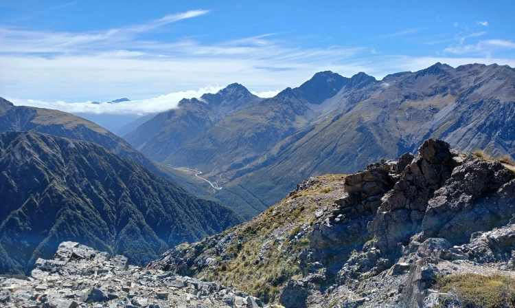
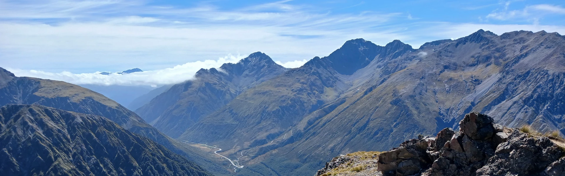
Avalanche Peak is the only peak in Arthur's Pass that is marked by a poled route to the summit. The climb is 1,100 m vertical from the village and over just 2.5 km horizontal. On a fine day, you will be rewarded with grand views of the surrounding peaks.
Distance
7.9 km
Walking time
Various options, 3-4 hr to summit
Difficulty
Advanced, Expert
Dogs
Not allowed
Wheelchair access
Not marked friendly
Current status
Weather outlook
Issued 10 Oct 2026, 9:23 pm
11 October 2026
Showers, becoming few and far between in the afternoon, then clearing to fine in the evening.
12 October 2026
Fine.
13 October 2026
A few showers developing.
14 October 2026
Rain, with heavy falls. Snow lowering to 2200 metres.
15 October 2026
A few showers, some possibly heavy, with snow to 700 metres.
Regional guidance only; elevation and terrain can produce different conditions.
Explore the area
Explore the track route and surrounding area before you set out.
Time required: 6-8 hours return. There are two routes up Avalanche Peak. Both start from SH73 at Arthur’s Pass village, approximately 700 m apart. This provides the option of tramping both routes to create a loop walk. Marked by a poled route to the summit, the climb is 1,100 m vertical from the village in over just 2.5 km horizontal. We recommend taking Avalanche Peak Track UP and Scotts Track DOWN. Avalanche Peak Track From Arthur's Pass Visitor Centre follow the bush edge northwards to pick up the start of the track, signposted before the Glasgow Bridge over Avalanche Creek (elevation 737 m). The track, rocky and steep in parts, climbs through mountain beech/tawhairauriki on the south side of Avalanche Creek. The creek drops over steep bluffs, creating spectacular waterfalls which you can see from the highway and occasionally from the track. The track moves away from the creek and emerges at the bushline to give good views down the Bealey valley to Cora Lynn Station, Black Range and Mount Bealey. Avalanche Peak Route From the bushline to Avalanche Peak summit (1833m), follow the yellow poles. Follow the ridge that runs between Rough Creek and Avalanche Creek catchments. From the bushline a worn trail leads through tussock and subalpine vegetation. Beware of steep drop-offs as you travel along this narrow ridge. Yellow markers on stakes mark the route all the way to the summit. As you climb, the tussock-covered ridge that leads down to Scotts Track can be seen on your right and should be noted for finding the descent route. Do not leave the marked route or attempt to cross over to the other route as a hidden canyon blocks the way. Mt Rolleston (Kaimatau), with Crow Glacier on its southern side, rises majestically from behind this ridge. The final part of this ridge is mainly rock. It narrows considerably and gains height in large steps. To reach the summit, follow the markers down into a basin, then climb up the scree directly to the left of the bluffs in front of you. The route winds through bluffs, climbing steeply at times. For the last 10 minutes along to the summit, the yellow and orange-coloured markers join together. This is to show that you return the same way along this section to meet Scotts Route. If it is windy or there is ice/snow on this section of ridge we recommend not going further and descending the way you came, as there are sheer bluffs either side of this razor-blade ridge. Scotts Route From Avalanche Peak Summit to the bushline, follow the orange poles back the way you came for a short distance. Scotts Route (orange poles) then leads off to left. Follow the ridge into the tussock where a foot-worn (and water-eroded) track should be picked up and followed. Take care, as there are steep drops into McGrath Creek. Scotts Track The track on the ridge between McGrath and Wardens creeks takes you almost parallel to the road for a while, before turning southwards crossing a few streams and bog patches. This track is considerably less steep than Avalanche Peak Track. The track meets the road about 700 m west of the Arthur’s Pass Visitor Centre. You’ll need to turn right and walk back along the side of the road to the village.
Plan and prepare well so that you enjoy your trip and return safely. The tramping track/route is steep and exposed to the weather, with sheer drops in some places. It should not be attempted in poor visibility or high winds. The route to the peak is prone to avalanches in winter and spring. During heavy snow conditions we advise visitors not to travel this route unless sufficiently equipped and experienced enough to assess the conditions and choose a safe path through avalanche terrain. Ensure you take your mobile phone as reception is possible for most of the track. You’ll be able to use the available route map to help your navigation, but we recommend taking a backup option. Paper maps are available at the DOC Visitor Centre on the main road.
Both tracks start from SH73 at Arthur’s Pass village, approximately 700 m apart. Use this location in Google Maps to find your way there.
We encourage you to continue gaining the skills and knowledge required for a safe trip. The NZ Mountain Safety Council has lots of free resources and information you can use. These can be accessed via www.mountainsafety.org.nz . We recommend trying these online learning tools: Trip Planning Tramping / field Skills Basic Navigation River Safety Additionally, check out the range of helpful videos available from the NZ Mountain Safety Council YouTube channel
Watch for strong northwesterly winds and heavy rain from the west. Snow is possible at any time of year. Conditions can change quickly. Heavy rain will make the descent more challenging, especially where the track is covered in loose rocks. Unsurprisingly, avalanches are common between June and November.
No dogs.
Track information, access and weather can change. Confirm current alerts and land-manager information close to departure, tell someone your plans, and carry equipment appropriate for the route and conditions.