08 October 2026
Mostly cloudy with patchy drizzle, clearing in the morning as fine breaks increase. Light winds, afternoon easterlies.
Loading outdoor place details…
Bendigo area
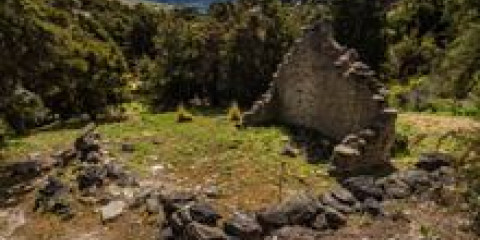
A short loop through kānuka shrubland, featuring the remains of old stone huts.
Distance
4.5 km
Walking time
1.5 hr loop
Difficulty
Easy
Dogs
Not allowed
Wheelchair access
Not marked friendly
Current status
No active alerts found. Conditions can still change, so check again before leaving.
Weather outlook
Issued 8 Oct 2026, 3:45 am
08 October 2026
Mostly cloudy with patchy drizzle, clearing in the morning as fine breaks increase. Light winds, afternoon easterlies.
09 October 2026
Fine. Light winds, then northerlies developing at night.
10 October 2026
Fine. Northerlies developing in the afternoon.
11 October 2026
Fine apart from isolated showers. Light winds.
12 October 2026
Cloud clearing and becoming fine. Light winds.
Regional guidance only; elevation and terrain can produce different conditions.
Explore the area
Explore the track route and surrounding area before you set out.
Gold was found here in 1862 and brought an immediate influx of miners and prospectors clambering over the hills. The accessible alluvial gold petered out in 1865, but gold-bearing quartz reefs were discovered and underground mines sprang up. By 1875, the Bendigo reef was said to be the richest and best defined in Otago. Mining continued until 1943 when the government mining subsidy was withdrawn. Renewed interest since then has triggered activity in the 1980s and again early in the 2000s. The historic reserve preserves the gold-mining relics of the area’s hard-rock quartz mining history. There are mine shafts, tunnels, stone huts, stamper batteries, heavy machinery, water races, dams and pipelines.
The track starts on Blue Mines Road. Starting in Cromwell: Head north on SH8. After around 14 km turn right onto Bendigo Loop Road – this turns into a gravel road. Turn right onto Blue Mines Road after around 600 metres. Continue for around 2.4 km until the start of the track. On Blue Mines Road you'll pass the schoolhouse ruins at Schoolhouse Flat, the main historic site of Logantown, Welshtown, and mining remnants. Use this location in Google Maps to find your way there.
We encourage you to continue gaining the skills and knowledge required for a safe trip. The NZ Mountain Safety Council has lots of free resources and information you can use. These can be accessed via www.mountainsafety.org.nz . We recommend trying these online learning tools: Trip Planning Tramping / field Skills Basic Navigation River Safety Additionally, check out the range of helpful videos available from the NZ Mountain Safety Council YouTube channel
No dogs.
Track information, access and weather can change. Confirm current alerts and land-manager information close to departure, tell someone your plans, and carry equipment appropriate for the route and conditions.