10 October 2026
Partly cloudy with isolated showers developing in the afternoon. Northeasterlies dying out in the afternoon.
Loading outdoor place details…
Tararua Forest Park
Tramp from the Mangahao reservoirs to Burn Hut, with views across the Horowhenua and northern Wairarapa
Distance
16.62 km
Walking time
1-2 days
Difficulty
Advanced
Dogs
Allowed — check local rules
Wheelchair access
Not marked friendly
Current status
No active alerts found. Conditions can still change, so check again before leaving.
Weather outlook
Issued 10 Oct 2026, 4:55 pm
10 October 2026
Partly cloudy with isolated showers developing in the afternoon. Northeasterlies dying out in the afternoon.
11 October 2026
Showers, clearing to fine spells early afternoon, then clouding over towards evening with drizzle on the ranges. Northerlies.
12 October 2026
Fine, then a few showers developing in the evening. Northwesterlies developing for a time in the afternoon.
13 October 2026
Occasional rain. Northeasterlies, turning northwesterly in the morning.
14 October 2026
Rain. Northwesterlies.
Regional guidance only; elevation and terrain can produce different conditions.
Explore the area
Explore the track route and surrounding area before you set out.
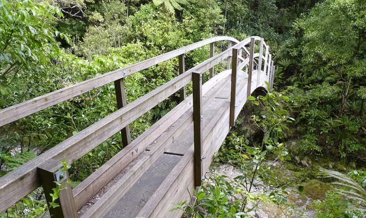
Mangahao Lower No. 2 Reservoir to Burn Hut Time: 3 to 4 hours Begin the track on the far side of Mangahao Lower No. 2 Reservoir. The path runs alongside the true right of the river for around 1 hour, with small ups and downs along the supposedly flat section. After passing a wooden bridge, the track ascends for another hour to the bush line. Upon reaching the tops densely covered with leatherwood, the track leads along the ridge for an additional hour to Burn Hut, positioned on a small spur. From here, either return the way you came or continue to the upper reservoir and walk back to your car along the road following the description below: Burn Hut to Mangahao Upper No. 1 Reservoir Time: 3 to 4 hours From Burn Hut, the track crosses a small saddle and then climbs back to the ridge line. After about 1 hour on the ridge, it sidles behind high point 835m and begins its descent, reaching College Stream within another 40 minutes. There is no established track down College Stream, so be prepared to walk in the stream bed, maneuvering through boulders and crossings. In case of heavy rain, it is advisable not to attempt this route as it might be impassable. After about an hour of following College Stream, you will arrive at its junction with Baber Creek. The track begins around this junction, on the true right, and takes approximately an hour to reach the dam near Mangahao Upper No. 1 Reservoir. Return from Mangahao Upper No. 1 Reservoir to Mangahao Lower No. 2 Reservoir Proceed along Mangahao Road for 4 km, from the upper reservoir to the lower reservoir. Due to the absence of a designated track or footpath, exercise caution with vehicles, especially on corners.
Expect a backcountry tramping track This track is a typical Tararua backcountry tramping track. It is rough and uneven, and you can expect to be scrambling up and over tree roots. Pack for bad weather The Tararua Ranges are well known for their wild, fast-changing and unpredictable weather. Anytime you go into the Tararua Forest Park, pack warm and waterproof clothing (even if the forecast is good). Take a distress beacon and an emergency shelter. Stay safe when crossing rivers If you plan to cross unbridged rivers, know how to cross safely and be prepared for if you cannot cross. Do not cross if the river is flooded, you cannot find safe entry and exit points or are unsure it’s safe. Turn back or wait for the river to drop. If in doubt, stay out. How to cross rivers safely
Burn Hut is a nice little 6-bunk hut with views out to Foxton Beach in the west, and Wairarapa in the east.
The starting point for the track is at the Mangahao reservoirs. From Shannon, follow East Road out of town, where it becomes Mangahao Road. After 5 minutes, you will pass Mangahao Power Station, and shortly after this the road will become gravel. Continue following Mangahao Road. Be aware that the gravel road is very winding – it is best suited to people who are confident driving on remote New Zealand gravel roads. We strongly advise driving slowly and carefully, and driving the road in daylight. After approximately 30 minutes, you will see Tokomaru No. 3 Reservoir on your left. Continue along the road as it climbs gently uphill, before descending steeply down into Mangahao Valley. You will then reach the Mangahao Lower No. 2 Reservoir, which is the recommended starting location. Use this location in Google Maps to find your way there. If you are starting the track from Mangahao Upper No. 1 Reservoir, or picking someone up from the other end to save them a road walk, continue along Mangahao Road until you come to the end of the road.
We encourage you to continue gaining the skills and knowledge required for a safe trip. The NZ Mountain Safety Council has lots of free resources and information you can use. These can be accessed via www.mountainsafety.org.nz . Level up in your outdoor knowledge with these interactive online learning tools: Trip Planning Tramping / field Skills Basic Navigation River Safety Additionally, check out the range of helpful videos available from the NZ Mountain Safety Council YouTube channel .
Dogs allowed. Keep dog under control at all times.
Track information, access and weather can change. Confirm current alerts and land-manager information close to departure, tell someone your plans, and carry equipment appropriate for the route and conditions.