10 October 2026
Partly cloudy with isolated showers developing in the afternoon. Northeasterlies dying out in the afternoon.
Loading outdoor place details…
Tararua Forest Park
Burtton's Track (Scotts Road to Mangahao Road) lies between Palmerston North and Shannon. This track is part of Te Araroa Trail.
Distance
17.5 km
Walking time
6 hr going south, 7 hr going north
Difficulty
Advanced
Dogs
On-lead only
Wheelchair access
Not marked friendly
Current status
No active alerts found. Conditions can still change, so check again before leaving.
Weather outlook
Issued 10 Oct 2026, 4:55 pm
10 October 2026
Partly cloudy with isolated showers developing in the afternoon. Northeasterlies dying out in the afternoon.
11 October 2026
Showers, clearing to fine spells early afternoon, then clouding over towards evening with drizzle on the ranges. Northerlies.
12 October 2026
Fine, then a few showers developing in the evening. Northwesterlies developing for a time in the afternoon.
13 October 2026
Occasional rain. Northeasterlies, turning northwesterly in the morning.
14 October 2026
Rain. Northwesterlies.
Regional guidance only; elevation and terrain can produce different conditions.
Explore the area
Explore the track route and surrounding area before you set out.
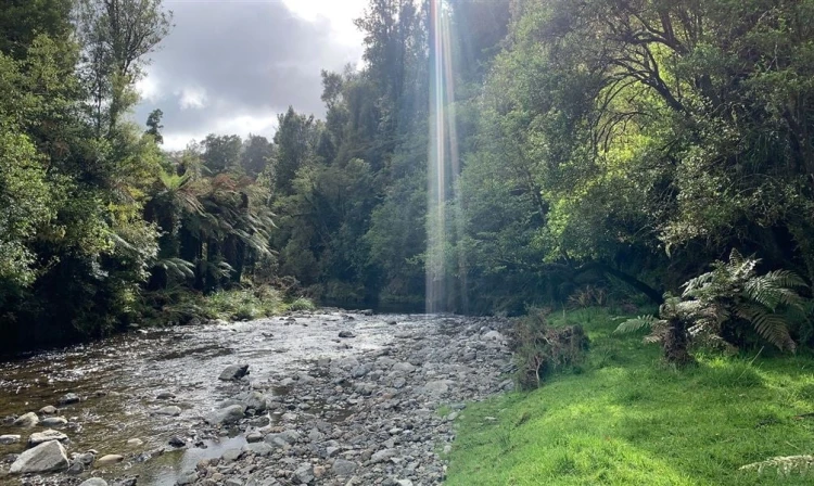
The track can be walked in either direction, but heading south from Scotts Road is easier, as the steepest sections are then downhill. If walking from south to north, add an extra 1 hour and 30 minutes to account for the uphill climb from the Tokomaru River in the latter part of the route. The following track description applies to the walk when undertaken from north to south. A stile crosses the fence and an information sign is located just before the bridge over the Kahuterawa Stream. Estimated times: DOC Boundary 1 hour 30 minutes Tokomaru River 3 hours Burtton’s Whare site 3 hours 30 minutes Mangahao Road Carpark 6 hours The walk begins along a gravel forestry road beside the Kahuterawa Stream. After about 40 minutes, you’ll reach a clearing where the forestry roads split. The trail is well-marked, taking the right-hand road and passing remnants of old farm buildings and yards. About an hour from the start, you’ll pass a second locked gate, after which the track steadily climbs, with the plantation forest gradually giving way to regrowth native bush. Following the boundary of the forest park, you’ll enjoy views of Kaihinau, the Tokomaru Gorge, and the Manawatu Plain to the west. The gradient increases until you reach a signpost and stile marking the entry into Tararua Forest Park, where the DOC-managed track begins. From here, the track descends from 500 meters to 200 meters above sea level, reaching No. 1 Stream in about an hour, marked with DOC orange triangles. Most of the year, the stream is shallow and easily crossed, but care is needed during rain or high water. After crossing No. 1 Stream, the track follows the eastern side of the Tokomaru River. Previously, it crossed the river twice, which may still appear on some maps—avoid these crossings and instead follow the newly re-routed track. The track re-enters the forest park, marking the start of the original Burtton’s Track. Five minutes ahead is the former Burtton’s Whare site, a good spot for a midway lunch break. From here, the track follows the historic trail built by Jim Burtton nearly 100 years ago, tracing the Tokomaru River upstream. After another 1 hour and 30 minutes, you’ll cross another stile, exiting Tararua Forest Park, with a cairn commemorating the trail's opening by the Prime Minister in February 2006. The final 3.2 km section, taking about an hour, follows the former Tokomaru Valley Road. While closed to unauthorized traffic, this road is occasionally used by registered 4WD vehicles. The DOC track ends at a car park near Mangahao Road, about 7.7 km from the Mangahao Power Station. From here, you can arrange transport, walk down Mangahao Road towards Shannon, or continue up the road towards the dams and the Mangahao-Makahika Track.
Burtton's Track is suitable for advanced riders. The track is best ridden in dry conditions from North to South and includes some river crossings. It's not recommended in wet conditions. The best option is to ride from Kahuterawa Rd or Scott's Rd to Gordon Kear Forest. It will take around 30 mins to ride through the forestry to the DOC boundary. Over the stile, a descent ending in a river crossing begins. From here on, expect some pushing/carrying on occasions until you get through to the forestry sections on Tokomaru Valley Road. Once there, keep on the gravel road until it meets Mangahao Road. Turn right to head uphill to the top of the saddle, then head downhill for around 5 km to Mangahao Power station and village – beware of cars in this section. This track is a shared-use path and is part of the Te Araroa walkway. All riders must give way to walkers and show respect to other track users.
This is part of the Te Araroa Trail . Before starting Te Araroa either as a through-walker of the whole country or a section walker, please register on Te Araroa website . Please download the app for detailed maps, trail alerts and other relevant information.
There is no cell phone coverage, so take extra clothing, food and first aid gear. Study a topographic map to get a good idea of the route. Take a compass and map, or GPS with you. Fires are not permitted at any time. No firearms are allowed on private land. This track has unbridged stream crossings. These can rise rapidly and flood during/after rain, making them unsafe to cross. There can be logging trucks anywhere on Scotts Road at any time, weekdays and weekends.
From Palmerston North the track can be accessed from Scotts Road leading off Tennant Drive (SH57) 15 km south after crossing the Manawatu River at Palmerston North. The track starts at the entrance to Gordon Kear Forest. There is a carpark on Scotts Road. Vehicles may not be parked on the forest road where there is a locked gate at the track. Any vehicles parked on the forest road risk being towed away or damaged. Use this location on Google Maps to help find your way there.
We encourage you to continue gaining the skills and knowledge required for a safe trip. The NZ Mountain Safety Council has lots of free resources and information you can use. These can be accessed via www.mountainsafety.org.nz . We recommend trying these online learning tools: Trip Planning Tramping / field Skills Basic Navigation River Safety Additionally, check out the range of helpful videos available from the NZ Mountain Safety Council YouTube channel
Dogs on a leash only.
Track information, access and weather can change. Confirm current alerts and land-manager information close to departure, tell someone your plans, and carry equipment appropriate for the route and conditions.