Walking tracks
- Tararua Southern CrossingTararua Forest Park · 8.8 km away
- Kapakapanui TrackTararua Forest Park · 19 km away
Loading outdoor place details…
Tararua Forest Park
This track provides two day-walking options: a return trip to Smith Creek via Puffer Saddle, or a more challenging and longer loop track
Distance
13.4 km
Walking time
5.5 hr (return to Smith Creek Shelter)
Difficulty
Intermediate, Advanced
Dogs
Allowed — check local rules
Wheelchair access
Not marked friendly
Current status
Explore the area
Explore the track route and surrounding area before you set out.
The full Dobson Loop Track is the more challenging of the two described here. About half of the loop follows a rough tramping track, with a long, steep ascent and descent that requires good fitness and backcountry experience. Starting from Kiwi Ranch Road, the track climbs steadily to Puffer Saddle, reaching a junction with the Southern Crossing track. Follow this track for the full clockwise loop. The ascent continues to a turnoff near the old Dobson Hut site (now just concrete remains). Take the signposted turnoff toward Smith Creek Shelter. The track then descends steeply to the Tauherenikau River. This section is rough and root-covered—take care to avoid slipping. The track reaches Smith Creek Shelter near the confluence of Smith Creek and the Tauherenikau River. From here, follow the route up Smith Creek valley. This section includes a large, old slip, requiring up to 1.5 hours to traverse via a marked detour. There are also several unbridged stream crossings, which may be unsafe during or after heavy rain. The track climbs out of Smith Creek valley to Puffer Saddle, then descends toward Kaitoke, meeting the Southern Crossing junction before continuing down to Kiwi Ranch Road.
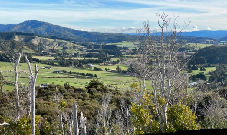
The track starts at Kiwi Ranch Road and climbs steadily to Puffer Saddle, passing a turnoff to the Southern Crossing along the way. From the saddle, it descends into Smith Creek valley, following the creek through red and hard beech forest to its confluence with the Tauherenikau River. In the Smith Creek section, a large, old slip may add up to 1.5 hours to the return trip, which was previously around four hours. Follow the marked alternative route. From Smith Creek Shelter, you can continue up the Tauherenikau Valley to Marchant Creek for views of the river and regenerating podocarp forest among the mānuka flats. To return, follow the same route back over Puffer Saddle to the road end. Be aware that sections of the track are clay-based and can become extremely slippery. Sturdy footwear with good grip is essential. Several unbridged stream crossings along Smith Creek may also be impassable during or after heavy rain.
Expect a Challenging Day Walk The track from Puffer Saddle to Smith Creek Shelter includes sections of clay that become extremely slippery after rain, as well as tree roots and a large slip that must be traversed. The full loop is more difficult than the track to Smith Creek Shelter via Puffer Saddle. It features a long, steep climb, rough and unformed sections, muddy and slippery terrain in wet conditions, and numerous tree roots. This route is best suited for fit, experienced trampers. Leave early and allow extra time in case the walk takes longer than expected. Be Prepared for Bad Weather The Tararua Forest Park is known for rapidly changing weather, including rain and cold temperatures. Always check the forecast before heading out. Stay safe when crossing rivers If you plan to cross unbridged rivers, know how to cross safely and be prepared for if you cannot cross. Do not cross if the river is flooded, you cannot find safe entry and exit points or are unsure it’s safe. Turn back or wait for the river to drop. If in doubt, stay out.
Turn off State Highway 2 onto Marchant Road at the YMCA Camp Kaitoke turnoff. Near the end of Marchant Road, turn right into Kiwi Ranch Road. The carpark is located on the left, approximately 500 m along Kiwi Ranch Road. Use this location in Google Maps to find your way there.
We encourage you to continue gaining the skills and knowledge required for a safe trip. The NZ Mountain Safety Council has lots of free resources and information you can use. These can be accessed via www.mountainsafety.org.nz . Level up in your outdoor knowledge with these interactive online learning tools: Trip Planning Tramping / field Skills Basic Navigation River Safety Additionally, check out the range of helpful videos available from the NZ Mountain Safety Council YouTube channel .
Dogs allowed. Keep dog under control at all times.
Track information, access and weather can change. Confirm current alerts and land-manager information close to departure, tell someone your plans, and carry equipment appropriate for the route and conditions.