11 October 2026
Rain, heavy at times, easing to showers in the morning, then clearing to fine in the evening.
Loading outdoor place details…
Kahurangi National Park
The route links the Aorere and Cobb valleys in Golden Bay. It is unmarked and suitable for trampers with a high degree of fitness and off-track experience.
Distance
66.36 km
Walking time
5-7 days
Difficulty
Expert
Dogs
Not allowed
Wheelchair access
Not marked friendly
Current status
Weather outlook
Issued 10 Oct 2026, 9:23 pm
11 October 2026
Rain, heavy at times, easing to showers in the morning, then clearing to fine in the evening.
12 October 2026
Fine, but becoming mostly cloudy with isolated showers in the evening.
13 October 2026
A few showers.
14 October 2026
Rain, with heavy falls.
15 October 2026
Occasional rain.
Regional guidance only; elevation and terrain can produce different conditions.
Explore the area
Explore the track route and surrounding area before you set out.
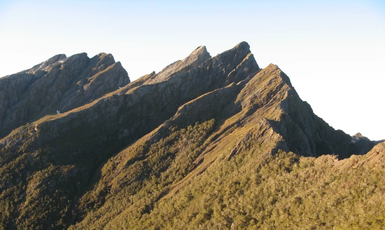
The track begins across the paddock behind the intentions shelter, climbing gradually for about 6 km through regenerating low forest to Lookout Knob. Beyond this point, the track transitions into mature forest and limestone-capped terrain, where several narrow limestone slots present steep drops - take care and move slowly through these sections. From here, the track continues to climb through beech and mānuka forest, passing Beathams Clearing, where water is sometimes available. It then sidles along the left side of the Pulpit before emerging at the open expanse of Cow Saddle. Beyond Cow Saddle, the route is fully exposed to weather conditions and follows a poled line to Boulder Lake. It sidles right toward a small outcrop on the skyline ridge, then continues under the bluffs of Brown Cow, crossing the top of a steep shingle scree slope before descending on a tussock spur to the lake. The sidle and scree section are avalanche hazards in winter and present fall risks year-round. Once at the lake, follow the eastern shoreline to reach Boulder Lake Hut . Water can be scarce along this route - apart from a small stream 30 minutes from the start, there are no reliable water sources until Boulder Lake . Carry at least 2–3 litres per person , and allow extra time for the journey. Many groups underestimate how long this section takes, so start early and consider carrying camping gear in case an overnight stop is needed. Side Trip – Dam Wall and Boulder River Waterfall A highlight along this trip is the view of a spectacular 65 m waterfall on the first day of the route. From Kiwi Creek, a 30-minute side trip (one way) leads to the remnants of the historic dam wall built by gold miners across the lake outlet stream. Water from the lake was once channelled through a series of flumes and aqueducts to sluice gold claims on the Quartz Range goldfields, around 6 km away. A short climb to a vantage point west of the dam wall provides a view of the spectacular 65 m waterfall - the source of the Boulder River.
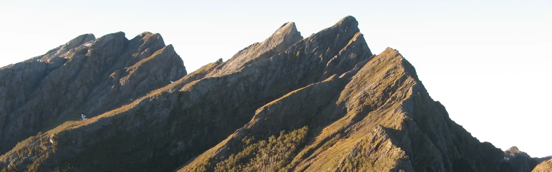
This section of the route is suitable only for experienced trampers with advanced off-track navigation skills, excellent fitness, and the ability to manage exposure to severe alpine weather. Streams and rivers are unbridged , and conditions can change rapidly. Carry gas or liquid fuel cookers , as no wood fuel is available at Adelaide Tarn or Lonely Lake huts, and bring a tent , as these huts have very limited sleeping space. From Boulder Lake Hut, continue up the valley and follow rock cairns leading up the only tussock spur to Green Saddle. An optional sidle into Green Saddle begins just above the bush edge on this spur. From here, continue to the next small saddle below point 1450 m, where two large rock cairns on a quartz outcrop mark the start of two sidles on the Anatoki side of the main ridge toward the Needles Eye. The first sidle follows a cairned animal track beneath point 1450 m, then climbs and follows a stunted bush ridge to a second sidle below points 1411 m and 1488 m. From here, descend and sidle through the bush on a marked animal track to locate cairns across a tussock face beneath prominent rock ribs. This leads to the top of the first finger of bush in a narrow, flax-filled gut below the Needles Eye. Climb this gut to reach the Needles Eye saddle. From the saddle, descend directly onto a short tussock spur to join a clear track and terrace that leads to Adelaide Tarn Hut . Do not attempt to sidle from the Needles Eye around the Needle itself - this terrain is steep and bluffed, and unsafe to traverse.
If travelling directly from Boulder Lake to Anatoki Forks Hut , follow the cairned route from the Needles Eye, sidling down toward the saddle that leads to Yuletide Peak. The route traverses beneath bluffs and rocky sections on the northern slopes of the Needle before reaching the saddle, then climbs up and over Yuletide Peak. If coming from Adelaide Tarn Hut , retrace your steps to the Needles Eye and sidle around the north side of the Needle to rejoin the main route. The cairned route over Yuletide Peak follows a long, broken ridge that gradually descends toward the Anatoki Forks. From the ridge, a marked track drops steeply through silver and mountain beech forest to the south branch of the Anatoki River. The river can be dangerous or impassable during flood, and trampers may need to move upstream to find a safe crossing or wait for levels to drop. Once across, the track joins the Anatoki Track - turn left and follow it to reach Anatoki Forks Hut .
From Adelaide Tarn, climb up behind the hut to the saddle directly east of Mt Douglas (Grid Ref 614 672). A steep gut marked with a rock cairn provides access to the headwaters of the Anatoki River. Once in the bush at the base of the gut, continue southward until you are below the bluffs beneath the Dragons Teeth. From here, veer east and follow the stream that becomes the Anatoki River. Continue downstream to Grid Ref 640 652, then climb the ridge to the southwest to reach an open ridge east of the Drunken Sailors. Sidle along the north side of the Drunken Sailors to locate the cairned route leading into a saddle and descending to Lonely Lake Hut .
From Lonely Lake Hut, follow the unmaintained track that climbs and sidles through bush to reach the Douglas Range ridgeline. Continue along the open ridge, occasionally using animal tracks to sidle around exposed sections. Cross the scree slopes beneath Kakapo Peak and regain the ridge before following the cairned route that sidles below point 1550 m and Waingaro Peak. From there, descend a well-marked spur track through bush to reach Fenella Hut . Note: The route between Lonely Lake and Waingaro Peak is cairned but unmaintained.
From Fenella Hut the track drops down a series of glacier worn rocky steps and after about 20 minutes you reach Cobb Hut. A short side walk takes you to Lake Cobb and Round Lake above it. From Cobb Hut continue down the valley, passing Chaffey Hut and finishing at Trilobite Hut and the roadend.
Boulder Lake Hut Adelaide Tarn Hut Anatoki Forks Hut Lonely Lake Hut Fenella Hut Trilobite Hut Chaffey Hut Cobb Hut
Experience Required The Douglas Range Route is suitable only for highly experienced trampers with advanced backcountry skills, including navigation, map reading, and route-finding . Much of the route is unmarked and follows natural features such as rivers, saddles, and ridges. Streams and rivers are unbridged , and there are many exposed and rough sections . Trampers must be fit, well-equipped, and self-sufficient . Poor visibility due to mist can make orientation difficult, and rain or flooding may alter travel plans. Freezing conditions can occur year-round. Maps Required Carry and know how to use 1:50,000 Topo50 maps: BP24 Takaka BP23 Gouland Downs A GPS and emergency beacon are essential items to carry. What to Expect Wasps are common from December to April - carry antihistamine if allergic. Avalanche hazards exist in winter, particularly near the bluffs of Brown Cow . Ensure you have the appropriate skills and equipment . Water: Treat, boil, or filter all drinking water. River Safety Rivers along this route are unbridged and can become impassable in flood. Do not cross if the river is high, swift, or you cannot identify safe entry and exit points. Turn back or wait for the river to drop if conditions are unsafe. Remember: If in doubt, stay out. Hunting and Fishing Trout fishing can be done in the Cobb River. Each angler must carry a fishing licence. Hunting is available in the Douglas Range Route area. Each hunter must carry a permit.
Turn off Aorere Valley Road at Bainham, 18 km from Collingwood. Follow the signs along James Road to the Aorere River bridge. Cross the bridge, and the track start and intentions shelter are a further 200 m along the road. Use this location on Google Maps to help find your way there. Ensure you complete your intentions in the intentions shelter and subsequent hut books. These will be checked in case of an emergency.
We encourage you to continue gaining the skills and knowledge required for a safe trip. The NZ Mountain Safety Council has lots of free resources and information you can use. These can be accessed via www.mountainsafety.org.nz . Level up in your outdoor knowledge with these interactive online learning tools: Trip Planning Tramping / field Skills Basic Navigation River Safety Additionally, check out the range of helpful videos available from the NZ Mountain Safety Council YouTube channel .
No dogs.
Track information, access and weather can change. Confirm current alerts and land-manager information close to departure, tell someone your plans, and carry equipment appropriate for the route and conditions.