10 October 2026
Cloudy periods, then a few showers from late afternoon, possibly heavy and thundery inland. Northeasterlies.
Loading outdoor place details…
Mount Thomas Forest Conservation Area
Connecting Wooded Gully Track with Summit Track, Forest Track is a pleasant one hour walk through beech forest, suitable for families with good levels of fitness.
Distance
3.13 km
Walking time
2 hours return
Difficulty
Easy
Dogs
On-lead only
Wheelchair access
Not marked friendly
Current status
No active alerts found. Conditions can still change, so check again before leaving.
Weather outlook
Issued 10 Oct 2026, 4:55 pm
10 October 2026
Cloudy periods, then a few showers from late afternoon, possibly heavy and thundery inland. Northeasterlies.
11 October 2026
Areas of early low cloud otherwise fine. Isolated afternoon showers, mainly about the foothills. Northeasterlies, then northwesterly from afternoon but light winds south of Rakaia River then becoming southerly there at night.
12 October 2026
Fine. Northeasterlies developing for a time in the afternoon and evening.
13 October 2026
Fine, but becoming cloudy in the afternoon. Northwesterlies.
14 October 2026
Rain easing in the afternoon. Southerlies, dying out in the afternoon.
Regional guidance only; elevation and terrain can produce different conditions.
Explore the area
Explore the track route and surrounding area before you set out.
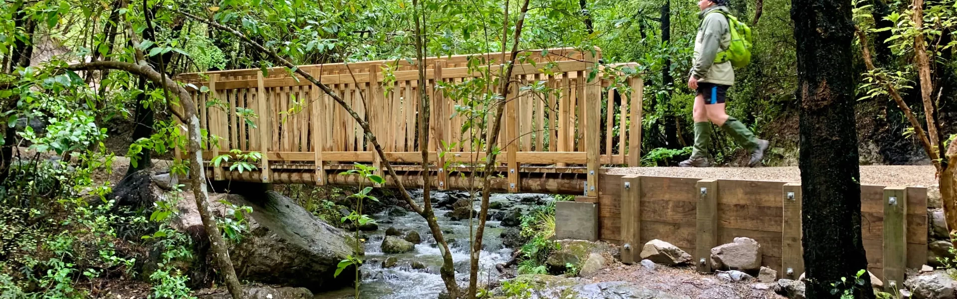
To reach the Forest Track, follow Wooded Gully Track from the picnic area for approximately 45 minutes. Once on Forest Track, navigate through the beech forest until you intersect with Summit Track. To return to the picnic area, take the lower section of Summit Track. Please note that there is a challenging 300 m uphill stretch after crossing the bridge on Forest Track. This route is recommended for families with moderate fitness levels.
Wasp populations reach high numbers from January to March – wear light-coloured clothing and carry antihistamine cream/tablets as a precaution.
Wooded Gully campsite is a great camping spot which is suitable for families and dogs and features a great stream to play in.
This track starts from the Wooded Gully camping and picnic area. From Oxford, follow Ashley Gorge Road for 13 km to Glentui. Continue on Birch Hill Road for 6 km then turn into Hayland Road and follow this for 4 km to the end. Birch Hill Road can also be accessed from Rangiora via Loburn. Use this location in Google Maps to find your way there.
We encourage you to continue gaining the skills and knowledge required for a safe trip. The NZ Mountain Safety Council has lots of free resources and information you can use. These can be accessed via www.mountainsafety.org.nz . We recommend trying these online learning tools: Trip Planning Tramping / field Skills Basic Navigation River Safety Additionally, check out the range of helpful videos available from the NZ Mountain Safety Council YouTube channel .
Dogs on a leash only.
Track information, access and weather can change. Confirm current alerts and land-manager information close to departure, tell someone your plans, and carry equipment appropriate for the route and conditions.