11 October 2026
Scattered showers, becoming confined south of Doubtful Sound in the afternoon.
Loading outdoor place details…
Fiordland National Park
Gertrude Saddle includes rocky alpine terrain and should only be attempted by experienced trampers and in good weather. Wet weather, snow or ice create treacherous conditions in any season.
Distance
7 km
Walking time
4-6 hr
Difficulty
Expert
Dogs
Not allowed
Wheelchair access
Not marked friendly
Current status
Weather outlook
Issued 10 Oct 2026, 9:23 pm
11 October 2026
Scattered showers, becoming confined south of Doubtful Sound in the afternoon.
12 October 2026
Partly cloudy, with one or two morning showers south of Secretary Island.
13 October 2026
Heavy rain developing, with snow to 2400 metres.
14 October 2026
Rain, with snow to 1900 metres, turning to showers.
15 October 2026
Showers, with snow to 800 metres, easing.
Regional guidance only; elevation and terrain can produce different conditions.
Explore the area
Explore the track route and surrounding area before you set out.
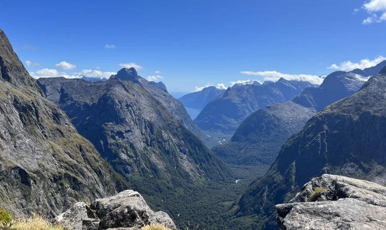
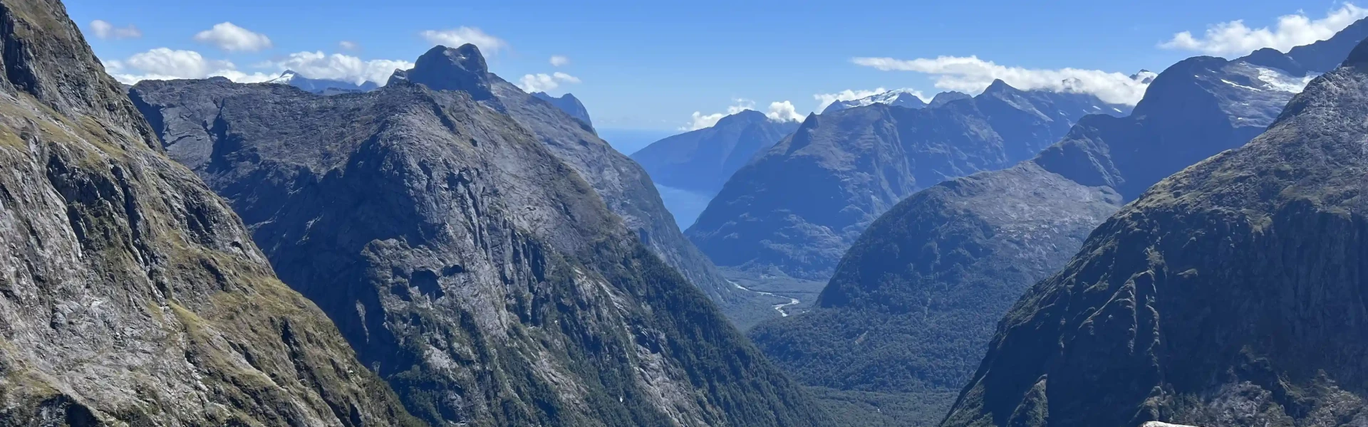
Time required : 4-6 hours return via same track. From the car park, the marked track meanders up the valley through spectacular alpine vegetation. From the head of the valley the route leads up towards the saddle; from this point there are no permanent track markers. Cross the Gertrude Stream below a large, steep waterfall area, about halfway up to Black Lake. From here, parts of the track are very steep and not suitable for those with limited tramping experience, or a dislike for heights. The track goes up steep rock slabs and is treacherous when wet or frosty – immediately above and below Black Lake there are steel cables to assist you. You’ll need good quality boots or hiking shoes. Above the cables, continue up through the boulders to the saddle. Return the same way. Breathtaking views of the valley and part of Milford Sound/Piopiotahi can be seen from the Gertrude Saddle. This track provides excellent access to the mountains for experienced climbers. Do not proceed beyond the saddle unless you have alpine climbing experience and equipment.
This is a challenging tramping route requiring tramping and alpine experience. The rock slabs become very slippery when wet, several people have died after slipping. The route is also not recommended in winter due to avalanche danger. The best time to go is from January through to March, but only in fine weather.
The car park is on the right-hand side of the road 1.4km before Homer Tunnel on Milford Sound Highway when driving from Te Anau. Use this location in Google Maps to find your way there.
We encourage you to continue gaining the skills and knowledge required for a safe trip. The NZ Mountain Safety Council has lots of free resources and information you can use. These can be accessed via www.mountainsafety.org.nz . We recommend trying these online learning tools: Trip Planning Tramping / field Skills Basic Navigation River Safety Additionally, check out the range of helpful videos available from the NZ Mountain Safety Council YouTube channel .
Be wary of rapidly deteriorating conditions as heavy rain is very common in this part of New Zealand. Watch for strong winds at the saddle. Do not attempt this route if rain is forecast, as one slip can be disastrous.
No dogs.
Track information, access and weather can change. Confirm current alerts and land-manager information close to departure, tell someone your plans, and carry equipment appropriate for the route and conditions.