10 October 2026
Low cloud, with patchy morning drizzle, then the chance of an evening shower. Northeasterlies, strong in exposed places, easing at night.
Loading outdoor place details…
Christchurch area
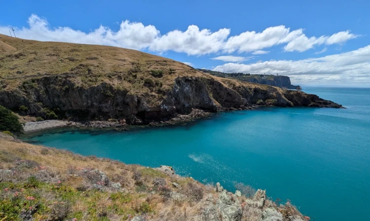
The Godley Cliffs leg of the Christchurch 360 Trail runs from just below the Mt Cavendish Gondola upper station to the seaside suburb of Sumner.
Distance
16.48 km
Walking time
10.5 hrs
Difficulty
Intermediate
Dogs
Allowed — check local rules
Wheelchair access
Not marked friendly
Current status
No active alerts found. Conditions can still change, so check again before leaving.
Weather outlook
Issued 10 Oct 2026, 10:55 am
10 October 2026
Low cloud, with patchy morning drizzle, then the chance of an evening shower. Northeasterlies, strong in exposed places, easing at night.
11 October 2026
Partly cloudy. Northeasterlies, dying out in the evening.
12 October 2026
Fine. Light winds, then northeasterlies developing in the afternoon.
13 October 2026
Fine, but becoming cloudy in the evening. Northwesterlies developing in the morning.
14 October 2026
Rain easing to isolated showers in the afternoon. Southwesterlies developing in the morning.
Regional guidance only; elevation and terrain can produce different conditions.
Explore the area
Explore the track route and surrounding area before you set out.
The Christchurch 360 Trail begins at a car park on the Summit Road , just east of the Gondola upper station on Mt Cavendish. If taking the Gondola, a short zigzag track leads down from the top station to the start point. Follow the mixed-use track over Tauhinukorokio / Mt Pleasant , passing under the radio antennas and continuing to the historic gun emplacements. From here, follow the Crater Rim Walkway east to Tapuwaeharuru / Evans Pass. Cross the road and continue along the Summit Road to join the Crater Rim Walkway toward Godley Head . The track passes the Godley Head Carpark (toilets available). If you fancy a night in a campground, you can book Godley Head Campsite , and continue exploring the tracks in the area. The track descends past Scott’s Cabin, Boulder Bay, and on to Te Onepoto / Taylors Mistake Beach . From Taylors Mistake , follow the coastal trail through the baches, around the headland, and through Nicholson Park to the Flowers Track . Continue down to Heberden Ave and end this leg of the Christchurch 360 Trail at Scarborough Park on The Esplanade , where there are toilets, a café, and a playground. Evans Pass and the Godley Head carpark split the trail into approximate thirds, if you want to break a bit off the leg to make it easier to complete in a day. The next leg on the journey is the Estuary Marshes , starting from this same location. To download the track file for your GPS or phone, a written description of the map, and to research the trail further, including finding out the things to see along the way, head to Christchurch 360 Godley Cliffs .
Traffic: The Christchurch 360 Trail passes along and crosses some roads that experience heavy traffic flows. Please exercise caution at all times around traffic and use the crossing facilities where provided. Cycles: If you choose to follow the Christchurch 360 on your bike, please ride safely and responsibly, and follow the road rules. Dogs: the 360 Trail runs through areas where dogs are prohibited: Taylors Mistake Beach in summer, except for passing through on a short leash Sumner Beach in summer, except for passing through on a short leash Charlesworth Reserve Travis Wetland Brookland Spit and Lagoon, 3 areas McLeans Grasslands Park Riccarton Bush Halswell Quarry Along the rest of the trail, expect to keep your dog on a leash, and in some areas also keep your dog strictly on the walking track.
You don't have to do the entire leg in one go; there are several shorter sections within the leg with access from the road network. Start: Major Hornbrook Saddle, below and to the east of the Gondola top station. There is a car park on the Summit Road at Major Hornbrook Saddle just below and to the east of the Gondola. *If you decide to ride the Gondola, car parking is available at the Gondola lower station, and the Crater Rim track descends from the Gondola to the start point; allow an extra 10 mins walking time in addition to the 10-minute ride up the Gondola. 1.2km 50 mins Broadleaf Lane : There is a carpark at the top and the bottom of Broadleaf Lane. 3.1km 2 hrs Evans Pass : The trail crosses the road at Evans Pass. There is a car park at the saddle. 2.5km 1 hr 45 mins Carpark above Livingston Bay : Before the track reaches the Godley Head car park, the track meets the road in two places, each with sufficient off-road space to park your vehicle. This is the first, the next is at Breeze Col. 1.5km 1 hr Godley Head Loop Track car park 1.7km 1 hr 10 mins Godley Head car park : There is ample car parking and a picnic area, as well as toilet facilities. 3.6km 2 hrs 30 mins Taylors Mistake : There is a very large car park that caters to the crowds that flock to Taylors Mistake in summer. 1.9km 1 hr 15 mins Nicholson Park : There is car parking in Searidge Lane adjacent to Nicholson Park. 1.1km 45 mins End: The Esplanade, Sumner , near the clock tower. There is car parking along The Esplanade.
We encourage you to continue gaining the skills and knowledge required for a safe trip. The NZ Mountain Safety Council has lots of free resources and information you can use. These can be accessed via www.mountainsafety.org.nz . Level up in your outdoor knowledge with these interactive online learning tools: Trip Planning Tramping / field Skills Basic Navigation River Safety Additionally, check out the range of helpful videos available from the NZ Mountain Safety Council YouTube channel .
Generally allowed on-leash, but see Essential Information tab.
Track information, access and weather can change. Confirm current alerts and land-manager information close to departure, tell someone your plans, and carry equipment appropriate for the route and conditions.