10 October 2026
Fine apart from morning valley fog, then a few showers from late afternoon, possibly heavy and thundery east of Alexandra. Northerlies developing early afternoon.
Loading outdoor place details…
Wanaka area
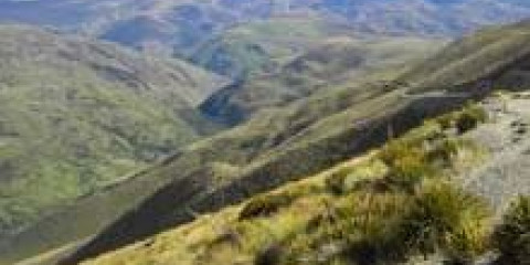
Highly visible over a large area of the surrounding landscape, the Grandview Ridge provides a spectacular vantage point for views over the upper Clutha Valley and peaks beyond.
Distance
35.57 km
Walking time
Various from 3-11 hr
Difficulty
Advanced
Dogs
Not allowed
Wheelchair access
Not marked friendly
Current status
Weather outlook
Issued 10 Oct 2026, 10:55 am
10 October 2026
Fine apart from morning valley fog, then a few showers from late afternoon, possibly heavy and thundery east of Alexandra. Northerlies developing early afternoon.
11 October 2026
Fine. Northwesterlies, dying out in the evening.
12 October 2026
Fine. Northwesterlies developing in the morning.
13 October 2026
A few showers. Northwesterlies, dying out in the afternoon.
14 October 2026
Showers, some heavy. Snow lowering to 900 metres in the afternoon. Southwesterlies developing in the afternoon.
Regional guidance only; elevation and terrain can produce different conditions.
Explore the area
Explore the track route and surrounding area before you set out.
From the Long Gully car park, a well-formed farm track on moderately steep hill terrain links tracks across the upper slopes and ridgeline of the Grandview Range. Options from a few hours to full or multi day are available, providing extensive views across the upper Clutha Valley to the Southern Alps/kā Tiritiri o te Moana. Longer options Long Gully car park to Timaru Creek Road Distance: 43.5 km to exit via Breast Hill Track, 37.5 km to exit before the Breast Hill Track junction via Pakituhi Hut This is the complete Grandview Ridge Track (previously known as Grandview Range Track) and provides great views of the upper Clutha Valley and the peaks beyond. The track provides access to the network of conservation areas including Breast Creek, Grandview Creek, Hospital Creek, Bluenose, Awa Nohoaka and Long Gully Conservation Areas. It traverses the ridgeline through private properties so keep to the poled route. Long Gully car park to Nook Road carpark Time: 9-11 hr Distance: 29 km You can also choose to continue onto the Awa Nohoaka Conservation Area access tracks from the Nook Road or Sandy Point carparks. Shorter options These tracks provide access to the Long Gully Conservation Area. Long Gully car park to Sandy Point car park via Deep Gully Track Time: 3-5 hr Distance: 11.5 km one way Long Gully car park to Sandy Point car park via Eastern Hill Track Time: 3-5 hr Distance: 11 km one way Deep Gully-Eastern Hills Loop Time: 3-5 hr Distance: 10.5 km This option offers a great loop with extensive views over the Upper Clutha Valley. The track starts across the road from the Sandy Point car park. A poled route follows the toe of the hill before climbing up Deep Gully and up onto the Grandview Ridge. Turn right to follow the Grandview Ridge track for 500 m before branching off and descending down the Eastern Hills track back to the starting point.
Mountain bikers can't exit/enter via the Breast Hill or Timaru River tracks - exit at the Hāwea end of Grandview Ridge, via the Grandview Mountain Track to Nook Road carpark.
In winter and spring these access points travel through ‘challenging’ avalanche terrain before entering ‘simple’ avalanche terrain on the tops – visit the NZ Avalanche Advisory if planning a trip between May and November. Three sections are closed annually for lambing: Deep Gully Track: 30 September to 4 November Eastern Hills Track: 26 September to 7 November Grandview Mountain Track (no exit): 5 October to 16 November
The main access points for the Grandview Ridge tracks are: Long Gully car park - approximately 24.5 km from Wānaka township on the Luggate/Tarras Highway (SH8a). Turn left off SH8a onto Jolly Road, travel 2.6 km and turn left onto the Long Gully farm access road. The Long Gully car park area is past farm buildings where a sign/stile indicates the start of Grandview Ridge Track. Nook Road carpark - approximately 5 km from Hāwea township. From Cemetery Road continue on to Gray road. Turn left at the end of Gray Road onto the Hāwea Back Road for less than 200 m before turning right onto Nook Road. Travel for 500 m before reaching the Nook Road carpark and the beginning of the Grandview Mountain Track . Walk or bike up this track for 9 km before reaching Grandview Ridge Track. Timaru Creek Road - approximately 7 km from Hāwea township. From Cemetery Road turn left onto Gladstone Road which then becomes Timaru Creek Road. There is a parking pull off on Timaru Creek Road 300 m on the left past the beginning of the Timaru Creek/ Breast Hill Track . This is only a walking access. Follow the Timaru Creek/Breast Hill Track to Pakituhi Hut. Grandview Ridge Junction is 300 m past this hut.
We encourage you to continue gaining the skills and knowledge required for a safe trip. The NZ Mountain Safety Council has lots of free resources and information you can use. These can be accessed via www.mountainsafety.org.nz . We recommend trying these online learning tools: Trip Planning Tramping / field Skills Basic Navigation River Safety Additionally, check out the range of helpful videos available from the NZ Mountain Safety Council YouTube channel
No dogs.
Track information, access and weather can change. Confirm current alerts and land-manager information close to departure, tell someone your plans, and carry equipment appropriate for the route and conditions.