10 October 2026
Cloud about the tops, and the odd shower.
Loading outdoor place details…
Holdsworth area
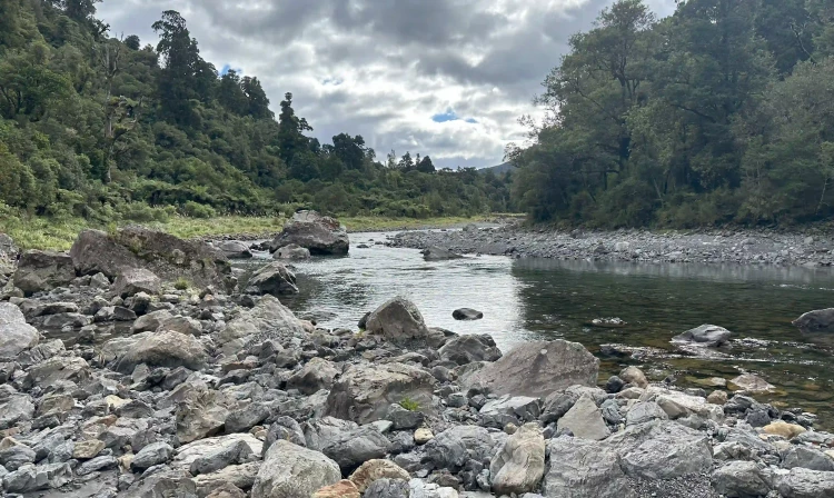
This is one of the classic tramps of the Tararua Forest Park. It follows the Waiohine and Tauwharenīkau rivers between Holdsworth and Kaitoke.
Distance
36 km
Walking time
2–3 days
Difficulty
Advanced
Dogs
Allowed — check local rules
Wheelchair access
Not marked friendly
Current status
Weather outlook
Issued 10 Oct 2026, 7:33 am
10 October 2026
Cloud about the tops, and the odd shower.
11 October 2026
Showers, possibly heavy, clearing in the afternoon with increasing fine spells. Low cloud and drizzle developing on western slopes in the evening.
12 October 2026
Fine, apart from morning drizzle. A few showers at night.
13 October 2026
Showers, some possibly heavy.
14 October 2026
Rain, with heavy falls.
Regional guidance only; elevation and terrain can produce different conditions.
Explore the area
Explore the track route and surrounding area before you set out.
The first half of this section is a well-formed gravel walkway. Through the second half, the track is less well-formed, muddy in places, steep with many tree roots. From Holdsworth Lodge, cross the bridge and continue up the track in the direction of Donnelly’s Flat. Turn left at the signpost and climb the Gentle Annie track towards Mountain House Shelter. This track is well graded, and offers several lookout points. The track follows the ridge to the Totara Creek turnoff. Follow the track along the ridge to a high point, 575m, and continue along the track, heading down towards Totara Creek. Follow the creek on the true left to the swingbridge crossing, then continue down stream on the true right. At the Waiohine River, cross the bridge and follow the signs to Totara Flats Hut. Totara Flats has numerous camping sites. Campers who use hut facilities are required to pay one hut ticket.
The first 2 hours of this track can be rocky and uneven under foot. The track then climbs to Cone Saddle and drops to Cone Hut. Expect to encounter stream crossings, muddy sections and windfalls across the track. The track can be narrow and indistinct in this places. From the hut the track continues down river across the flats. Before reaching a high bluff, swing away from the river, following the track up a steep short climb onto a high river terrace and continue to the river. A large slip will be encountered shortly. Either follow the all-weather track over the slip (30 minutes), or travel downstream on the river terrace to Makaka Creek (only possible when the river is low). Cross the Makaka Creek bridge and climb up the bank to the marked junction. Turn right onto the Cone Saddle track and climb steadily up a spur to the ridge top. From here the track sidles into Clem Creek and climbs to Cone Saddle. Descend the track to Cone Hut in the Tauherenikau Valley. Cone hut is a basic hut and does not require hut tickets. From Cone Hut go down river, crossing muddy terraces and grassy flats, to Tutuwai Hut.
This track is relatively flat until Smith Creek. Beyond Smith Creek, expect to encounter small slips, stream crossings, muddy and slippery sections and windfalls across the track. Slips and washouts along this section of the track have caused the terrain in some areas to become steep, narrow and slippery and can be difficult to negotiate. Caution is required when crossing. From Tutuwai Hut continue down the true left, crossing grass flats and bush terraces past low wide slips. Climb onto the river terraces, where the track continues downstream to a swingbridge. Cross the bridge and follow the track. Some side streams must be treated with care in wet weather. After crossing grassy river flats, Smith Creek shelter is reached. The shelter is not suitable for overnight stays. The track from here follows Smith Creek up-stream to the base of the Puffer Track. Climb the Puffer Track to a saddle and down to the Kaitoke roadend carpark, located along Kiwi Ranch Road.
This track has unbridged stream crossings that can become impassable after heavy rain. Ensure you monitor weather conditions before leaving and do not attempt to cross flooded streams. Your safety is your responsibility. Stay safe in the outdoors by following the Land Safety Code. Tell someone your plans, including when to raise the alarm if you haven't returned, by using the Outdoors Intentions form (external site). Tararua Forest Park is renowned for its changeable and wild weather, particularly on the open tops. Much of the terrain is rugged, so trampers should travel prepared. Overnight parties should always include experienced trampers.
Totara Flats Hut Cone Hut Tutuwai Hut
Holdsworth end Turn off State Highway 2 onto Norfolk Road, 2 km south of Masterton. This is signposted and there is a timber processing plant on the corner. Follow Norfolk Road 15 km to Mount Holdsworth road end. Use this location in Google Maps to find your way there. Kaitoke end Turn off State Highway 2 onto Marchant Road (signposted at the western side of the Remutaka Hill) at the YMCA Camp Kaitoke turnoff. Near the end of Marchant Road, turn right into Kiwi Ranch Road. The carpark is located on the left, approximately 500 m along Kiwi Ranch Road. Use this location in Google Maps to find your way there.
We encourage you to continue gaining the skills and knowledge required for a safe trip. The NZ Mountain Safety Council has lots of free resources and information you can use. These can be accessed via www.mountainsafety.org.nz . We recommend trying these online learning tools: Trip Planning Tramping / field Skills Basic Navigation River Safety Additionally, check out the range of helpful videos available from the NZ Mountain Safety Council YouTube channel .
Dogs allowed. Keep dog under control at all times.
Track information, access and weather can change. Confirm current alerts and land-manager information close to departure, tell someone your plans, and carry equipment appropriate for the route and conditions.