11 October 2026
Scattered showers, becoming confined south of Doubtful Sound in the afternoon.
Loading outdoor place details…

Fiordland National Park
Enjoy this easy day walk along the Hollyford Track to the beautiful Hidden Falls or the nearby hut for lunch.
Distance
18 km
Walking time
4 - 6 hr
Difficulty
Advanced
Dogs
Not allowed
Wheelchair access
Not marked friendly
Current status
Weather outlook
Issued 10 Oct 2026, 9:23 pm
11 October 2026
Scattered showers, becoming confined south of Doubtful Sound in the afternoon.
12 October 2026
Partly cloudy, with one or two morning showers south of Secretary Island.
13 October 2026
Heavy rain developing, with snow to 2400 metres.
14 October 2026
Rain, with snow to 1900 metres, turning to showers.
15 October 2026
Showers, with snow to 800 metres, easing.
Regional guidance only; elevation and terrain can produce different conditions.
Explore the area
Explore the track route and surrounding area before you set out.
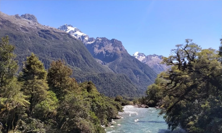
Time required: 2-3 hours one-way and return via the same track. The Hollyford Track to Hidden Falls is a fairly flat track that is well marked. I t is a popular walk for families as Hidden Falls Hut is only 9km for the road end. From the road end, cross the swing bridge over Humboldt Creek. After about 30-40 minutes walk there is another bridge across Swamp Creek. There is still a flood channel that can be impassible in heavy rain. You will pass through beautiful rainforest with a number of places to stop for rests. From the Hidden Falls Swing Bridge there is a track heading out about 50m to where you can get great views of the waterfall. The rocks on this path are often slippery. Hidden Falls Hut is about 15 minutes from Hidden Falls Swing Bridge. There are some beautiful lunch spots either near the side of the Hollyford River or at Hidden Falls Hut. On a clear day there are fantastic views of the Darran Mountains and even in the rain this is a great walk under the canopy of the forest. This area has a lot of early history with the Hollyford being an old Pounamu/Greenstone trail that early Māori would use. Hidden Falls Hut area is one of Davy Gunn’s cattle run clearings that he farmed between 1926 and 1955. This is the first part of the 56 km Hollyford Track that follows the Hollyford River out to Martins Bay on the West Coast.
There are long drop toilets at the Hollyford Road end and at Hidden Falls Hut. Be Aware During heavy rain there are side streams that may be impassable so this trip is recommended when there are no heavy rain warnings for Fiordland National Park. Be prepared to wait for streams to drop or backtrack if needed. Dogs are not permitted in Fiordland National Park. The Hollyford is a popular area for hunting and hunting permits can be obtained online from the Department of Conservation. The closest petrol station is in Te Anau so it is recommended to fill up before you go.
Hidden Falls Hut is a 12 bunk serviced hut. Adults are $15 per night, youth $7.50 and children under 7 are free.
The Hollyford Track begins at the end of Lower Hollyford Road, which turns off SH94 Milford Road shortly after The Divide. The turn off point is called Marian Corner, and is about 87 km along the Milford Road from Te Anau. Allow 2 hours to drive from Te Anau to the end of the Hollyford Road. The Hollyford Road was reopened to the road end in 2021 after some severe flooding in 2020 that took out many parts of the road and destroyed Gunn’s camp. Since these floods the track to Hidden Falls has had new bridges put in and the slips have all been repaired. Use this location in Google Maps to find your way there.
We encourage you to continue gaining the skills and knowledge required for a safe trip. The NZ Mountain Safety Council has lots of free resources and information you can use. These can be accessed via www.mountainsafety.org.nz . We recommend trying these online learning tools: Trip Planning Tramping / field Skills Basic Navigation River Safety Additionally, check out the range of helpful videos available from the NZ Mountain Safety Council YouTube channel .
No dogs.
Track information, access and weather can change. Confirm current alerts and land-manager information close to departure, tell someone your plans, and carry equipment appropriate for the route and conditions.