10 October 2026
Cloud about the tops, and a few showers northwest of the Lakes.
Loading outdoor place details…
Hāwea Conservation Park
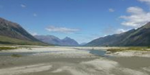
The Hunter River Valley is part of the Hāwea Conservation Park and nestled between the Young and Huxley ranges. Its open grasslands, braided river system and deep canyon gorges offer remote seekers a beautiful but challenging backcountry experience.
Distance
23 km
Difficulty
Advanced
Dogs
Not allowed
Wheelchair access
Not marked friendly
Current status
No active alerts found. Conditions can still change, so check again before leaving.
Weather outlook
Issued 10 Oct 2026, 9:23 pm
10 October 2026
Cloud about the tops, and a few showers northwest of the Lakes.
11 October 2026
Showers about the Divide, clearing early evening, otherwise fine.
12 October 2026
Fine.
13 October 2026
Rain developing.
14 October 2026
Heavy rain easing to showers. Snow lowering to 1900 metres.
Regional guidance only; elevation and terrain can produce different conditions.
Explore the area
Explore the track route and surrounding area before you set out.
1 day, 23 km one way. Scrubby Flat Creek to Ferguson Hut: 1 hr 30 min – 2 hr, 7 km Ferguson Hut to Forbes Hut: 2–3 hr, 10 km Forbes Hut to West Branch bushline: 3 hr, 6 km The track begins at Scrubby Flat Creek. From here to Ferguson Hut , there is no marked route, so navigation skills are essential, and you’ll need to cross the Hunter River at least four times. From Ferguson Hut, follow the 4WD track across Ferguson Creek and continue to the end of the grassy flat. Past this point, the route is unmarked. Cross the Hunter River and follow the track through a narrow stretch of forest to Joes Flat. After crossing the flat, the track re-enters the forest, emerging onto a terrace at the lower end of Forbes Flat, where Forbes Hut is located about halfway up. Beyond Forbes Hut, follow the flat upwards and cross the Hunter River below the forks—use caution, especially after heavy rain, as conditions can be hazardous. Cross the West Branch to reach the start of the track, located on a ridge between the East and West branches. About an hour past the forks, the track crosses the river again and continues along its true right up to the bushline.
Kidds Bush to Scrubby Flat Creek: 12 hr, 45 km one way The 4WD farm road from Kidds Bush Campsite to Scrubby Flat Creek passes through Hunter Valley Station. Reaching the Hāwea Conservation Park boundary at Scrubby Flat takes at least 4 hours by vehicle or around 12 hours on foot. Permission from the landowner is required to cross Hunter Valley Station; apply at Hunter Valley Station at least two days before your trip. The route includes 22 gates—leave them as you find them. From Terrace Creek, the road follows the Hunter River valley floor for about 30 km, with some 300 m climbs and frequent steep drop-offs to the lake. Use caution, as the road is generally only 3-5 m wide with many blind corners and limited passing spots. Note that the bridge at Little Hopwood Burn is closed for safety; follow the detour signs. In the first 25 km, you’ll encounter six river crossings, with four more up to Scrubby Flat Creek along the valley floor.
2–3 days, 46.5 km one way Dingle Burn car park to Turihuka campsite: 3–4 hr, 12 km Turihuka campsite to Hunter River mouth: 10–12 hr, 20 km Hunter River mouth to Scrubby Flat Creek: 3–4 hr, 14.5 km Starting at the Dingle Burn car park, follow the private 4WD road above the lake to Silver Island Bay. Here, the public track branches off, crossing the Silver Burn and climbing along the western side of the peninsula to the Turihuka Conservation Area, where you’ll find a basic campsite with a picnic table and toilet at the mouth of the Dingle Burn. From the campsite, the undulating Lake Hāwea Track continues, fording the Dingle Burn and winding through pockets of kānuka and beech forest to reach the mouth of the Hunter River. The track up to Scrubby Flat Creek crosses broad valley flats, meandering through open grasslands and small forest pockets, with multiple crossings over the braided river.
Biking on the formed track is permitted from the carpark to Turihuka Conservation Area and beyond to the open flats of the Hunter Valley. Permission to ride through Hunter Valley Station must be approved before entering or exiting via Kidds Bush. A $20 fee per bicycle is charged by Hunter Valley Station. Apply for permission from Hunter Valley Station . This is a challenging ride with rough terrain if the intention is to enter and exit using the western and eastern entry and exit points. Riders need to be suitably prepared for remote backcountry terrain including being prepared for and knowing how to fix basic mechanical breakdowns (chain break, flat tyres).
Access via Hunter Valley Station Closed 1 October to 1 December annually for farming practices. Access may also be declined at other times. Track closures for stock movement The Dingle Burn Peninsula Track will sometimes be closed for up to five hours while stock is moved along the track. This is because the track goes through a working farm. Closure signs will be at either end of the Dingle Burn Peninsula Track, do not continue past the signs. Camping Camping beside huts is free and gives you access to toilets and water. Camping elsewhere within the conservation park is permitted, but you must choose your site carefully and follow the Leave No Trace principles. Make sure you bury toilet waste well away from any water sources, or bring it out with you. Dogs Permission is required from Hunter Valley Station. If access is granted, dogs must be on a leash or confined in a vehicle at all times when travelling through station land.
Eastern Side From Lake Hāwea Township follow the unsealed Dingleburn Station Road for 14 km to the public carpark. No vehicle access is permitted beyond this point. Western Side Meads road gives access to the Kidds Bush Camping Area . Access along the western side of Lake Hawea to the Hawea Conservation Park beyond Terrace Creek requires prior permission from Hunter Valley Station Managers. To avoid a long journey on foot you may wish to fly by plane or helicopter into the Hunter Valley. Unless an authorised aircraft operator is being used, for helicopter of plane access you must obtain an aircraft landing permit from the Tititea/Mt Aspiring National Park Visitor Centre in Wanaka. Hunter Valley Road travels through active slips that may cause temporary road closures from just after Station Cattle Yards. These closures do not effect access to Kidds Bush and Bee Burn. Temporary road closures may also occur for short lengths of time during periods of elevated lake levels.
We encourage you to continue gaining the skills and knowledge required for a safe trip. The NZ Mountain Safety Council has lots of free resources and information you can use. These can be accessed via www.mountainsafety.org.nz . We recommend trying these online learning tools: Trip Planning Tramping / field Skills Basic Navigation River Safety Additionally, check out the range of helpful videos available from the NZ Mountain Safety Council YouTube channel
Not Applicable
Track information, access and weather can change. Confirm current alerts and land-manager information close to departure, tell someone your plans, and carry equipment appropriate for the route and conditions.