11 October 2026
Cloudy periods.
Loading outdoor place details…
Makarora area
The Brewster Track to Brewster Hut is a rewarding alpine trip in the heart of Mt Aspiring National Park. It involves a number of challenges, including crossing the unbridged Haast River, steep and rugged track conditions, and rapidly changing alpine weather. For those with suitable skills and experience, the hut affords amazing views of the surrounding mountains. Beyond the hut is an unforgiving environment.
Distance
5 km
Walking time
6 – 8 hr return
Difficulty
Advanced
Dogs
Not allowed
Wheelchair access
Not marked friendly
Current status
Weather outlook
Issued 11 Oct 2026, 7:33 am
11 October 2026
Cloudy periods.
12 October 2026
Fine, but becoming overcast at night.
13 October 2026
Rain, heavy for a time in the afternoon. Snow to 2300 metres.
14 October 2026
Rain, with snow to 2100 metres, easing.
15 October 2026
Partly cloudy with isolated showers.
Regional guidance only; elevation and terrain can produce different conditions.
Explore the area
Explore the track route and surrounding area before you set out.
This is a steep and challenging alpine route that takes around 6 to 8 hours return. Over just 2.8 km, the track climbs 1000 metres through rugged terrain, so a good level of fitness and experience is essential. The track begins at Fantail Falls. Before setting off, assess the unbridged Haast River to ensure it is safe to cross. If it is, choose the safest crossing point for the conditions at the time and head toward the orange track markers on the far side. From there, the track climbs steadily through beech forest to the bushline. Expect slippery rocks and tree roots, which require careful foot placement. Sturdy, grippy footwear is essential, and you’ll need to use your hands to scramble up some of the steeper sections. Above the bushline, the track continues up a steep snow grass face and onto a narrow ridge leading to Brewster Hut. This exposed section is subject to strong winds and snow, which can make travel hazardous. To return, retrace your steps. The descent is steep and slippery, and in some places it is safer to turn around and climb down facing the slope. Before recrossing the Haast River, reassess the conditions. Water levels may have risen during your trip, and you may need to wait for the river to drop. While it can be frustrating to wait with the carpark so close, it is much safer to do so. Make sure you carry an emergency shelter, extra food, and a communication device to let your trusted contact know if your return is delayed. If you are at Brewster Hut during heavy rain, it may be wise to stay put until rivers and creeks have had time to settle. This can help avoid being stuck at the river’s edge waiting for safe crossing conditions.
Some experienced trampers choose to continue past Brewster Hut to explore the foot of Brewster Glacier or even summit Mt Armstrong. These are serious off-track routes with no official markings and no track maintenance , so it's important to understand the risks before heading out. Brewster Glacier Route This is not a marked track - you’ll need excellent navigation skills and be confident travelling off-track. The terrain is steep and exposed , with bluffs and drop-offs that leave little room for error. Rock cairns placed by other hikers are not reliable for navigation. Fog can roll in fast , cutting visibility down to just a few metres - making route-finding extremely difficult. Avoid this route in: Wet weather Poor visibility Snow or icy conditions Avalanche Risk (May to November) The area is prone to avalanches during this time. If you're heading up, you’ll need specialist alpine gear , including: Crampons and ice axe Avalanche transceiver Probe Shovel Glacier Hazards Brewster Glacier and its ice caves are highly unstable . Large chunks of ice break off regularly - it’s safest to stay well back from the glacier. Mt Armstrong The route to the summit is also unmarked and unmaintained . There are steep sections where care is essential. In poor weather or low visibility, it’s easy to lose your way . Like the glacier route, this one also requires strong navigation skills and off-track experience .
Before heading out, make sure you're well-prepared. This area is remote and conditions can change quickly. Carry an emergency communication device , such as a satellite messenger or Personal Locator Beacon (PLB). In winter, alpine skills and equipment are essential. The terrain can produce avalanches that cross the track , especially from May to November. Check the weather forecast before you go. If rain is expected, reschedule your trip or choose another track . The Haast River is unbridged and rises quickly. Never attempt to cross the Haast River in flood. It is a strong river, and the terrain downstream is extremely dangerous if you are swept away. Bring enough water for your entire trip. The hut’s water tank can run dry in summer. Day walkers and campers should bring all water with them. Know your limits. If the terrain or weather becomes too difficult at any point, turning back may be the safest option .
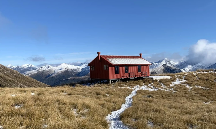
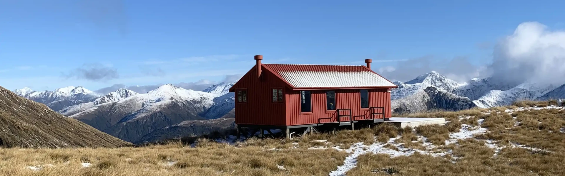
The 12-bunk Brewster Hut is next to a small tarn, just off the ridge to the right. The hut is open year-round, with bookings required from late October to the end of May. You'll need a warm sleeping bag and clothing as the hut has no heating. Camping has left a negative impact on the environment, so staying in the hut is best, but if you do camp, follow the Leave No Trace principles.
The track begins at the Fantail Falls carpark on the Haast Pass-Makarora Road (SH6). This is signposted on the east of the road. The carpark fills up quickly, so you may need to wait for a park. Parking on the road isn't recommended, as the traffic is swift along SH6. Use this location in Google Maps to help find your way there.
We encourage you to continue gaining the skills and knowledge required for a safe trip. The NZ Mountain Safety Council has lots of free resources and information you can use. These can be accessed via www.mountainsafety.org.nz . We recommend trying these online learning tools: Trip Planning Tramping / field Skills Basic Navigation River Safety Additionally, check out the range of helpful videos available from the NZ Mountain Safety Council YouTube channel .
The weather can change rapidly in Mt Aspiring National Park. Brewster Track is open to very heavy rain from the west which can fall as snow in the colder months. Strong winds from the northwest are also prevalent. Be wary of southerly wind changes which can bring rapidly deteriorating conditions. Whiteout conditions caused by snow or low cloud may be present. Hypothermia is a real risk, even in summer. Be prepared by having warm, windproof clothing and appropriate footwear.
No dogs.
Track information, access and weather can change. Confirm current alerts and land-manager information close to departure, tell someone your plans, and carry equipment appropriate for the route and conditions.