11 October 2026
Showers about the Divide, clearing in the evening, otherwise fine.
Loading outdoor place details…
Lake Sumner Forest Park
The Jollie Brook Circuit starts and finishes off Lake Sumner Road. There are many river crossings.
Distance
24 km
Walking time
18 hr 30 min
Difficulty
Advanced, Expert
Dogs
Not allowed
Wheelchair access
Not marked friendly
Current status
Weather outlook
Issued 10 Oct 2026, 9:23 pm
11 October 2026
Showers about the Divide, clearing in the evening, otherwise fine.
12 October 2026
Fine.
13 October 2026
Partly cloudy with isolated showers.
14 October 2026
Rain, with heavy falls.
15 October 2026
Rain developing, with snow to 600 metres.
Regional guidance only; elevation and terrain can produce different conditions.
Explore the area
Explore the track route and surrounding area before you set out.
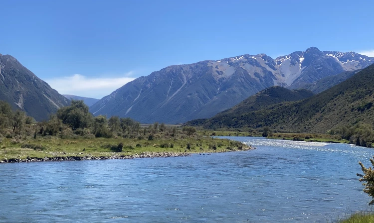
Jollie Brook swing bridge to Sisters swing bridge Time: 1 hr On the river flats of the Hurunui River, a signpost marks the track that follows the true left of the Hurunui River to the Sisters car park. The Jollie Brook needs to be crossed – this may not be possible in high river flows. Sisters swing bridge to Gabriel Hut Time: 2 hr From the swing bridge the track is marked with poles up the true left of the valley. Traverse a series of large ancient river terraces close to the hillside until you reach Gabriel Hut. Gabriel Hut to Jollie Brook Hut Time: 1 hr 30 min Track leads up Gabriel Stream through beech forest to a low saddle then follows a side-stream to the Jollie Brook. Cross the Jollie Brook to reach the hut. Lake Sumner is a further 30-minutes from the hut. Good camping is available here if the hut does not appeal. Jollie Brook Hut to Jollie Brook swing bridge Time: 4 hr The track downstream from the hut is well marked but there are a few crossings back and forth across the river. When the valley opens out, traverse across grass and gravel flats until you reach the junction with Cold Stream. After crossing Cold Stream, gravel flats lead to a short gorge. The valley starts to close in, with sections of track appearing intermittently between frequent stream crossings. Eventually the track breaks out onto narrow grassy flats leading to the Hurunui River. Cross the river via the swing bridge just below the Jollie Brook / Hurunui confluence. Optional Detour to Cold Stream Hut Jollie Brook Track - Cold Stream Hut Time: 1 hr This route turns off the Jollie Brook Track, about halfway between Jollie Brook Hut and the Jollie Brook swing bridge. Cross Cold Stream and follow it, crossing several times to reach the hut.
River Crossings: All river crossings between Gabriel and Jollie Brook huts are bridged. There are numerous river crossings from Jollie Brook Hut to the swingbridges. Dogs: No dogs are permitted.
Gabriel Hut Lake Sumner is a further 30-minutes from Gabriel hut. Good camping is available here if the hut does not appeal. Jollie Brook Hut Cold Stream Hut
Lake Sumner Forest Park lies 100 km northwest of Christchurch between the Lewis Pass and Arthur’s Pass National Park. From Christchurch, take SH1 north then turn onto SH7 at Waipara. At Waikari, turn left and follow the Hawarden–Waikari Road through Hawarden, to Lake Sumner Road. From Hanmer Springs , Lake Sumner Road is signposted off SH7 just after the historic Hurunui Hotel. Lake Sumner Road is suitable for 2WD vehicles as far as Lake Taylor. Lake Sumner Road passes through two privately operated stations on leasehold and freehold land. Keep to the road and do not disturb stock. Beyond Lake Taylor, the road to Loch Katrine is suitable for 4WD vehicles only. The Jollie Brook Circuit starts and finishes off Lake Sumner Road, with the option of starting from either of the two swing bridges over the Hurunui River (approximately 3 km apart on the Lake Sumner Road). Use this location for the Hurunui Swing Bridge and this location for the Sisters Swing Bridge on Google Maps to help you find your way there. Private roads There are several other 4WD roads in the lakes area which are privately owned by the neighbouring stations: Lakes Station, Lake Taylor Station and Eskhead Station. These private roads are not to be used unless you have permission before your visit.
We encourage you to continue gaining the skills and knowledge required for a safe trip. The NZ Mountain Safety Council has lots of free resources and information you can use. These can be accessed via www.mountainsafety.org.nz . We recommend trying these online learning tools: Trip Planning Tramping / field Skills Basic Navigation River Safety Additionally, check out the range of helpful videos available from the NZ Mountain Safety Council YouTube channel
No dogs.
Track information, access and weather can change. Confirm current alerts and land-manager information close to departure, tell someone your plans, and carry equipment appropriate for the route and conditions.