8 October 2026
Partly cloudy. Isolated showers in the afternoon and evening.
Loading outdoor place details…

Whakaari Conservation Area
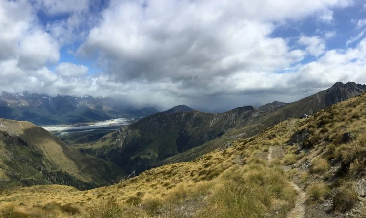
Experience scheelite mining history, open tussock country and grand views on Judah Track.
Distance
15.18 km
Walking time
6 hours return
Difficulty
Intermediate
Dogs
Not allowed
Wheelchair access
Not marked friendly
Current status
Weather outlook
Issued 8 Oct 2026, 7:33 am
8 October 2026
Partly cloudy. Isolated showers in the afternoon and evening.
9 October 2026
Cloud about the terrain lifting in the morning, then returning in the evening. Isolated afternoon and evening showers.
10 October 2026
Partly cloudy. A few showers developing in the afternoon, frequent about the northwest ranges.
11 October 2026
Partly cloudy.
12 October 2026
Fine.
Regional guidance only; elevation and terrain can produce different conditions.
Explore the area
Explore the track route and surrounding area before you set out.
From the car park and shelter , the track meanders past some houses and fields before steeply climbing to join with the main Mt Judah 4WD track. Follow the gently climbing road to the left and look out for the historic Glenorchy battery which was used for Scheelite mining. Continue along the track until you a reach the first junction. A left-hand trail heads down into the Buckler Burn valley and back up for the McIntosh Loop but continue straight ahead on the main 4WD track to the next junction. At this point you can go either way and return via a loop. If you head left you will hike down to a small stream crossing and then back up to Jean Hut. Continue to follow the signs and orange markers up a steep set of switch backs until you reach Heather Jock Hut . If returning via the loop follow the gentler descent to Boozer and Bonnie Jean Hut. Cross the stream again to return to the Mt Judah track and descent back to the carpark.
Although a well-defined track, it is a constant climb with an overall ascent/descent of approx. 900m.
Heather Jock is a small, basic, 3 - bed hut with a long drop toilet and access to a rainwater tank that requires boiling before consumption. The hut is free of charge but can be popular, it’s recommended to take camping equipment if you intend to stay overnight. There are keas in the area so also be mindful that they might checkout your campsite. Jean and Bonnie Jean Huts are historic huts, they are not available for overnight stays.
The Whakaari Conservation Area carpark and start of the track is about 2km from Glenorchy on the Queenstown side of the Buckler Burn stream. If approaching from Queenstown, as you near Glenorchy, you will pass an airstrip and entrance to Blanket Bay on your left with the carpark around the next corner on the right (just before the road takes a steep descent downhill). Use this location in Google Maps to find your way there. Alternatively, start the walk from Glenorchy, by taking the 1.9km Buckler Burn Trail adding around 15-20 minutes each way.
We encourage you to continue gaining the skills and knowledge required for a safe trip. The NZ Mountain Safety Council has lots of free resources and information you can use. These can be accessed via www.mountainsafety.org.nz . We recommend trying these online learning tools: Trip Planning Tramping / field Skills Basic Navigation River Safety Additionally, check out the range of helpful videos available from the NZ Mountain Safety Council YouTube channel .
No dogs.
Track information, access and weather can change. Confirm current alerts and land-manager information close to departure, tell someone your plans, and carry equipment appropriate for the route and conditions.