08 October 2026
Mostly cloudy with patchy drizzle, clearing in the morning to fine breaks. Light winds.
Loading outdoor place details…
Bendigo area
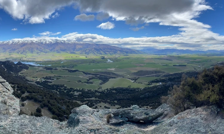
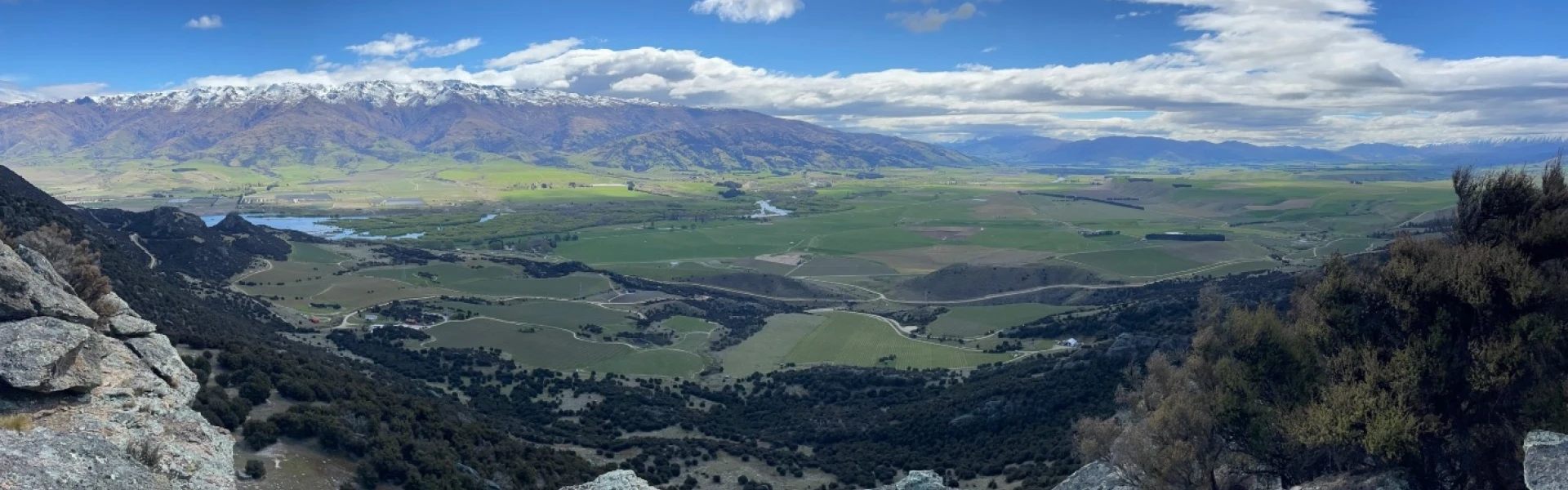
This 10 km return loop offers views of Lake Dunstan and the Upper Clutha Valley as it weaves its way through regenerated kānuka shrublands and impressive rocky cliffs.
Distance
10 km
Walking time
5 hr
Difficulty
Advanced
Dogs
On-lead only
Wheelchair access
Not marked friendly
Current status
No active alerts found. Conditions can still change, so check again before leaving.
Weather outlook
Issued 8 Oct 2026, 11:31 am
08 October 2026
Mostly cloudy with patchy drizzle, clearing in the morning to fine breaks. Light winds.
09 October 2026
Fine. Light winds, then northerlies developing at night.
10 October 2026
Mainly fine, isolated showers developing in the afternoon. Northerlies developing in the morning.
11 October 2026
Fine. Light winds.
12 October 2026
Fine. Light winds.
Regional guidance only; elevation and terrain can produce different conditions.
Explore the area
Explore the track route and surrounding area before you set out.
The track begins 200 m from the historic reserve entrance, with parking recommended at Logantown. It initially follows the Matilda Battery Track before branching right at Spec Gully. Winding through the Kānuka Scenic Reserve, the track climbs through regenerated kānuka forest and rocky crags, offering stunning views over Lake Dunstan and the Upper Clutha Valley. It loops around Chinamans Creek, crossing a ridge before following the valley-facing ridgeline. Deep in the gully, near stone hut ruins, a biv provides shelter alongside historic relics. It is a rugged trail with steep sections, but the elevation gain grants you breathtaking views all the way from the Old Woman Range to the Saint Bethans Range. There’s also a shorter loop walk that takes between one and one-and-a-half hours. Follow the Kānuka Track, as above, but instead of crossing Burma Road – the only one you'll come to – follow it down to the gate and turn right to come back along the marked fence line and back to the stile.
There are old and very deep mining shafts throughout this area. Extreme care must be taken; children must be closely supervised. The Bendigo reserves and conservation areas have extreme and rapidly changing conditions. Winters bring snow-covered ranges, while summers are hot and dry. Be well-prepared with suitable gear, including a sun hat, sunscreen, plenty of water, warm layers, and waterproof, windproof clothing and footwear.
The main entrance to Bendigo is off SH8 at Crippletown, just north of Lake Dunstan and the Rocky Point picnic and boat ramp area. Here, Loop Road goes up the hill and passes through the old Bendigo Township, past the schoolhouse ruins at Schoolhouse Flat to the main historic sites of Logantown, Welshtown and the mining remnants scattered throughout. The track starts 200 m from the entry to the historic reserve and parking is recommended some 200 m up the road at the Logantown site. Use this location on Google Maps to help find your way there.
We encourage you to continue gaining the skills and knowledge required for a safe trip. The NZ Mountain Safety Council has lots of free resources and information you can use. These can be accessed via www.mountainsafety.org.nz . We recommend trying these online learning tools: Trip Planning Tramping / field Skills Basic Navigation River Safety Additionally, check out the range of helpful videos available from the NZ Mountain Safety Council YouTube channel
Dogs on a leash only.
Track information, access and weather can change. Confirm current alerts and land-manager information close to departure, tell someone your plans, and carry equipment appropriate for the route and conditions.