11 October 2026
Showers, possibly heavy, clearing to fine in the morning, but returning at night. Northwesterlies developing in the morning.
Loading outdoor place details…
Anawhata Farm Regional Park
Kuatakia Track takes 1.5 hours one way. The recommended option is to start from Anawhata Farm, walk to Kuatakia Trig, and return the same way, making this a 3-hour return walk.
Distance
10 km
Walking time
3 hours
Difficulty
Intermediate
Dogs
On-lead only
Wheelchair access
Not marked friendly
Current status
No active alerts found. Conditions can still change, so check again before leaving.
Weather outlook
Issued 10 Oct 2026, 11:01 pm
11 October 2026
Showers, possibly heavy, clearing to fine in the morning, but returning at night. Northwesterlies developing in the morning.
12 October 2026
Mostly cloudy with isolated showers, becoming widespread for a time in the afternoon. Northwesterlies.
13 October 2026
Partly cloudy, with isolated showers in the afternoon and evening. Northwesterlies.
14 October 2026
A few showers clearing to fine in the afternoon. Northwesterlies.
15 October 2026
A few showers, some possibly heavy. Northerlies, turning westerly.
Regional guidance only; elevation and terrain can produce different conditions.
Explore the area
Explore the track route and surrounding area before you set out.
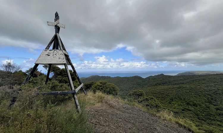
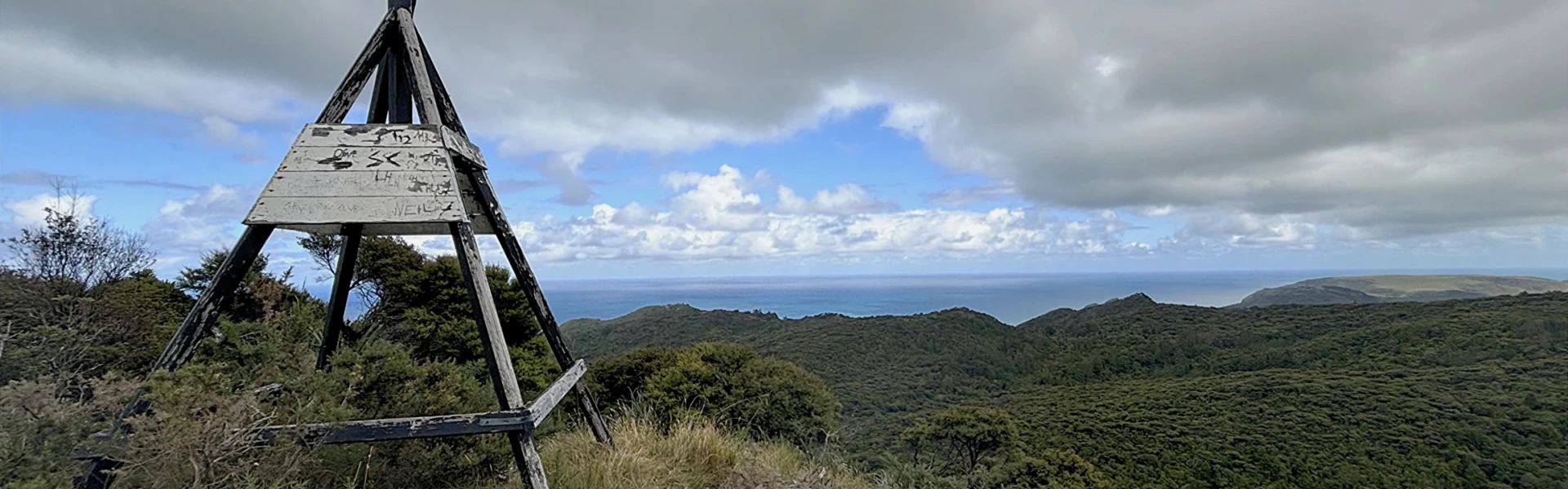
Kuatakia Track is a 1.5-hour point-to-point walk. The recommended option is to start from Anawhata Farm, walk to Kuatakia Trig, and return the same way, making this a 3-hour return walk. Kuatakia Track is a dogs-on-lead track. Please keep dogs under control at all times and stay clear of stock when walking through Anawhata Farm. The walk begins at the car park near the stockyards at Anawhata Farm. From here, follow the orange markers for a 500-metre walk through farmland. As you leave the farm and enter the bush, the track descends towards Gentle Stream before climbing over a ridge and heading towards the suspension bridge that crosses Anawhata Stream. After crossing Anawhata Stream, the track climbs steeply up a ridge with sections of elevated platform steps, offering great views above the forest and down into the valleys below. The track then descends along another ridge to a bridge crossing Kuatakia Stream. From the stream, a steady climb leads up to Kuatakia Trig. Kuatakia Trig is an ideal place to stop for a break or lunch, with a rocky outcrop providing expansive north-western views towards Te Henga and the Tasman Sea. Beyond Kuatakia Trig, the track continues for a further 1 kilometre to Smyth Ridge Track. For a day walk, it is recommended to return the same way from Kuatakia Trig, enjoying the views as you descend the two ridges before finishing back at Anawhata Farm.
This track is physically demanding, with steep climbs. Walkers should have a good level of fitness and wear sturdy footwear. Animals: Dogs are allowed on leash . Smokefree regional parks: Our regional parks are smoke-free. Waste: All our regional parks are rubbish free. Take all rubbish and recycling with you when you leave. Outdoor fires: It is illegal to light a fire outside in all public areas in the Auckland region. For more information about the park and track, head to the Auckland Council website .
To help protect native kauri trees from kauri dieback disease, all walkers are required to clean their footwear before entering the track. Use the cleaning station provided to thoroughly scrub and disinfect your boots. When visiting areas with healthy kauri trees, please make sure you follow these steps: Clean your footwear, tyres and equipment before and after visiting our kauri forests. If you are walking your dog, you should also make sure you clean their paws. Use cleaning stations every time you pass one while you are walking in a park. Stay on the tracks and keep off kauri roots. Stay away from closed tracks. Don't remove soil from, or bring soil into, areas with kauri trees.
Craw campground is an open grassed area at the old Craw Homestead site on top of a ridge off Anawhata Road. It is uphill, 700m east from the track entrance.
Anawhata Farm Carpark is situated on Anawhata Rd, around 11 km from the turn off from Piha Rd. Use this location in Google Maps to find your way there.
Follow the New Zealand Land Safety Code: • Plan your trip – know the route, check weather conditions, and allow enough time. • Tell someone – inform a trusted person of your plans. • Be aware of the weather – conditions on the west coast can change quickly. • Know your limits – choose tracks suitable for your fitness and experience. • Take sufficient supplies – carry food, water, and warm, waterproof clothing. We encourage you to continue gaining the skills and knowledge required for a safe trip. The NZ Mountain Safety Council has lots of free resources and information you can use. These can be accessed via www.mountainsafety.org.nz . Level up in your outdoor knowledge with these interactive online learning tools: Trip Planning Tramping / field Skills Basic Navigation River Safety Additionally, check out the range of helpful videos available from the NZ Mountain Safety Council YouTube channel .
On leash
Track information, access and weather can change. Confirm current alerts and land-manager information close to departure, tell someone your plans, and carry equipment appropriate for the route and conditions.