10 October 2026
Cloud about the tops, and the odd shower.
Loading outdoor place details…
Tararua Forest Park
This track leads from the Waiohine road end to Totara Flats Hut. It is a good overnight trip.
Distance
9.3 km
Walking time
4 hr and 30 min
Difficulty
Intermediate
Dogs
Allowed — check local rules
Wheelchair access
Not marked friendly
Current status
Weather outlook
Issued 10 Oct 2026, 9:23 pm
10 October 2026
Cloud about the tops, and the odd shower.
11 October 2026
Showers, clearing in the afternoon, but cloud and drizzle remaining about western slopes.
12 October 2026
Fine, apart from morning drizzle. A few showers at night.
13 October 2026
Showers, some possibly heavy.
14 October 2026
Showers clearing.
Regional guidance only; elevation and terrain can produce different conditions.
Explore the area
Explore the track route and surrounding area before you set out.
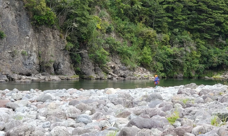
The track begins at the end of Waiohine Gorge Road. Cross the river over the high bridge and take the right-hand track that leads up the valley. Follow the track along the true right of the Waiohine River, crossing various side streams, some of which are unbridged. Just before Makaka Creek (also known as Long Flat Creek), the track reaches a junction where the Cone Saddle Track meets the Lower Waiohine Track, descending from Cone Saddle. Continue up the valley, following the signs towards Totara Flats Hut. There is a large slip upstream in the Waiohine Valley from Makaka Creek. The only way to bypass the slip is to walk upstream along the riverbank from Makaka Creek. This option is only safe when the river is low, so if conditions are questionable, be prepared to turn back. After the slip, the track continues upstream, climbing onto a high riverbank before dropping back down to the river. Shortly after descending to the river, you'll notice Sayer Creek on the true left side of the Waiohine River (the opposite bank from the Lower Waiohine Track). Sayer Hut is located near the confluence of Sayer Creek and the Waiohine River. To reach the hut, you'll need to cross the Waiohine River, which has no bridge. Only attempt this crossing if you have good river crossing skills and if the river conditions are favourable (low flow, no rain forecast). Continue along the Lower Waiohine Track, heading up the Waiohine Valley and crossing the grassy flats known as Totara Flats. The track re-enters the bush at the end of the flats and arrives at Totara Flats Hut. The hut is situated in a clearing on river flats above the Waiohine River.
Sayer Hut Totara Flats Hut
Lower Waiohine Track begins at the end of Waiohine Gorge Road (nearest towns Carterton and Greytown). Waiohine Gorge Road is gravel with rough, narrow, and windy sections. There are two forded stream crossings. Drive carefully. Use this location in Google Maps to find your way there.
We encourage you to continue gaining the skills and knowledge required for a safe trip. The NZ Mountain Safety Council has lots of free resources and information you can use. These can be accessed via www.mountainsafety.org.nz . Level up in your outdoor knowledge with these interactive online learning tools: Trip Planning Tramping / field Skills Basic Navigation River Safety Additionally, check out the range of helpful videos available from the NZ Mountain Safety Council YouTube channel .
Dogs allowed. Keep dog under control at all times.
Track information, access and weather can change. Confirm current alerts and land-manager information close to departure, tell someone your plans, and carry equipment appropriate for the route and conditions.