11 October 2026
Showers, becoming few and far between in the afternoon, then clearing to fine in the evening.
Loading outdoor place details…
Arthur's Pass National Park
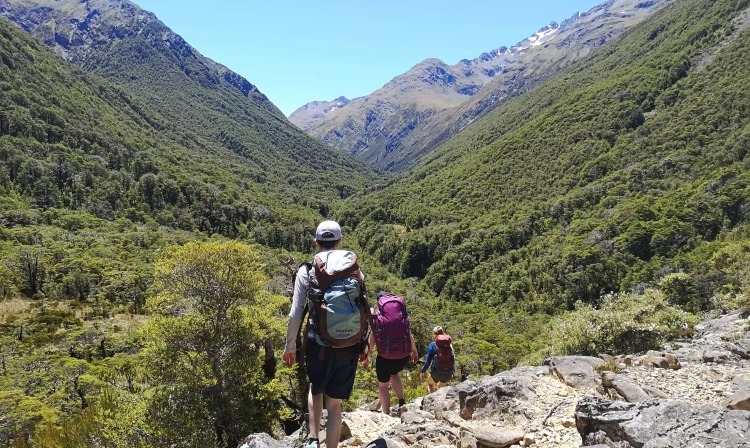
This route is a classic traverse of the Southern Alps, crossing over Goat Pass. This track is part of Te Araroa Trail.
Distance
23.7 km
Walking time
2 - 3 days
Difficulty
Expert
Dogs
Not allowed
Wheelchair access
Not marked friendly
Current status
Weather outlook
Issued 11 Oct 2026, 7:33 am
11 October 2026
Showers, becoming few and far between in the afternoon, then clearing to fine in the evening.
12 October 2026
Fine, cloud developing in the evening.
13 October 2026
Rain developing in the morning. Snow lowering to 2400 metres in the afternoon.
14 October 2026
Rain, with heavy falls.
15 October 2026
Showers, some heavy.
Regional guidance only; elevation and terrain can produce different conditions.
Explore the area
Explore the track route and surrounding area before you set out.
East to West option (Arthur’s Pass to Otira): Day 1: Bealey River to Goat Pass Hut (5 hours) Begin crossing the Bealey River, 5km south of Arthur’s Pass Village. Use safe river crossing skills to find the best place to cross and postpone your trip if river is unsafe. Next you will travel up the Mingha riverbed for an hour with multiple crossings, then you will see a marked track into the bush. The track climbs up Dudley Knob where you will next see Mingha Bivvy . Follow the marked trail where it will change into subalpine scrub, then boardwalks sections. This leads to summit of Goat Pass and Goat Pass Hut which is just north of this. There is a side trip at Goat Pass (2 hours) up to Lake Mavis. Due to avalanche danger, this trip is recommended only in summer conditions. Day 2: Goat Pass Hut to SH73 via Deception River (8-9 hours) Follow the marked route into the upper Deception River. This section involves a lot of riverbed rock scrambling and concentration so take care and leave early enough to give yourself time for the day. Upper Deception Hut is within the first hour and situated on a scrubby terrace. Continue on for another 2.5 hours to a large flat. There are small geothermal springs and the track now goes down a gorge for 2 hours to where the Deception River meets Otira River. Use the Morrison’s footbridge there. West to East option (Otira to Arthur’s Pass) Day 1: Morrison’s Footbridge to Goat Pass Hut (9 hours, 13.8 km) Starting from State Highway 73, 6.6 km north of Otira. Cross Morrison’s Footbridge and follow signs up the true right of the Deception River. After 30 minutes the first river crossing is a broad and open riverbed. If this crossing is challenging due to high water flow the upper part of the route is likely to be dangerous and should not be attempted until the flow subsides. The route continues up the narrowing gorge with multiple river crossings and short detours around deep pools. There are limited opportunities to camp but a wider section of riverbank between Spray Creek and Gorge Creek, 3 hours from the start, offers a possible campsite on a narrow grassy flat. Progress can be slow. If daylight is fading, an overnight stop at Upper Deception Hut , 7 hours from start, may be advisable. The remaining 2 km to Goat Pass Hut is difficult as the stream route becomes narrower and steeper and can take another two hours. Day 2: Goat Pass Hut to SH 73 near Greyney’s Shelter (5.5 hours, 9.9 km) The Mingha track is a change of scene. A short climb from the hut crests the pass to a view down the Mingha Valley. The initial descent is easy in good weather with extensive boardwalks. There is no shelter until reaching the bush line after 2 km. If extreme rain, cold and wind conditions are likely on the upper track it may be wiser to remain at Goat Pass Hut until conditions improve. The recently restored Mingha Bivvy , 2.5 km below the pass, offers emergency shelter. The bush track is generally well-formed, apart from short steep scrambles to cross several side steams. The final 1.5 hours follows a poled route along a wide riverbed, water levels permitting.
The annual Coast to Coast event runs every second Friday and Saturday in February. This might reduce access. Backcountry trips such as this require the right equipment for self-sufficiency, enough food for extra stays and an effective outdoor communication device is recommended. Multiple river crossings will be required on this trip. If a river is unsafe to cross, postpone your trip if you are at the start or find shelter and wait for levels to drop. Backcountry alpine risks such as avalanches, bluffs and hazardous weather can be expected. Shuttles can be booked for access, research options for ones operating from the Bealey Hotel SH73 or The Sanctuary in Arthur’s Pass.
Upper Deception Hut – Basic Hut, 6 bunks. Goat Pass Hut – Standard Hut, 20 bunks – radio for calling the Arthur’s Pass Visitor Centre. Mingha Bivvy – Basic Hut, 2 bunks. Greyney’s Shelter is marked as a campsite on some maps, but camping is no longer permitted. Klondyke Corner Campsite is 2 km further south.
North End: SH 73 at Morrisons Footbridge, 19.7 km north of Arthur’s Pass Village. Use this location in Google Maps to find your way there. South End: SH 73, 5.4 km south of Arthur’s Pass village, near Greyney’s Shelter. Use this location in Google Maps to find your way there. Consider booking transport. A shuttle may be available from accommodation providers The Sanctuary, in Arthur’s Pass, and Bealey Hotel, SH 73. There are also other shuttle providers that travel between Hokitika and Chistchurch.
We encourage you to continue gaining the skills and knowledge required for a safe trip. The NZ Mountain Safety Council has lots of free resources and information you can use. These can be accessed via www.mountainsafety.org.nz . We recommend trying these online learning tools: Trip Planning Tramping / field Skills Basic Navigation River Safety Additionally, check out the range of helpful videos available from the NZ Mountain Safety Council YouTube channel .
No dogs.
Track information, access and weather can change. Confirm current alerts and land-manager information close to departure, tell someone your plans, and carry equipment appropriate for the route and conditions.