10 October 2026
Mostly cloudy, but some afternoon fine spells. Rain developing at night about and west of Taranaki Maunga, possibly heavy. Northerlies.
Loading outdoor place details…
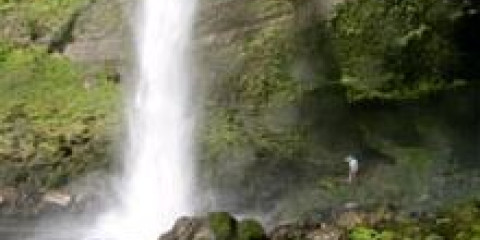
Mount Damper and Waitaanga Conservation Area
This track to Te Rerepahupahu Falls is recommended for fit and experienced trampers only. It is the longest of the Waitaanga Forest walks and is an overnight trip.
Distance
14 km
Walking time
7 hr 30 min - 9 hr
Difficulty
Advanced
Dogs
Not allowed
Wheelchair access
Not marked friendly
Current status
No active alerts found. Conditions can still change, so check again before leaving.
Weather outlook
Issued 10 Oct 2026, 4:55 pm
10 October 2026
Mostly cloudy, but some afternoon fine spells. Rain developing at night about and west of Taranaki Maunga, possibly heavy. Northerlies.
11 October 2026
Showers, possibly heavy with thunderstorms, clearing to fine spells in the afternoon. Clouding over in the evening with rain north of Taranaki Maunga. Northwesterlies dying out in the evening.
12 October 2026
A few showers. Westerlies, turning northerly before dawn.
13 October 2026
Occasional rain, clearing in the evening. Northwesterlies.
14 October 2026
Rain becoming persistent in the evening. Northerlies.
Regional guidance only; elevation and terrain can produce different conditions.
Explore the area
Explore the track route and surrounding area before you set out.
From the falls follow the signpost, then white poles to the stile and entrance to the Waitaanga Forest. Follow the disc markers to the left. There are extensive views over the Waitaanga Forest to the Kotare Scenic Reserve in the north. After 1 hour 30 minutes the track climbs a small spur through regenerating kamahi, reaching the main ridge 30 minutes later. The track then enters tawa forest interspersed with mature rimu and rata. You reach Mt Damper after 2:30 to 3 hours. The summit marker (528 m) is on a side ridge to the left of the track. After 6 hours the track descends to the Waitaanga River Valley. South from the ridge are views of the beech forest in the Tatu track region. After a further 30 minutes, the track comes to the edge of a high bluff with a view of one of the last remaining unlogged mixed podocarp forests in Taranaki. Descend to the river valley and cross the swingbridge. Turn left and walk for 45 minutes to the next track junction, where you turn left again to Te Rerepahupahu Falls. There is a small clearing beside the falls to camp in. There are no other facilities. The next day return to Mt Damper Falls carpark via the same track (7 hr 30 min). Or with prior transport arrangements, continue out on Waitaanga South Road to Rerepahupahu Falls Track (4 hr 30 min)
This track is recommended for fit and experienced trampers. Expect tree windfalls, overgrown sections and missing track markers. Allow extra time for route finding.
The route starts from Mt Damper Falls carpark on the Okau Road off SH3 north of New Plymouth. Use this location in Google Maps to find your way there.
We encourage you to continue gaining the skills and knowledge required for a safe trip. The NZ Mountain Safety Council has lots of free resources and information you can use. These can be accessed via www.mountainsafety.org.nz . We recommend trying these online learning tools: Trip Planning Tramping / field Skills Basic Navigation River Safety Additionally, check out the range of helpful videos available from the NZ Mountain Safety Council YouTube channel
No dogs.
Track information, access and weather can change. Confirm current alerts and land-manager information close to departure, tell someone your plans, and carry equipment appropriate for the route and conditions.