11 October 2026
Showers, clearing early afternoon but remaining mostly cloudy. Northerlies developing in the morning.
Loading outdoor place details…
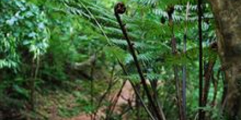
Catchpool Valley & Ōrongorongo Valley
Learn about forest plant life from information signs on this easy walk.
Distance
1.3 km
Walking time
45 min one way
Difficulty
Easy
Dogs
On-lead only
Wheelchair access
Not marked friendly
Current status
Weather outlook
Issued 11 Oct 2026, 5:43 am
11 October 2026
Showers, clearing early afternoon but remaining mostly cloudy. Northerlies developing in the morning.
12 October 2026
Cloud clearing and becoming fine in the morning. Northerlies.
13 October 2026
Occasional rain. Northerlies.
14 October 2026
Occasional rain clearing in the afternoon but remaining cloudy. Northwesterlies.
15 October 2026
Showers, some possibly heavy. Northerlies, turning southerly.
Regional guidance only; elevation and terrain can produce different conditions.
Explore the area
Explore the track route and surrounding area before you set out.
Time required : 45 mins one way The Māori name of this track is a shortened version of ‘Nga Taonga o te Ngahere’. This translates to “The Treasures of the Forest”. This name refers to the use of the walk for identifying plants of traditional cultural use to Maori people which you’ll discover along this short walk. The trail is located in the Catchpool Valley which is one of the most popular entrances to the Remutaka Forest Park.
The entrance to Catchpool Valley is open during summer (daylight savings) from 6am to 8pm, and in winter from 6am to 6pm. There is no cellphone coverage in the Catchpool Valley, however a 24-hour emergency phone is available at the camping ground on Catchpool Road.
Graces Stream campsite is a great little backcountry campsite not far from the end of the track. Catchpool Valley campsite is a popular campsite in Catchpool Valley, with plenty of short and longer walks to explore.
Catchpool valley is 12 km south of Wainuiomata. Follow the Coast Road for 10 km to the Remutaka Forest Park entrance, then follow the Catchpool valley road for 2 km to the car park and information area. Use this location in Google Maps to find your way there.
We encourage you to continue gaining the skills and knowledge required for a safe trip. The NZ Mountain Safety Council has lots of free resources and information you can use. These can be accessed via www.mountainsafety.org.nz . We recommend trying these online learning tools: Trip Planning Tramping / field Skills Basic Navigation River Safety Additionally, check out the range of helpful videos available from the NZ Mountain Safety Council YouTube channel .
Dogs on a leash only.
Track information, access and weather can change. Confirm current alerts and land-manager information close to departure, tell someone your plans, and carry equipment appropriate for the route and conditions.