09 October 2026
Mainly fine but the chance of an inland afternoon or evening shower. Areas of low cloud or fog possible at night. Light winds but easterlies about the coast for a time this afternoon.
Loading outdoor place details…
Rakiura National Park
The North West Circuit offers challenging multi-day tramping around Rakiura/Stewart island’s northern coast.
Distance
125 km
Walking time
9 - 11 days
Difficulty
Advanced
Dogs
Not allowed
Wheelchair access
Not marked friendly
Current status
No active alerts found. Conditions can still change, so check again before leaving.
Weather outlook
Issued 9 Oct 2026, 4:49 pm
09 October 2026
Mainly fine but the chance of an inland afternoon or evening shower. Areas of low cloud or fog possible at night. Light winds but easterlies about the coast for a time this afternoon.
10 October 2026
Areas of low cloud or fog in the morning and again at night, otherwise partly cloudy with isolated afternoon and evening showers. Easterlies about the coast for a time in the afternoon.
11 October 2026
Fine, but becoming mostly cloudy with isolated showers in the evening. Northerlies, turning westerly in the afternoon.
12 October 2026
Fine. Northwesterlies developing in the morning.
13 October 2026
Showers developing in the morning. Northwesterlies, dying out in the evening.
Regional guidance only; elevation and terrain can produce different conditions.
Explore the area
Explore the track route and surrounding area before you set out.
Time: 4 hr Distance: 12 km Starting from Oban, it's a 90-minute walk along roads to reach Lee Bay, the official entrance to Rakiura National Park, though you can arrange transport to get you there. The first day of the North West Circuit follows part of the Rakiura Track , one of DOC’s Great Walks, where the trail is well-maintained and mostly free of mud. From Lee Bay, the track winds through forested terrain, staying close to the shore until it reaches the eastern end of Maori Beach. At the western end of the beach, a swing bridge crosses a tidal inlet, and the track climbs over a headland near Wooding Bay, passing a turn-off to North Arm Hut . The trail then descends to Magnetic Bay, with Port William Hut located at the northern end, accessible via a short five-minute side trail.
Time: 3–4 hr Distance: 6 km From Port William Hut, return to the main track and head north. Near Sawyers Beach, the track crosses a footbridge and quickly turns inland, taking you to Little Bungaree Beach. After crossing another footbridge, the track follows a stream for a short while before climbing over a low ridge to Big Bungaree Beach. Bungaree Hut is located near the northern end of the beach.
Time : 6 hr Distance : 11.5 km From Bungaree Hut, the track crosses another forested ridge, then sidles to reach the southern end of Murray Beach. At the end of Murray Beach, the track heads inland, and soon crosses a bridge. From here the track follows an old logging tramline through regenerating forest for about 30 minutes. For the next 90 minutes, the track traverses undulating, forested terrain, past Christmas Village Beach. Christmas Village Hut is a further 30 minutes on. If you've found the track challenging up to this point, it might be a good time to consider turning back. Side trip: Christmas Village Hut to Mt. Anglem/Hananui Time : 6 hr return Distance : 11 km The track to Mount Anglem/Hananui, Stewart Island’s highest point, is a short distance along the track to Yankee River. The track is marked and leads through forest, mānuka, leatherwood scrub and subalpine meadow to the 980 m summit. Note: This track can be very muddy and foggy.
Time : 6 hr Distance : 12 km About 20 minutes after leaving Christmas Village Hut, you'll pass the Mt Anglem turnoff and continue westward for about three hours, traveling through stands of rimu trees on a generally dry track. Once you reach the coastline again, the track follows the length of Lucky Beach before turning inland for another three hours, crossing more undulating forested slopes with tall rimu stands. A five-minute side track at Yankee River leads down to Yankee River Hut .
Time : 4–5 hr Distance : 8.5 km After crossing a swingbridge over the Yankee River, the track climbs 220 metres over Black Rock Point before descending to Smoky Beach. This is one of the longest beaches on the northern part of Stewart Island, with distinctive sand dunes. A swing bridge crosses Smoky River, inland from the western end of the beach, but unless the river is in flood or it is extreme high tide you can easily wade where the river meets the beach. The track then follows broken and forested terrain, drops down onto the coast and then up to Long Harry Hut .
Time : 6 hr Distance : 9.5 km From the hut follow the coastal terrace to Cave Point ridge, then along the ridge before descending to the rocky coastline. The coast is followed for 30 minutes before the track re-enters the scrub at a signpost. It then climbs fairly steeply to reach a lookout over East Ruggedy Beach. The track descends through scrub to a river crossing, where the sand can be very soft. From here to East Ruggedy Hut is a further 15 minutes inland, marked by poles through the sand dunes.
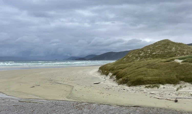
Time : 7 hr Distance : 14 km In recent years this section of track has been considerably re-routed making it easier, less muddy and more scenic. Shortly after leaving East Ruggedy Hut, the track crosses undulating forested terrain before descending through dunes to West Ruggedy Beach. This spectacular beach, with its granite pillars and rolling dunes, is followed for almost its entire length to the end. The track follows the beach, but at extreme high tide you may need to take the high tide detour up and over a steep rocky outcrop halfway down the beach. The track re-enters the bush at the southern end of the beach, then crosses around to the eastern side of the Ruggedy Range. It then descends to Waituna Bay. From here it is a steady climb up to Big Hellfire Hut .
Time : 7 hr Distance : 15 km From Big Hellfire the track follows the main ridge before descending to Little Hellfire beach. At the south end of the beach is a signpost for Mason Bay. The track travels inland over a bush saddle and finally descends near the north end of Mason Bay. At extreme high tide this section can be impassable – there is a high tide route marked through the sand dunes. Care Is required as the sand dunes move and markers are sometimes covered over with sand. High tide route will take approximately an extra 1.5 hours. Caution: Fill drink bottles at Big Hellfire Hut before leaving, as there are no reliable water sources until Little Hellfire Beach. Caution: Access on to the north end of Mason Bay beach may only be possible at low tide Recent sand erosion is causing waves to come up to the cliffs at high tide. This means trampers may not be able to get down to the beach safely for the 12 hours of high tide. The beach may also be inaccessible at low tide if there are low pressure systems or storm surges. The north end of Mason Bay beach is 6 hours walk from Big Hellfire Hut, so if trampers can't get down safely to the beach they will have to return to the hut or find shelter until conditions are safe to access the beach. About 1 km further along the beach there is a large rock. Previously it was possible to get around this at any time except extreme high tide. This is no longer correct – it's only passable at low tide, at other times trampers should take the high tide route which starts just before it. The low tide track cannot be used within approximately 2 hours either side of high tide. Please check with the Rakiura National Park Visitor Centre regarding tide times at Mason Bay, as they differ from Oban times. From here, follow the beach approximately 4 km to Duck Creek. Flag markers on a pole mark the track turn-off to Mason Bay Hut.
Mason Bay Hut to Freshwater Hut Time : 3–4 hr Distance : 15.5 km Follow the track to the Island Hill homestead and then over flat tussock and mānuka country to Freshwater River and Freshwater Hut . Note: This track is often flooded during periods of heavy rain. Side trip: Rocky Mountain Track Time : 3 hr return Distance : 5 km A climb from behind the Freshwater Hut, through forest and subalpine scrubland to rock outcrops, gives panoramic views over the Freshwater Flats and Paterson inlet.
Time : 6–7 hr Distance : 11 km This section of track is steep and often slippery. It crosses over Thompson Ridge to the North Arm of Paterson Inlet. During periods of heavy rain, some creeks on this track may become impassable. North Arm Hut and North Arm Campsite are part of the Rakiura Great Walk.
Time : 5 hr Distance : 12 km The track traverses above North Arm to Sawdust Bay. From the former sawmill site the track cuts across a low headland to reach Kidney Fern Arm in Prices Inlet, and continues through forest for another hour before emerging at Kaipipi Bay. From there it follows the former Kaipipi Road to Halfmoon Bay.
The North West Circuit can be walked in either direction, but the anticlockwise direction gives a gentler introduction to the tramping. By the time you reach the longer, harder days on the western side of the island as your pack will be lighter. By catching a water taxi out from Freshwater Landing trampers can shave off a couple of days’ less interesting walk at the end. Allow 9–11 days to walk the full 125 km circuit. This track is suitable for fit, well equipped and experienced trampers. Track times are an indication only and extra time should be allowed in adverse conditions. What to expect Track surfaces are varied and involve long sections of mud that can be knee-deep and thick, regardless of the season. Some sections of track are prone to flooding. There are unbridged river crossings along this route – it is only suitable for trampers skilled and experienced in safe river crossing. Keep to the tracks as valleys are steep and the bush is dense. Beach access can be difficult when tides are high and seas are rough – if necessary, wait for low tide. Take a photo of the tide timetables at the Rakiura National Park Visitor Centre before you set off. Although the tramping is not overly difficult, some of the long days require considerable stamina, and trampers need to be prepared to spend extended periods in muddy conditions. Communication Cell phone coverage is very limited and should not be relied on. Take a personal locator beacon. Weather Stewart Island’s weather is extremely changeable and difficult to predict. Strong winds, hail and heavy rain can occur at any time of the year. Snow can occur above the bush line on any part of the Northwest Circuit, including side trips. Obtain an up-to-date weather forecast before starting the track and be well equipped for extreme weather conditions. Huts and hut tickets None of the huts have gas cooking facilities, lighting, power or toilet paper. All backcountry huts on the Southern and North West Circuit Tracks require Backcountry Hut Tickets or an Backcountry Hut Pass. Trampers planning on staying at any of the Great Walk huts and campsites (Port William Hut/Campsite, North Arm Hut/Campsite and Maori Beach Campsite) while walking the North West Circuit Track must make a booking prior to departure.
There are regular air flights to Rakiura from Invercargill and a ferry service from Bluff. Boat, shuttle or plane transport options may be available to the start of the tracks. Here are the Google Map links for the Rakiura National Park Visitor Centre and the start of the track at Lee Bay .
We encourage you to continue gaining the skills and knowledge required for a safe trip. The NZ Mountain Safety Council has lots of free resources and information you can use. These can be accessed via www.mountainsafety.org.nz . We recommend trying these online learning tools: Trip Planning Tramping / field Skills Basic Navigation River Safety Additionally, check out the range of helpful videos available from the NZ Mountain Safety Council YouTube channel
No dogs.
Track information, access and weather can change. Confirm current alerts and land-manager information close to departure, tell someone your plans, and carry equipment appropriate for the route and conditions.