11 October 2026
Areas of early low cloud otherwise fine. The odd shower from early afternoon about Stewart Island, then about the mainland from late afternoon. Westerlies developing in the morning, strong about Stewart Island until evening.
Loading outdoor place details…
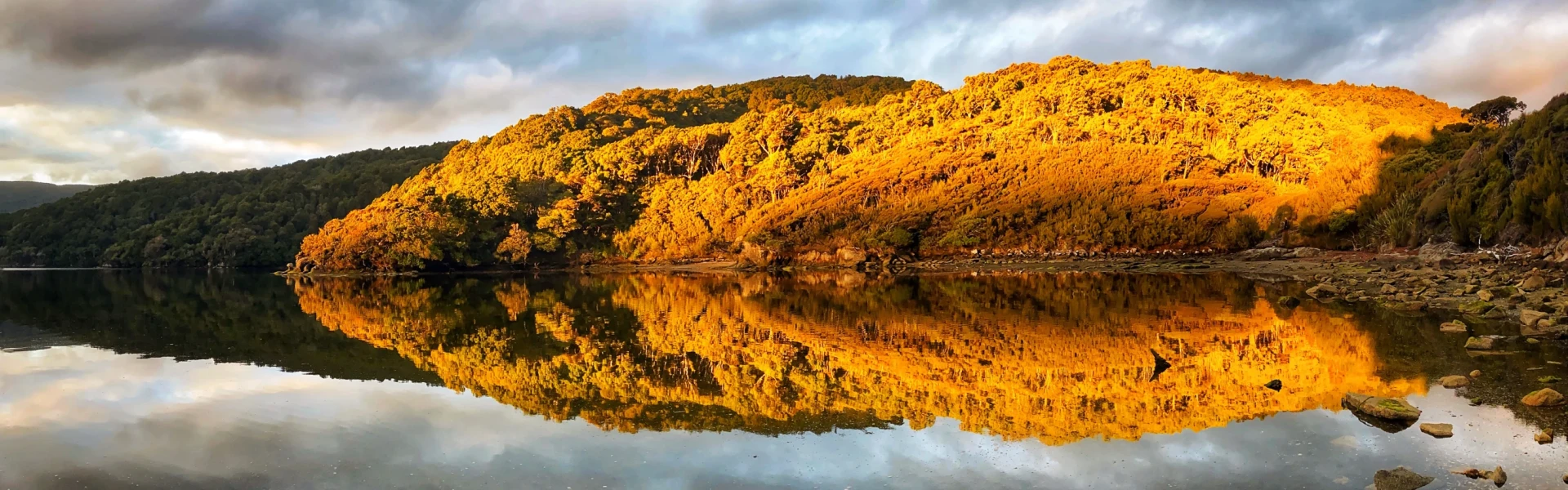
Rakiura National Park
Escape on an island adventure - relax and unwind in the peaceful surroundings with the bush, birds and beach at your side.
Distance
32 km
Walking time
3 days
Difficulty
Intermediate
Dogs
Not allowed
Wheelchair access
Not marked friendly
Current status
No active alerts found. Conditions can still change, so check again before leaving.
Weather outlook
Issued 10 Oct 2026, 11:01 pm
11 October 2026
Areas of early low cloud otherwise fine. The odd shower from early afternoon about Stewart Island, then about the mainland from late afternoon. Westerlies developing in the morning, strong about Stewart Island until evening.
12 October 2026
Fine. Northwesterlies developing before dawn.
13 October 2026
Isolated showers turning to rain in the afternoon. Northerlies, turning westerly in the evening.
14 October 2026
Rain becoming persistent in the morning. Southeasterlies developing in the morning.
15 October 2026
Rain easing. Southeasterlies.
Regional guidance only; elevation and terrain can produce different conditions.
Explore the area
Explore the track route and surrounding area before you set out.
Passing through the chain link sculpture at Lee Bay, the track follows the coast to Little River, which is crossed by a bridge. At low tide it is possible to walk around the beach and pick up the track at the point. From there the track heads around Peter’s Point and on to Maori Beach. The creek at the southern end of Maori Beach can easily be waded at low tide, however at high tide, continue along the track until you come to a small foot bridge. A track leading to a rusting steam boiler, a relic from the sawmilling days, can be found just few minutes on from the turn-off to this bridge. Maori Beach campsite is situated in a grassy clearing close to the beach. A larger bridge spans the tidal stream at the northern end of the beach and from here the track climbs a small hill and continues on to the intersection with the track to North Arm. Turn right and you will gradually drop down to the campsite above Magnetic Beach in Port William/Potirepo. Port William Hut is just a few minutes beyond the campsite.
This section of track starts on the hill between Maori Beach and Port William. Trampers usually stay the night at Port William Hut and then backtrack the 40 minutes to the turn-off. The track passes through a variety of vegetation including previously milled and virgin podocarp forest. Remnants of milling activity are seen along the track as it follows old tramlines for the logs being directed to their various destinations. During long periods of rain the track can get muddy. Gaiters are recommended as it can reach above footwear level. Some people also prefer to use tramping poles along this section. North Arm Hut is sited above a beach with a great view of the inlet from the dining room. Although it is too shallow to swim, at low tide you can find blue mussels on the rocks.
This section of track provides trampers access to the shores of Paterson Inlet. The track sidles around the headland from North Arm to Sawdust Bay. It passes a sawmill site which was operated between 1914 and 1918. The track continues through rimu and kamahi dominated forest emerging at the sheltered bays of Kidney Fern Arm and Kaipipi Bay. At Kaipipi Bay two sawmills employed more than 100 people in the 1860s. The track between Kaipipi and Halfmoon Bays follows the former Kaipipi Road, in its heyday the most used and best maintained on the island. From Fern Gully carpark it is another 2 km along the road (turn left into Main Rd) to get back to Oban township.
Stewart Island’s weather is very changeable and difficult to predict. Strong winds, hail and heavy rain can occur at any time of the year. You should come equipped for the very worst weather conditions. Expect it to rain heavily and for it to be cold. It is highly recommended to bring a tarp to shelter under when taking breaks during the day. See the full packing list on the Gear tab.
There are two huts (Port Willam and North Arm) and three campsites (Maori Beach, Port William and North Arm) on the Rakiura Track. Note, campsites are not adjacent to the huts. Camping is only permitted at the designated campsites. When camping, you may not use hut facilities, but a cooking shelter, water supply and toilet are provided at each site. Bookings are required for both huts and campsites.
Getting to the start of the Rakiura Track: The Rakiura Track can be walked in either direction, starting from two locations: The official entrance to Rakiura National Park is at Lee Bay, 5 km from Oban. If walking from the DOC Visitor Centre in Oban, turn right and walk down Main Road. Turn left into Elgin Terrace, past the supermarket, and up the hill. Follow this main coastal road over a series of hills to Horseshoe Bay, then on to Lee Bay. The Fern Gully car park, 2 km beyond the Rakiura National Park Visitor Centre, is located on Main Road in Oban. If you prefer not to walk from Oban, shuttles can be used for drop-offs at Lee Bay or water taxis can be used for access to Rakiura Track huts. Access to North Arm hut by boat is dependent on tides. Getting to Stewart Island/Rakiura: To get to Oban, the only township on Stewart Island/Rakiura, you can take a 20-minute flight from Invercargill or a 1-hour ferry trip across Foveaux Strait from the southern port of Bluff. In Oban you’ll find accommodation, supplies, equipment hire and transport to and from the start of the track.
We encourage you to continue gaining the skills and knowledge required for a safe trip. The NZ Mountain Safety Council has lots of free resources and information you can use. These can be accessed via www.mountainsafety.org.nz . We recommend trying these online learning tools: Trip Planning Tramping / field Skills Basic Navigation River Safety Additionally, check out the range of helpful videos available from the NZ Mountain Safety Council YouTube channel .
Frontal systems from the south are common; heavy rain and strong wind should be expected. Snow to sea level is possible in the colder months.
No dogs allowed.
Track information, access and weather can change. Confirm current alerts and land-manager information close to departure, tell someone your plans, and carry equipment appropriate for the route and conditions.