Walking tracks
- Rakiura TrackRakiura National Park · 36 km away
- Kepler Track: Carpark to Dock Bay and Brod BayFiordland National Park · 140 km away
Loading outdoor place details…
Invercargill area
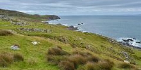
An easy-access coastal track that offers stunning views across Foveaux Strait to Rakiura. This track is part of Te Araroa Trail.
Distance
4.1 km
Walking time
45 min one way
Difficulty
Intermediate
Dogs
Not allowed
Wheelchair access
Not marked friendly
Current status
No active alerts found. Conditions can still change, so check again before leaving.
Explore the area
Explore the track route and surrounding area before you set out.
This track is part of the Te Araroa Trail and crosses private coastal land, linking the SH1 section of the trail to Motupohue/Bluff Hill. It is a 45-minute walk from SH1 to Lookout Point. From there you can return the same way, turn left onto the Millennium Track to reach the summit of Motupohue, or continue along the Foveaux Walkway for 3.2 km to Stirling Point for the iconic “end of the world” photo under the signpost. Dogs are not permitted on this track (but are allowed further along on Foveaux Walkway on leads). Use this location on Google Maps to help find your way there.
No dogs.
Track information, access and weather can change. Confirm current alerts and land-manager information close to departure, tell someone your plans, and carry equipment appropriate for the route and conditions.