Walking tracks
- Tāwharanui North/South Coast TrackTāwharanui Regional Park · 162 km away
- Long Bay Coastal WalkLong Bay Regional Park · 186 km away
Loading outdoor place details…
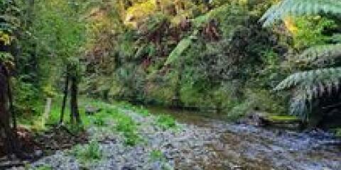
Puketi and Omahuta Forests
This tramping track passes through Ōmahuta and Puketī Forests. It offers views across the forest and passes large kauri trees.
Distance
20.8 km
Walking time
8 hr
Difficulty
Advanced
Dogs
Allowed — check local rules
Wheelchair access
Not marked friendly
Current status
No active alerts found. Conditions can still change, so check again before leaving.
Explore the area
Explore the track route and surrounding area before you set out.
Blackbridge Road to Mangapukahukahu Stream/Waipapa River junction This track starts at the end of Blackbridge Road where you will find Blackbridge campsite with water and a toilet. The track descends into the valley and follows Mangapukahukahu Stream through a gorge. The stream can flood quickly, do not take this route if the river is high or if there is forecast/recent heavy rain. Cross Waiapapa river to join Waiapapa River Track. There is a deep pool at the confluence of Mangapukahukahu Stream and Waipapa River, so follow the markers to a shallower crossing point. Mangapukahukahu Stream/Waipapa River junction to Pukatea Ridge Track Continue along the Waipapa River Track upstream. The track is narrow and can be very slippery, watch for the orange triangles to stay on the track. The track crosses Pukatea Stream to become Pukatea Ridge Track. Pukatea Ridge Track to Puketī Recreation Area You will have to navigate a series of steps here that lead to Pukatea Ridge through mature forest. Follow the 4WD Pirau Ridge Road downhill to Puketī Recreation Area. Caution the road is shared with cyclists and work vehicles. You can camp at Puketī Recreation Area campsite or stay at Puketī Forest Hut (bookings required).
This is a backcountry tramping track. It is rough, muddy and slippery in places. This track has a section through a steep gorge and unbridged river and stream crossings. Flooding is a real risk. There is a wet weather bypass route. This is described in the Northland Te Araroa trail notes, in the Puketī Forest (Bypass) section. There are campsites at Blackbridge Road and Pūketi Recreation Area. Plan to stay at these campsites to help prevent the spread of kauri dieback. Only camp elsewhere in emergencies, like if you are delayed by flooded rivers. Wasps are particularly common in summer. Carry medication if you are allergic to their stings.
Stop kauri disease and protect kauri Scrub all soil off shoes and gear. Use cleaning stations. Always stay on the track. How you can help save kauri
Blackbridge campsite Puketī Recreation Area campsite Puketī Forest Hut
These roads are unsealed, rough and narrow, and are not suitable for caravans or campervans. Beehives are located beside some sections of the road. From SH1, just south of Mangamuka town: turn onto Ōmahuta Road continue onto Ōmahuta Forest Road turn onto Kauri Sanctuary Road continue onto Kauri Pā Road turn onto Blackbridge Road continue to Blackbridge Campsite. Use this location in Google Maps to find your way there.
We encourage you to continue gaining the skills and knowledge required for a safe trip. The NZ Mountain Safety Council has lots of free resources and information you can use. These can be accessed via www.mountainsafety.org.nz . Level up in your outdoor knowledge with these interactive online learning tools: Trip Planning Tramping / field Skills Basic Navigation River Safety Additionally, check out the range of helpful videos available from the NZ Mountain Safety Council YouTube channel .
Dogs with a DOC permit for recreational hunting or management purposes only.
Track information, access and weather can change. Confirm current alerts and land-manager information close to departure, tell someone your plans, and carry equipment appropriate for the route and conditions.