
10 October 2026
Cloud increasing, and showers developing this evening. Northeasterlies.
Loading outdoor place details…
Beachlands
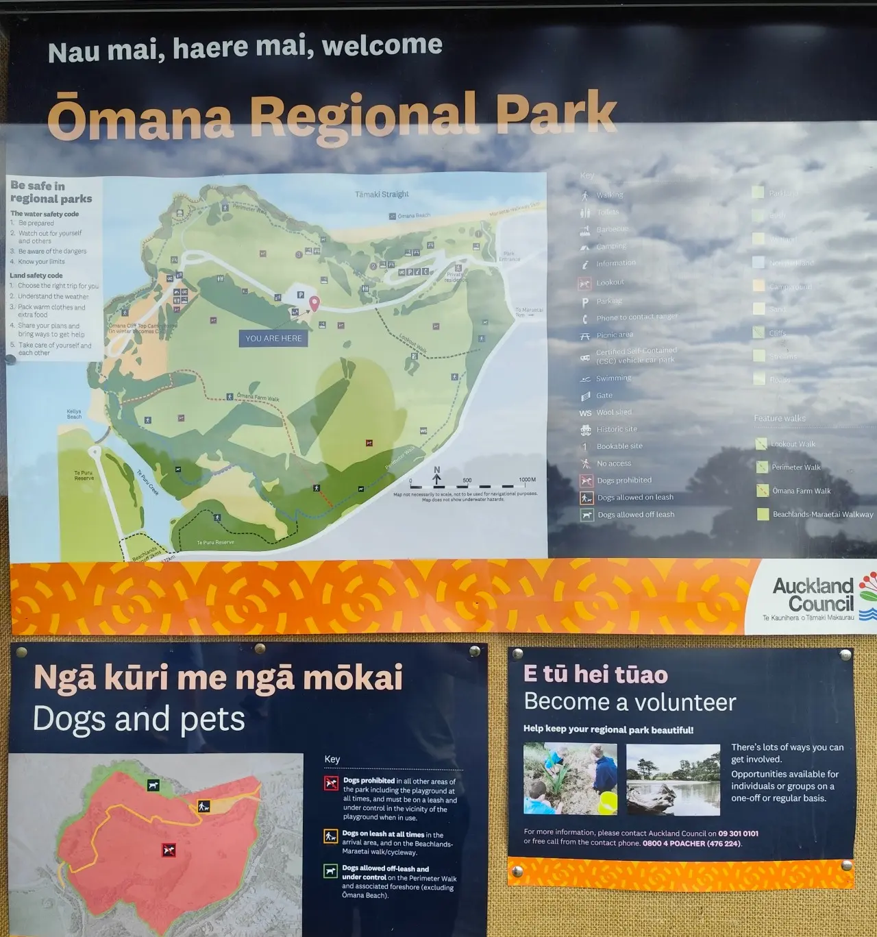
The Ōmana Perimiter Walk is a scenic and relatively easy loop showcasing the stunning Beachlands-Maraetai coastline in southeast Auckland. This diverse walk features native forest, tidal estuaries rich with life-giving mangroves (manawa), open paddocks, breathtaking coastal views, and a historic Māori pā site.
Distance
2.6 km
Walking time
1 hour
Difficulty
Easy
Dogs
On-lead only
Wheelchair access
Not marked friendly
Current status
No active alerts found. Conditions can still change, so check again before leaving.
Weather outlook
Issued 10 Oct 2026, 4:55 pm
10 October 2026
Cloud increasing, and showers developing this evening. Northeasterlies.
11 October 2026
Showers, possibly heavy, easing to the odd light shower by midday. Scattered rain developing late evening. Northwesterlies.
12 October 2026
Showers becoming isolated in the morning but remaining cloudy. Northwesterlies developing in the morning.
13 October 2026
Mostly cloudy with isolated showers developing in the morning. Northwesterlies.
14 October 2026
Partly cloudy with isolated showers. Northwesterlies.
Regional guidance only; elevation and terrain can produce different conditions.
Explore the area
Explore the track route and surrounding area before you set out.
The Ōmana Perimiter Walk is a scenic and relatively easy loop showcasing the stunning Beachlands-Maraetai coastline in southeast Auckland. This diverse walk features native forest, tidal estuaries rich with life-giving mangroves (manawa), open paddocks, breathtaking coastal views, and a historic Māori pā site.
Animals: Dogs are allowed on leash . Smokefree regional parks: Our regional parks are smoke-free. Waste: All our regional parks are rubbish free. Take all rubbish and recycling with you when you leave. Outdoor fires: It is illegal to light a fire outside in all public areas in the Auckland region. For more information about the park and track, head to the Auckland Council website .
Feel like spending a little more time in Ōmana Regional Park? Pitch your tent or park up your campervan at Omana Cliff Top Campground and enjoy a calm, relaxing evening just a short distance from the beach. Getting there: Continue on Omana Beach Road a short distance to reach the campground. Use this location on Google Maps to help find your way there.
Head down Whitford Maraetai Rd from the rural town Whitford, south-east of Auckland. Continue onto Maraetai Dr turning left shortly after onto Omana Beach Rd where you will reach the carpark as you enter Omana Regional park. Use this location in Google Maps to find your way there.
We encourage you to continue gaining the skills and knowledge required for a safe trip. The NZ Mountain Safety Council has lots of free resources and information you can use. These can be accessed via www.mountainsafety.org.nz . Level up in your outdoor knowledge with these interactive online learning tools: Trip Planning Tramping / field Skills Basic Navigation River Safety Additionally, check out the range of helpful videos available from the NZ Mountain Safety Council YouTube channel .
Dogs allowed on Leash
Track information, access and weather can change. Confirm current alerts and land-manager information close to departure, tell someone your plans, and carry equipment appropriate for the route and conditions.