11 October 2026
A few showers, possibly heavy, clearing to fine in the afternoon. Northeasterlies, turning northwesterly in the morning.
Loading outdoor place details…
Putangirua Pinnacles Scenic Reserve
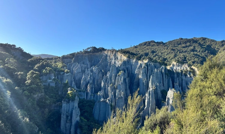
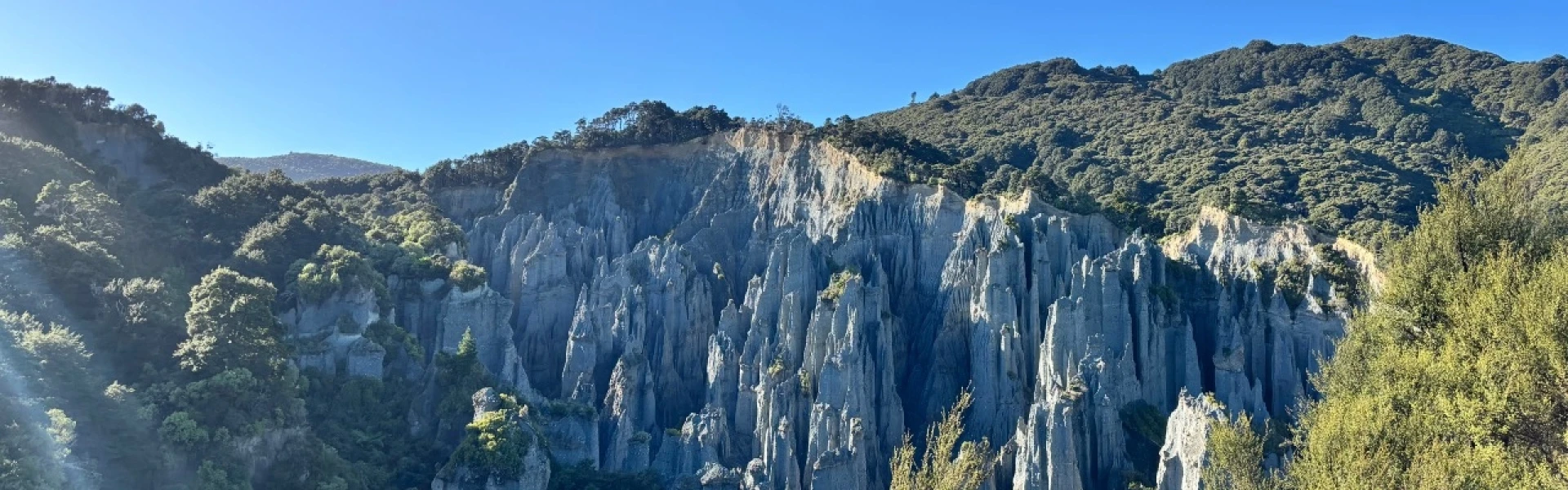
Enjoy amazing views of the famous Putangirua Pinnacles from the lookout, then return to the carpark along the ridge. Note: the river track continues to be closed due to considerable danger caused by flashing flooding and rockfall.
Distance
3.6 km
Walking time
2 hours return
Difficulty
Easy
Dogs
On-lead only
Wheelchair access
Not marked friendly
Current status
Weather outlook
Issued 10 Oct 2026, 11:01 pm
11 October 2026
A few showers, possibly heavy, clearing to fine in the afternoon. Northeasterlies, turning northwesterly in the morning.
12 October 2026
Fine. Northwesterlies, dying out in the morning.
13 October 2026
Mainly fine, isolated showers developing in the afternoon. Northwesterlies.
14 October 2026
Partly cloudy with isolated showers. Northwesterlies.
15 October 2026
Rain developing. Northwesterlies, turning southwesterly.
Regional guidance only; elevation and terrain can produce different conditions.
Explore the area
Explore the track route and surrounding area before you set out.
From the carpark, head up the easy bush walk for 500m, before heading left through the beautiful forest as you gradually ascend to the ridge line. Follow this for another 1.2km until you see a sign indicating to turn right to reach the lookout. This is situated above the pinnacles, giving impressive views of these geological formations. From there, return the way you came. The track along the river has been closed due to erosion and risks caused by rockfall and flash flooding. For a longer walk with excellent views of Palliser Bay and Lake Onoke, continue uphill from the lookout to a bulldozed 4WD track and turn left. It returns you to the coast 300 metres from the Pinnacles Road entrance. Allow 3 to 4 hours for the return trip. Note that this involves some road walking to get back to the car, so take care.
Part of the Pinnacles Ridge Track car park is damaged from a washout. Stay clear of the washout edge and temporary safety barrier. Follow the signposted tracks if accessing the river and walks. Following the stream bed is discouraged. The track which used to follow the stream is permanently closed.
Putangirua Pinnacles Campsite Te Kopi Homestead Te Kopi Cottage
This walk is in Aorangi Forest Park which lies between Martinborough in the north and Cape Palliser in the south. It starts in Putangirua Pinnacles Scenic Reserve which is 13 km along Cape Palliser Road from the Lake Ferry turn-off, approximately one hour’s drive from Martinborough. The turn-off and campsite are 500 m past DOC's bookable Te Kopi Lodges. Use this location in Google Maps to find your way there.
We encourage you to continue gaining the skills and knowledge required for a safe trip. The NZ Mountain Safety Council has lots of free resources and information you can use. These can be accessed via www.mountainsafety.org.nz . We recommend trying these online learning tools: Trip Planning Tramping / field Skills Basic Navigation River Safety Additionally, check out the range of helpful videos available from the NZ Mountain Safety Council YouTube channel .
Dogs on a leash only.
Track information, access and weather can change. Confirm current alerts and land-manager information close to departure, tell someone your plans, and carry equipment appropriate for the route and conditions.