11 October 2026
Showers, possibly heavy with thunderstorms and snow to 2000 metres, easing in the morning and clearing in the afternoon. Cloud remaining about western faces.
Loading outdoor place details…
North Egmont area
Winding across the lower slopes of Taranaki Maunga you'll discover towering cliffs, a mighty waterfall, a sphagnum moss swamp and stunning views on this day walk version of the popular 2–3 day Pouākai Circuit.
Distance
19 km
Walking time
7 hr 30 min - 9 hr 30 min
Difficulty
Advanced
Dogs
Not allowed
Wheelchair access
Not marked friendly
Current status
Weather outlook
Issued 10 Oct 2026, 9:23 pm
11 October 2026
Showers, possibly heavy with thunderstorms and snow to 2000 metres, easing in the morning and clearing in the afternoon. Cloud remaining about western faces.
12 October 2026
A few showers, more persistent in the morning and afternoon.
13 October 2026
Showers, some possibly heavy.
14 October 2026
Showers.
15 October 2026
Rain turning to showers, some heavy. Snow lowering to 1400 metres.
Regional guidance only; elevation and terrain can produce different conditions.
Explore the area
Explore the track route and surrounding area before you set out.
From Egmont Road end follow signs to Holly Hut. The track climbs through montane forest and subalpine scrub. It passes beneath the towering lava columns of the Dieffenbach Cliffs and crosses Boomerang Slip. You might notice the red water of the Kokowai Stream caused by manganese oxide oozing from the earth. Once past the Kokowai Track turnoff, the track gradually descends to the Ahukawakawa Track junction. Turn left for a 5 minute walk to Holly Hut . Minarapa Stream just prior to the hut can be impassable after heavy rain. Side trip : Holly Hut to Bells Falls/Te Rere a Tahurangi (1 hour return) It’s worth a side trip down to this mighty waterfall, one of the best in Egmont National Park. Over many millennia the water of the Stony River/Hangatahu has eroded a pathway through the volcanic rock of The Dome to form the 31 m falls.
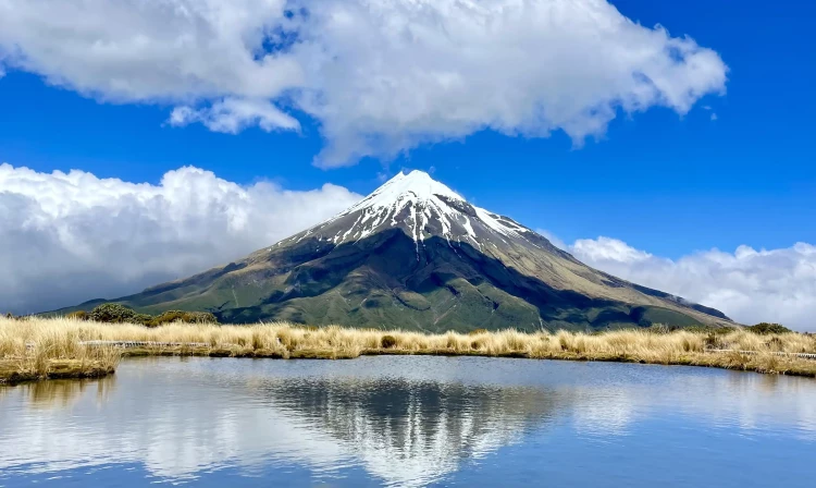
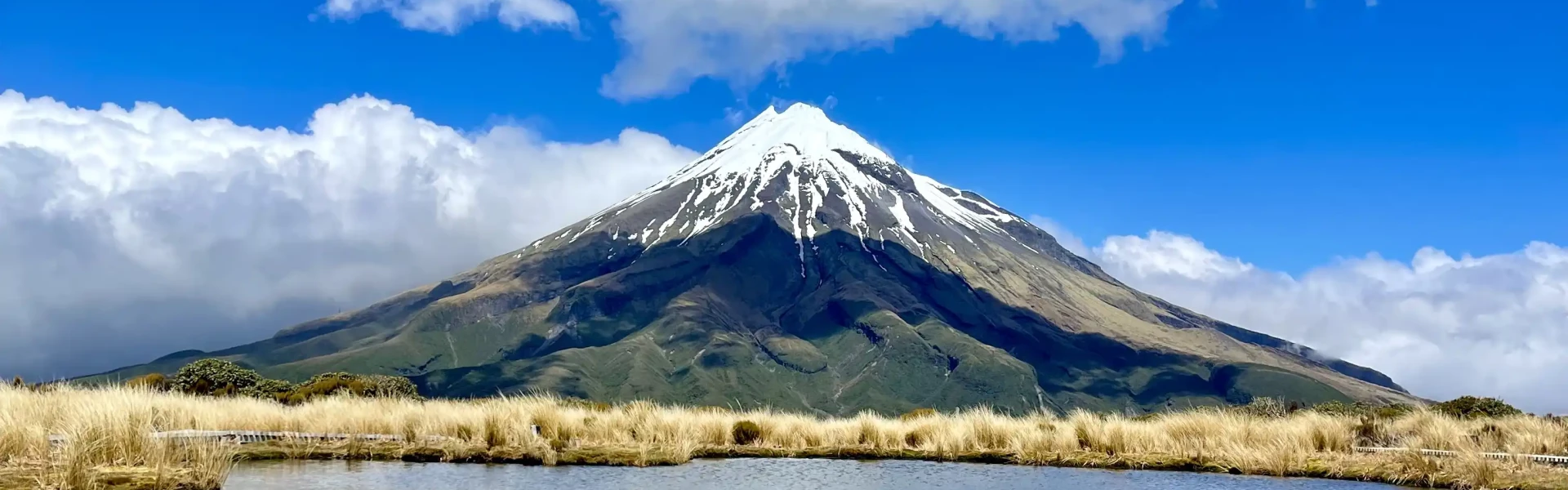
Return to the Ahukawakawa Track junction and follow the boardwalk across the Ahukawakawa Swamp. This unique microclimate is home to many plant species, some usual at this altitude and others found nowhere else in the world. You can stop at the viewing platform before continuing on to cross the curved wooden bridge over the Stony/Hangatahua Stream. This area is a wetland. There is a boardwalk, but expect water and mud, in some places over the track.The track then climbs steeply through mountain cedar to reach the Pouākai Track junction. Turn right and continue beneath the aptly named Hump and past the Mangorei Track junction to reach the picturesque Pouākai Tarns. On a fine day, you can see a stunning reflection of Taranaki Maunga in the tarn (pond). The area around these small alpine tarns is very fragile. Keep to the boardwalks to help protect this fragile wetland area. Do not enter the tarn either. Side trip: Pouākai Trig (1.5 hours return) On a fine day take a detour at the Pouākai Track junction – turn left towards Pouākai Trig (1440 m) with stunning views of Te Papa-Kura-o-Taranaki and the coastline. This track is a little rugged in places – be prepared for some mud and track erosion.
Backtrack to the junction with Mangorei Track and head downhill to Pouākai Hut . Enjoy a break on the hut deck and take in the spectacular views up the Taranaki coastline. From there, a long descent to the road end winds through cool forest dripping with mosses and lichens – these twisted kamahi trees are known locally as ‘Goblin forest’ as it is very much like walking through an enchanted forest.
As this is a backcountry tramp, the track will be rough, muddy or wet in places. There is deep mud in sections across the Ahukawakawa Swamp, so boots are better than hiking shoes. This is a point-to-point track so you will need to arrange transport to/from one end. Shuttle services are available – book directly with an operator. Alternatively, consider Pouākai Circuit which takes 2-3 days. Ensure you take your mobile phone as reception is possible for most of the track.
Both Holly Hut and Pouākai Hut require bookings in advance via DOC's booking system. There is also the option to camp nearby to each of the huts using DOC campsite passes (first come, first served) however Pouākai Hut only has space for two tents.
Starting in Inglewood: Head west on SH3 out of Inglewood. After around 1.9 km turn left onto Lepper Road Upper. Continue on this road for 5.9 km until Egmont Road. Continue on Egmont for around 10.4 km until the end of the road. Te Papakura o Taranaki Visitor Centre is at the end of the road. Use this location in Google Maps to find your way there.
We encourage you to continue gaining the skills and knowledge required for a safe trip. The NZ Mountain Safety Council has lots of free resources and information you can use. These can be accessed via www.mountainsafety.org.nz . We recommend trying these online learning tools: Trip Planning Tramping / field Skills Basic Navigation River Safety Additionally, check out the range of helpful videos available from the NZ Mountain Safety Council YouTube channel .
Taranaki can be a very windy spot; this is more likely as you gain elevation. Passing frontal systems can drop a lot of rain on the mountain in a short period. Low cloud can cause disorientation, especially above the bushline. You must be well prepared with suitable clothing and equipment for all weather and conditions. Sections of this track can become impassable in winter conditions due to snow and ice. Check with North Tarakaki Visitor Centre for up-to-date track conditions.
No dogs.
Track information, access and weather can change. Confirm current alerts and land-manager information close to departure, tell someone your plans, and carry equipment appropriate for the route and conditions.