11 October 2026
A few showers, possibly heavy, clearing to fine in the afternoon. Northeasterlies, turning northwesterly in the morning.
Loading outdoor place details…
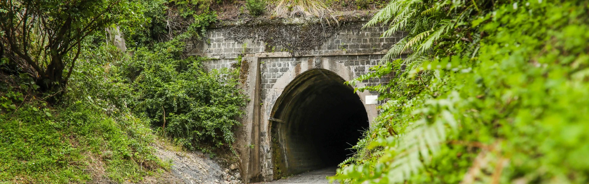
Remutaka Forest Park
Journey from Petone foreshore along the Hutt River, over the historic railway line through the Remutaka Ranges, then explore Wairarapa farmland and rugged coastlines on the other side.
Distance
122 km
Walking time
1-5 days
Difficulty
Intermediate
Dogs
Not allowed
Wheelchair access
Not marked friendly
Current status
✅ 28 September to 11 October: OPEN for school holidays, with Stop/Go during weekday working hours and fully open weekends. Stop/Go may have waits of up to 30 minutes. ❌12 to 16 October: CLOSED. ✅ 17 to 18 October: OPEN As a reminder, these safety upgrades affect 2km of the Remutaka Rail Trail section, between Cross Creek Yards and Cross Creek Carpark. Find out more about the upgrades Map outlining the closure area at Cross Creek on the Remutaka Rail Trail section. The affected area is a 2km section of track from Cross Creek Yards to Cross Creek Carpark.
Weather outlook
Issued 10 Oct 2026, 11:01 pm
11 October 2026
A few showers, possibly heavy, clearing to fine in the afternoon. Northeasterlies, turning northwesterly in the morning.
12 October 2026
Fine. Northwesterlies, dying out in the morning.
13 October 2026
Mainly fine, isolated showers developing in the afternoon. Northwesterlies.
14 October 2026
Partly cloudy with isolated showers. Northwesterlies.
15 October 2026
Rain developing. Northwesterlies, turning southwesterly.
Regional guidance only; elevation and terrain can produce different conditions.
Explore the area
Explore the track route and surrounding area before you set out.
The Remutaka Cycle Trail Great Ride is one of 23 Great Rides in Ngā Haerenga New Zealand Cycle Trail s . This 1 22 km trail follows a former railway route that runs from the Hutt Valley all the way to the Wairarapa and then around the remote south c oast , following a pioneer droving route . Throughout the trail you will see remarkably different landscapes, from urban to wild terrain, passing beautiful lakes famous for rare native birds , riding through native forests and some of the country’s oldest pastoral farm land. Riders can also experience some of New Zealand’s richest cultural heritage , including ancient Māori settlement sites and the legacy of stone and steel from the days of steam-powered rail . Suitable for a range of ages and abilities and is open to mountain bikers, walkers and horse riders on the Rail Trail section. The trail can be ridden in either direction . It is made up for four distinct sections of differing lengths and grades (difficulty) of between one (easiest) and four (advanced) . Hutt River Trail Section (35.2km) Remutaka Rail Trail Section (25.4km) Western Lake Road Section (42.5km) Wild Coast Track Section (18.6km) For more information on each section visit Remutaka Cycle Trail.
Amenities Fill up your water bottles in Petone’s Te Puni Wai O ra spring for the best water in town. From the Waione Bridge, the trail follows the Hutt Valley beside Te Awa Kairangi Hutt River, through parkland between the river and Lower Hutt and Upper Hutt . H ospitality options are never far away and some are signposted from the trail . The Te Marua Store is a great stop for ice cream , coffee and snacks before heading up to the Rail Trail section. Water is available just around the corner at Plateau Park . This is the last water spigot before Featherston. There are no food outlets between Featherston and Orongorongo (the Western Lake Rd section and Wild Coast Track section), so take everything with you. Toilets are available in many places on the trail. Parking is available at Maymorn , Kaitoke, Cross Creek, Featherston, Wainuiomata Beach , but parking is limited at Petone Esplanade. However, riding from Wellington (13km) on Te Ara Tupua or catching the urban trai n to Petone station are good options. Cellphone coverage is patchy in places. The Wild Coast is very remote, take everything you need, including spares. Bike hire, door-to-trail shuttles and baggage transfers are available for single or multi-day rides. Get prepared Pack adequate food and water – particularly from Maymorn to Featherston, and Featherston to Orongorongo . The Wild Coast Track section is remote, exposed and contains active sl ips. Do not attempt this section during or after bad weather . Take warm waterproof clothing, durable footwear, and plenty of sunscreen. Plan your route before you leave. Let someone know where you’re going. Be aware Dogs must be on a leash at all times on the Hutt River Trail section. No dogs permitted on the Wild Coast Track section beyond Corner Creek to Orongorongo Station. It can get very windy on the Wild Coast Track section , with limited shelter. Private or commercial pick-up shuttle services at Ocean Beach or the official trail end at Orongorongo River mouth are available. Or, you can cycle the Wainuiomata Connector Ride back to Petone . For more information visit RemutakaCycleTrail.com Regular trail updates are posted on the Remutaka Cycle Trail Facebook page.
There is a basic campsite with a pit toilet at Cross Creek and a DOC campground on Western Lake Road at Corner Creek at the far end of Ocean Beach.
The Remutaka Cycle Trail starts at Petone wharf, located on the Petone Esplanade. It ends at the mouth of the Orongorongo River on Wainuiomata Coast Road. Use this location in Google Maps to find your way there. There are regular bus and train services to the start and finish points of each of the four sections of the trail, including Petone, Lower Hutt, Upper Hutt, the Wairarapa, and Wellington CBD. Timetables are available from the Metlink website .
We encourage you to continue gaining the skills and knowledge required for a safe trip. The NZ Mountain Safety Council has lots of free resources and information you can use. These can be accessed via www.mountainsafety.org.nz . We recommend trying these online learning tools: Trip Planning Tramping / field Skills Basic Navigation River Safety Additionally, check out the range of helpful videos available from the NZ Mountain Safety Council YouTube channel .
Yes (on some trails)
Track information, access and weather can change. Confirm current alerts and land-manager information close to departure, tell someone your plans, and carry equipment appropriate for the route and conditions.