10 October 2026
Cloud about the tops, and the odd shower.
Loading outdoor place details…
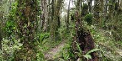
Tararua Forest Park
This route crosses the southern end of the Tararua Forest Park, starting at the Akatarawa Saddle and finishing at Kaitoke.
Distance
40.7 km
Walking time
3–4 days
Difficulty
Advanced, Expert
Dogs
Allowed — check local rules
Wheelchair access
Not marked friendly
Current status
Weather outlook
Issued 10 Oct 2026, 9:23 pm
10 October 2026
Cloud about the tops, and the odd shower.
11 October 2026
Showers, clearing in the afternoon, but cloud and drizzle remaining about western slopes.
12 October 2026
Fine, apart from morning drizzle. A few showers at night.
13 October 2026
Showers, some possibly heavy.
14 October 2026
Showers clearing.
Regional guidance only; elevation and terrain can produce different conditions.
Explore the area
Explore the track route and surrounding area before you set out.
Distance/times: Akatawara Road to Maymorn Junction: 9.9km / 3 hrs Maymorn to Rentata Hut: 1.5km / 45 minutes This route starts at Akatarawa Saddle on Akatarawa Road, between Upper Hutt and Waikanae. The Waiotauru 4WD Road (also known as Odlin’s Road) begins on the eastern side of the saddle—follow this road as it climbs into the hills. This is a shared-use track, so be mindful of 4WD vehicles and dirt bikes. The initial section is relatively easy walking. The road winds up a long ridge, passing a notable slip near the edge of the track shortly before Maymorn Junction. At Maymorn Junction, take the ridge track signposted for Renata Hut. This forested tramping track follows the ridge for 1.5 km before reaching Renata Hut .
Distance: 7.2 km Time: 4-5 hours Continue along the Renata Ridge Track from Renata Hut, gradually climbing to the Renata high point (924 m). From there, the track follows Renata Ridge as it loops north before turning back. It then climbs toward Elder, reaching Elder Hut just before the Elder high point. This section is one of the more manageable tracks in the Tararuas, with a relatively gentle gradient and no major obstacles to scramble over or navigate.
Distance: 5.9 km Time: 3-4 hours From Elder Hut, the track continues along Renata Ridge, climbing steeply toward the main Tararua Range. It eventually emerges from the bush and ascends to the Aston high point (2.8 km / up to 2 hrs). At Aston, the track meets the Southern Crossing route. Follow this route over Alpha (1361 m), then descend to Alpha Hut , located just below the bush line (3.1 km / up to 2 hrs). Gaiters will be helpful here to help get through the vegetation.
Distance: 16.3 km Time: 8-9 hours From Alpha Hut, descend from 1187 m to the saddle at Hells Gate, then climb onto Marchant Ridge. Along the ridge, you’ll pass the Bull Mound, Omega, and Block 16 track turn-offs—these provide alternative routes into the Tauherenikau Valley but require a river crossing, which may be hazardous after heavy rain. Marchant Ridge is a long, forested section with rough terrain underfoot and can become muddy in wet conditions, often slowing progress. The section from the Smith Creek Shelter junction along the Dobson Loop Track has mobile phone reception. Watch carefully for the track turn-off leading into the Kiwi Ranch Road car park, where the route ends.
Frequent freezing temperatures, thick mist, and gale-force winds make the Tararua tops highly dangerous. Before leaving the bush, assess the weather carefully and be prepared to turn back if you lack the experience or equipment for the conditions.
The track can be started from Akatarawa Saddle , or from Kaitoke, at the Kiwi Ranch Road car park . Leaving a vehicle at the Akatarawa Saddle is not advised due to break-ins.
We encourage you to continue gaining the skills and knowledge required for a safe trip. The NZ Mountain Safety Council has lots of free resources and information you can use. These can be accessed via www.mountainsafety.org.nz . Level up in your outdoor knowledge with these interactive online learning tools: Trip Planning Tramping / field Skills Basic Navigation River Safety Additionally, check out the range of helpful videos available from the NZ Mountain Safety Council YouTube channel .
Dogs allowed. Keep dog under control at all times.
Track information, access and weather can change. Confirm current alerts and land-manager information close to departure, tell someone your plans, and carry equipment appropriate for the route and conditions.